Catalogue
Chapter I General Provisions ……………………………………………………………………………………………………………………………………………………………………………………………………………………………………………………………………………………………………………………………………………………………………………………………………………………………………………………………………………
The first part of the city urban system planning ………………………………………………………………………………………………………………………………………………………………………………………………………………………………………………………………………………………………………………………………………………………………………………………………………………………………………………………………
Chapter II Urban and Rural Development Strategies and Objectives ………………………………………………………………………………………………………………………………………………………………………………………………………………………………………………………………………………………………………………………………………………………………………………………………………………………………………………………………
Chapter III Regional Urban System Planning ………………………………………………………………………………………………………………………………………………………………………………………………………………………………………………………………………………………………………………………………………………………………………………………………………………………………………………………………………
Section 1 Space Control and Coordination Planning ……………………………………………………………………………………………………………………………….
Section 2 Urban System Structure Planning ………………………………………………………………………………………………………………………………………….
Section III Urban Function Orientation ……………………………………….
Section IV Industrial Development Planning …………………………………………
Section 5 Comprehensive Transportation Planning ………………………………………………………………………………………………………………………………………….
Section 6 Planning of Major Infrastructure and Social Service Facilities ……………………………………………………………………………………………………….
Section 7 Historical and Cultural Heritage and Scenic Tourism Planning ………………………….
Section 8 Urban Ecological and Environmental Protection Planning …………………………………………………………………………………………………………………………………………….
Section 9 Comprehensive Disaster Prevention Planning …………………………………..
Section 10 Construction Planning of "Two-oriented Society Comprehensive Reform Area" ………………………………………………………………………………
Section 11 New Rural Construction Planning …………………………………
Section 12 Recent Construction Planning ………………………………………….
Part II Central City Planning …………………………………………………………………………………………………………………………………………………………………………………………………………………………………………………………………………………………………………………………………………………………………………………………………………………………………………………………………………
Chapter IV City Nature and City Scale 15
Chapter V Spatial Control in Urban Planning Area 15
Chapter VI Overall Layout of Cities ………………………………………………………………………………………………………………………………………………………………………………………………………………………………………………………………………………………………………………………………………………………………………………………………………………………………………………………………………
Chapter VII Urban Land Layout Planning ………………………………………………………………………………………………………………………………………………………………………………………………………………………………………………………………………………………………………………………………………………………………………………………………………………………………………………………………………
Chapter VIII Industrial Layout Planning …………………… 20
Chapter IX Comprehensive Urban Transportation Planning ………………………………………………………………………………………………………………………………………………………………………………………………………………………………………………………………………………………………………………………………………………………………………………………………………………………………………………………………………
Chapter X Urban Municipal Public Facilities Planning ……………………………………………………………………………………………………………………………………………………………………………………………………………………………………………………………………………………………………………………………………………………………………………………………………………………………………………………………………
Section 1 Water Supply Project Planning …………………………………………………………………………………………………………………………………….
Section 2 Drainage Engineering Planning …………………………………………………………………………………………………………………………………………….
Section 3 Power Engineering Planning …………………………………………………………………………………………………………………………………………………….
Section IV Telecommunication Engineering Planning ……………………………………………………………………………………………………………………………………………….
Section 5 Gas Engineering Planning ……………………………………..
Section VI Environmental Sanitation Planning …………………………………………………………………………………………………………………………………………….
Section 7 Planning of Funeral Facilities …………………………………………………………………………………………………………………………………………….
Chapter XI Urban Comprehensive Disaster Prevention Planning ……………………………………………………………………………………………………………………………………………………………………………………………………………………………………………………………………………………………………………………………………………………………………………………………………………………………………………………………………
Section 1 Flood Control and Waterlogging Control Planning …………………………………………………………………………………………………………………………………….
Section 2 Fire Control Planning …………………………………………
Section 3 Development and Utilization Planning of Civil Air Defense and Underground Space ……………………………
Section IV Earthquake-resistant Planning ………………………………………………………………………………………………………………………………………………….
Chapter XII Urban Green Space System Planning ……………………………………………………………………………………………………………………………………………………………………………………………………………………………………………………………………………………………………………………………………………………………………………………………………………………………………………………………………
Chapter XIII Protection Planning of Historical and Cultural Heritage and Scenic Spots 31
Chapter XIV Urban Environmental Protection Planning 32
Chapter 15 Urban Landscape Planning ………………………………………………………………………………………………………………………………………………………………………………………………………………………………………………………………………………………………………………………………………………………………………………………………………………………………………………………………………
Chapter 16 Old City Renewal and Reconstruction Planning ………………………………………………………………………………………………………………………………………………………………………………………………………………………………………………………………………………………………………………………………………………………………………………………………………………………………………………………………
Chapter 17 Planning of Economic and Technological Development Zones …………………………………………………………………………………………………………………………………………………………………………………………………………………………………………………………………………………………………………………………………………………………………………………………………………………………………………………………
Chapter 18 Zoning Control and Spatial Development Timing 35
Chapter 19 Implementation Measures and Suggestions ……………………………………………………………………………………………………………………………………………………………………………………………………………………………………………………………………………………………………………………………………………………………………………………………………………………………………………………………………
Chapter 20 Supplementary Provisions …………………………………………………………………………………………………………………………………………………………………………………………………………………………………………………………………………………………………………………………………………………………………………………………………………………………………………………………………………
Chapter I General Provisions
Article 1 The Master Plan of Yueyang City (2008-2030) (hereinafter referred to as "the Plan") is formulated according to the Urban and Rural Planning Law of People’s Republic of China (PRC) and the needs of urban development in Yueyang City. This plan is the guiding document for urban planning, construction and management in Yueyang City.
Article 2 Planning basis
(1) People’s Republic of China (PRC) Urban and Rural Planning Law (January 1, 2008);
(2) Measures for the Compilation of Urban Planning (2006);
(3) Mandatory Provisions of Engineering Construction Standards (urban and rural planning) (2000);
(4) Measures for Implementing the Urban and Rural Planning Law of People’s Republic of China (PRC) in Hunan Province (January 1, 2010);
(5) The Eleventh Five-Year Plan for National Economic and Social Development in Hunan Province;
(6) Urban System Planning of "3+5" Urban Agglomeration in Hunan Province (2009-2030);
(7) The Eleventh Five-Year Plan of Yueyang National Economic and Social Development;
(8) Overall Land Use Planning of Yueyang City (2006-2020);
(9) Yueyang City Master Plan (1996-2015)
(ten) the relevant national, provincial and municipal laws and regulations, standards and norms and related planning of various industries.
Article 3 Planning spatial levels: city area, urban planning area, central city area and planning and construction area.
(1) City area: refers to the administrative area under the jurisdiction of Yueyang City, with a total area of 15019.2km2.
(2) Urban planning area: refers to the urban built-up area and the area where planning control must be implemented due to the needs of urban construction and development. Specifically, it includes Yueyang urban area of 1,463.2km2 (including built-up area of 86.32km2); Two villages related to Baiyun Town, Linxiang City are 4.3km2; There are seven villages, farms and floating tail farms in Matang Town, Yueyang County, 18.2 km2, and three villages in Xinkai Town, 14.3km2; The total area is 1500km2 (see the planning area definition map for details).
(3) Central urban area: refers to the planned construction land and suburban areas of the city, with a total area of 375 km2. Including: the main urban construction land and its adjacent areas, with an area of 170km2; Yunxi urban construction land and its adjacent areas, covering an area of 137.3km2; Land for construction in Lucheng and Lukou urban areas and their adjacent areas, with an area of 34.3km2; Junshan urban construction land and its adjacent areas, covering an area of 33.4km2..
(4) Planned construction area: refers to the planned urban construction land area, with a total land area of 155km2.
Article 4 Planning guiding ideology
(a) adhere to Scientific Outlook on Development, in accordance with the requirements of the five overall plans, and promote the comprehensive, coordinated and sustainable development of Yueyang’s economy and society.
(2) Adhere to the resource-saving and environment-friendly development model and take the development road of new urbanization; Highlight the historical context and local characteristics.
(3) Adhere to the people-oriented concept, ensure the public safety and public interests of urban and rural residents, and build a modern lakeside livable city.
Article 5 Planning period: 2008-2030.
The short term is 2008-2015, the medium term is 2016-2020, the long term is 2021-2030, and the long-term vision is after 2030.
The provisions in bold type in Article 6 are mandatory for planning. Construction in violation of mandatory planning content is a serious violation of urban planning and should be investigated and dealt with according to law.
The first part is the urban system planning of the city.
Chapter II Strategies and Objectives of Urban and Rural Development
Article 7 Regional development orientation
Yueyang City is located in the radiation circle of the economic zones of the Yangtze River Delta and the Pearl River Delta. It is the sub-center and the first gateway city of the "3+5" urban agglomeration with Changsha-Zhuzhou-Xiangtan as the center in Hunan Province. It is located in the dual radiation range of the "Changsha-Zhuzhou-Xiangtan Urban Agglomeration" and the "Wuhan 1+8 Urban Agglomeration", and has the geographical advantages of being integrated into the "two districts" and relying on the "two circles (belts)".
Eight strategies for economic and social development
Under the guidance of the construction of "one industrialization, three basics" and "two-oriented society", we should adhere to the new road of industrialization, rationally adjust the industrial structure, and establish a modern industrial system with informationization and high technology as the guide, new industries and modern logistics as the basis, highly developed sightseeing agriculture and tourism, comprehensive prosperity of the three industries and integration of urban and rural areas; Implement the strategy of revitalizing the city through science and education and sustainable development, vigorously improve the level of opening up, accelerate the process of internationalization, and strengthen the construction of human settlements.
Nine strategies for the coordinated development of urban and rural areas
With the goal of building a well-off society and a harmonious society, we will fully implement Scientific Outlook on Development, implement the strategic policy of taking the city as the driving force, feeding agriculture through industry, interacting and coordinating urban and rural development, and coordinate urban and rural infrastructure, industrial structure and population distribution on the basis of improving the overall urban and rural planning, deepening supporting reforms and improving the public finance system; Coordinate the allocation of urban and rural resource elements; Coordinate the construction of urban and rural social security system and the development of social undertakings, promote urban-rural integration and promote urban-rural common prosperity. Gradually form a new pattern of urban and rural economic and social integration development with "unified system, overall planning, resource sharing and common interests".
The development strategy of Shantou Town
Actively and steadily push forward the urbanization process in accordance with the principles of industrial agglomeration, perfect functions, land conservation, intensive development, rational layout and unique characteristics; Adhere to the principle of organic combination and coordinated development of large, medium and small cities and small towns, actively cultivate metropolitan areas and urban agglomerations, and form a joint force for regional development; Adhere to the "two-wheel drive" development strategy of new industrialization and new urbanization, accelerate the orderly concentration of population, resources and other production factors, promote the coordinated development of urban and rural areas as a whole, and strive to form a new path of resource-saving and environment-friendly urbanization development.
Article 11 Economic and social development goals (see Annex III for details)
Prediction of urban population and urbanization level in Article 12
In 2015, the urban population was 3.15 million and the urbanization level was 55%.
In 2020, the urban population will be 3.55 million and the urbanization level will be 60%.
In 2030, the urban population will be 4.35 million, and the urbanization level will be 70%.
Chapter III Planning of Urban System in Urban Areas
Section 1 Space Control and Coordinated Planning
Spatial division of land in Article 13
The land in the city is divided into three categories: forbidden construction area, restricted construction area and suitable construction area.
Article 14 Prohibited construction areas and control measures
(1) Prohibited construction area: refers to the area where protection is the mainstay and construction activities are prohibited. Including ecologically sensitive areas, basic farmland protection areas, cultural relics protection areas, infrastructure corridors, water source protection areas, mineral resources distribution areas and other protected areas designated according to needs. Among them, ecologically sensitive areas include nature reserves, scenic spots, forest parks, ecological corridors and natural water bodies for ecological conservation. See Table 3-1 for details.
List of Prohibited Construction Areas Table 3-1
|
type
|
Containment in body
|
|
main type
|
Zhonglei
|
|
Ecological sensitive area
|
scenic area/spot
|
Yueyang Tower-Dongting Lake, Fushou Mountain-Miluo River, Longjiao Mountain, etc.
|
|
forest park
|
Mufu Mountain, Shiniuzhai, Dayun Mountain, Wujian Mountain, Taohua Mountain, Lianyun Mountain, etc.
|
|
nature reserve
|
Dongting Lake Nature Reserve (including East Dongting Lake Wetland)
|
|
Natural water body
|
Dongting Lake, Huanggai Lake, Tieshan Reservoir, Long Yuan Reservoir, Yangtze River, Xiangjiang River, Miluo River, Xinqiang River, Huarong River and Ouchi River, etc.
|
|
Ecological green corridor
|
Riverside and lakeside ecological green corridors
|
|
Ecological green corridors on both sides of Beijing-Guangzhou Railway and Wuhan-Guangzhou Passenger Dedicated Line
|
|
Ecological green corridors on both sides of Beijing-Hong Kong-Macao Expressway and its double track, Hangrui Expressway and Pingyi Expressway
|
|
Ecological green corridors on both sides of National Highway 107 and 106
|
|
Ecological green corridors on both sides of provincial roads 201, 203, 207, 301, 306 and 308.
|
|
Basic farmland protection area
|
Basic farmland protection area
|
|
Cultural relics protection area
|
There are 12 national key cultural relics protection units, 35 provincial cultural relics protection units, 15 municipal cultural relics protection units and 275 county (city, district) cultural relics protection units.
|
|
Infrastructure corridor
|
Control corridors such as power telecommunication lines, water main canals and oil and gas pipelines.
|
|
Water source protection land
|
Surface and underground water source protection sites and their protection scope
|
|
Distribution area of mineral resources
|
Underground mineral distribution area
|
(2) Control measures
Prepare special protection plans, delimit core protection areas and peripheral protection zones, and strictly protect natural mountain forests, rivers and lakes, forest vegetation, various animals and other ecological resources, historical and cultural relics and mineral resources in the areas;
It is strictly forbidden to carry out development and construction in the core protection zone, and high-intensity development should be controlled in the peripheral protection zone, and moderate development and construction should be reported to the higher authorities for approval;
Delineate basic farmland protection areas, prepare protection plans, strictly control the occupation of basic farmland for non-agricultural construction or change its use nature;
Prohibit all kinds of pollutants from being discharged into the ecological zone without treatment or if the treatment is not up to standard;
It is strictly prohibited to carry out development and construction in all kinds of prohibited construction areas;
All kinds of cultural sites, unearthed cultural relics addresses, cultural relics protection units, etc. should delimit the scope of protection according to relevant laws and technical regulations, and prohibit non-protective development and construction within their scope;
It is strictly forbidden to carry out various engineering facilities and urban construction in various mineral resources distribution areas, and the abandoned original mineral resources distribution areas must be ecologically managed to restore their ecological attributes;
It is forbidden to reclaim new non-ecological agricultural land for natural mountains, actively implement returning farmland to forests or carrying out ecological farmland farming, and properly restore its natural ecological appearance;
It is strictly forbidden to borrow soil and carry out destructive construction on both sides of the control range such as the main water conveyance canal, 220KV power line and oil and gas pipeline. Article 15 Restricted construction areas and control measures
(1) Restricted construction areas include all kinds of land suitable for farming except basic farmland protection areas, hills and mountains with a slope of 15-25 degrees, and areas with fragile ecological environment. They are areas with weak carrying capacity of resources and environment, which are related to the overall ecological pattern of cities and towns, distributed among urban groups and distributed in patches.
(2) Control measures
Strictly protect cultivated land in the area and prohibit illegal occupation of cultivated land;
Organize some areas to return houses to farming, merge towns and villages in a timely manner, develop and transform rural vacant housing bases into cultivated land, and prepare land development and consolidation plans;
Strictly control the per capita land use index of rural residential areas and industrial and mining areas in townships, market towns, central villages and grass-roots villages, control the decentralized construction of rural houses, strengthen the construction of ecological environment, plant trees, green barren hills and ecologically control abandoned land;
Strengthen the service for urban functions, and maintain and strengthen the road network construction between towns;
Scientific site selection and feasibility demonstration should be carried out for polluting enterprises and urban municipal facilities to be built, and major infrastructure construction should be conducive to the development and safety of cities and towns.
Article 16 Suitable construction areas and control measures
(1) Suitable construction area: refers to the land space dominated by efficient land use in cities and towns. The construction density in the area is high, the development intensity is high, and the land output benefit per unit area is high; The population is focused, the functions are concentrated, and the economic center is prominent; The second and third industries are highly concentrated in space.
(2) Control measures
Scientifically formulate the system planning, overall planning and regulatory detailed planning of cities (villages) and towns;
Make full use of the land in the area (including abandoned land), establish and improve the system of paid use of state-owned land, and improve the land utilization rate and production efficiency;
Urban construction must be adapted to local conditions, make full use of topography and current resource conditions, and protect the mountains, vegetation, water system, culture, history, customs, local style and spatial characteristics in the area;
Strictly protect urban drinking water sources and water intakes;
Urban construction intensive areas must carry out unified planning and coordination, and do a good job in space utilization planning in accordance with the principles of co-construction and sharing of facilities, co-construction and co-protection of environment and spatial coordination and unity;
Ecological isolation protection zones should be built between towns and urban groups to improve the internal and external environment, improve the quality of life in towns and beautify the landscape environment.
Article 17 Regional coordination
(1) Coordination between the city and surrounding areas: strengthen exchanges and cooperation with the "Yangtze River Delta" and "Pearl River Delta" regions in economic and technological aspects, actively undertake industrial transfer, and promote the extension and upgrading of the industrial chain; Strengthen in-depth cooperation with "Changsha-Zhuzhou-Xiangtan" and "Wuhan City Circle" in industry, technology and infrastructure, implement dislocation development, and form a complementary economic type; Strengthen the construction of infrastructure such as road traffic, electricity and communication in the border areas, and establish a facility sharing mechanism; Accelerate the development of tourism networks with neighboring areas; Cooperate to protect the ecological environment in the border area; Strengthen the building of the ability to resist natural disasters in neighboring areas, improve the common ability to resist disasters and save themselves, and form a unified rescue system; Strengthen the cultural and life links between neighboring areas.
(2) Urban coordination within the city: strengthen economic exchanges and cooperation between neighboring towns, focus on developing industries with different characteristics, and build an economic development relationship of mutual assistance and common progress; Establish a flexible and unified policy mechanism, eliminate local protection, and create a good internal and external development environment; Establish the concept of strengthening ecological environment protection and sustainable development, and strengthen pollution prevention and control in cities and towns; Establish a resource sharing mechanism; Open commodity trading and social service markets, and cancel regional administrative restrictions; Coordinate the construction of high-speed information network, infrastructure network and social service facilities network to realize the integration of "three networks" in cities and towns in the city.
Section 2 Urban System Structure Planning
Article 18 Spatial layout structure
(A) the spatial layout form
Adhere to the principle of "urban and rural integration, regional integration, key breakthroughs, and all-round promotion", rationally arrange towns according to the development model of circles, and build a "one belt and two circles" urban spatial layout form that connects the north and the south and links the east and the west.
(2) "Belt" refers to the central urban development belt. Including the Xiangjiang River and the Yangtze River to the east and the Beijing-Hong Kong-Macao Expressway to the west. The development axis includes Beijing-Guangzhou Railway, Yangtze River, Xiangjiang River, National Highway 107, Beijing-Hong Kong-Macao Expressway and its double tracks, and Changlin Intercity Railway. Through the development axis, it is integrated into Wuhan city circle to the north and connected to Changsha-Zhuzhou-Xiangtan city group to the south. The plan will guide the population, industry, land, infrastructure and other urban construction elements to gather in this area.
(3) "Two Circles" refers to "Yue-Lin-Rong" metropolitan area and "Mi-Xiang-Ying" urban group.
"Yue-Lin-Rong" metropolitan area refers to the metropolitan area with the central city as the center, including Chang ‘an Town of Linxiang City and Yueyang County as the peripheral towns, with 306 provincial highway, Hangrui Expressway, Jingyue Railway and Yuechang Railway as the development axis, one-hour commuting distance as the service radius, radiating Huarong County, the western part of the city and the towns in southern Hubei, forming a "3+1" urban spatial layout pattern in the northern part of the city.
"Mi-Xiang-Ying" urban cluster refers to the urban cluster with Miluo City, Xiangyin County and Yingtian Town as the core, with 308 Provincial Highway, Pingyi Expressway and Pingyi Intercity Railway as the development axis, and the one-hour commuting distance as the service radius, connecting Pingjiang County in parallel and radiating the eastern towns of the city, forming a "3+1" urban spatial layout pattern in the southern part of the city.
Article 19 Urban hierarchical structure
Divide the urban hierarchy into five levels. The first level: more than 500,000 (big cities); The second level: 200,000-500,000 (medium-sized cities); The third level is 500,000-200,000 (small cities); The fourth level: 30,000-50,000 (central town); The fifth level: 10,000-30,000 (general towns).
Article 20 Urban scale structure (see Table 3-2 for details)
Table 3-2 List of Urban Scale and Grade Structure
|
Gauge level
|
Quantity (units)
|
Town name
|
Population
(ten thousand people)
|
Comparative example (%)
|
|
Big cities (more than 500,000 people)
|
one
|
Yueyang city
|
160
|
36.78
|
|
Medium-sized cities (200,000-500,000 people)
|
six
|
Miluo, Linxiang, Huarong, Xiangyin, Yueyang and Pingjiang
|
170
|
39.08
|
|
Small cities (< 200,000 people)
|
one
|
Yingtian
|
eight
|
1.84
|
|
Central town (30,000-50,000 people)
|
14
|
Taolin, Dongshan, Gongtian, Wushi, Lijiaduan, Qianliang Lake, Changle, Yanglousi, Zhushi, Jietoupu, Xinquan, Nanjiang, Changshou and Qikou.
|
50
|
11.50
|
|
General towns (10,000-30,000 people)
|
31
|
Huanggai, Dinghu, Nieshi, Zhanqiao, Zhongfang, Shuangtang, Guangxingzhou, Xushi, Wanyu, Nianyuxu, Caojun, Xinkai, Huangsha, Baixiang, Zhang Guying, Yuetian, Taolin Temple, Dajing, Chuanshanping, Baishui, Zhangshu, Nanhu Zhou, Xiangbin, Dong Tang and Wengjiang.
|
47
|
10.80
|
|
Combined plan
|
53
|
|
435
|
100.00
|
Twenty-first urban construction land standards
The construction land of large, medium and small cities should be strictly controlled according to the upper limit index of 100m2/ person; Small towns are controlled according to the upper limit of 110m2/ person; Township towns and independent industrial and mining areas are controlled according to the upper limit index of 130m2/ person. See Table 3-3 for the scale of urban construction.
List of Urban Construction Scale Table 3-3
|
cities and towns
name
|
Town planning model
|
Land use dominates the development direction.
|
cities and towns
name
|
Town planning model
|
Land use dominates the development direction.
|
|
population size
(ten thousand people)
|
Land use scale
(km2)
|
population size
(ten thousand people)
|
Land use scale
(km2)
|
|
Yueyang city
|
160
|
155
|
To the east,
northward
|
Miluo city
|
30
|
30
|
To the east,
northward
|
|
Linxiang city
|
30
|
30
|
To the north,
southward
|
xiangyin county
|
30
|
30
|
To the south,
eastward
|
|
pingjiang xian
|
30
|
30
|
To the south,
eastward
|
Huarong county
|
25
|
25
|
To the south,
westward
|
|
yueyang county
|
25
|
25
|
To the east,
southward
|
Yingtian town
|
eight
|
eight
|
To the east,
southward
|
|
Yanglousi
|
3.0
|
3.3
|
southward
northward
|
Taolin
|
3.0
|
3.3
|
westward
northward
|
|
Changle
|
3.0
|
3.3
|
westward
northward
|
Lijiaduan
|
4.0
|
4.4
|
southward
eastward
|
|
Dongshan
|
4.0
|
4.4
|
southward
westward
|
Zhuzikou
|
3.0
|
3.3
|
westward
southward
|
|
Jietoupu
|
5.0
|
5.5
|
northward
eastward
|
Xinquan
|
3.0
|
3.3
|
southward
westward
|
|
Gongtian
|
4.0
|
4.4
|
southward
northward
|
Taroko
|
4.0
|
4.4
|
southward
eastward
|
|
Wushi
|
5.0
|
5.5
|
southward
eastward
|
Changshou
|
3.0
|
3.3
|
southward
eastward
|
|
Nanjiang
|
3.0
|
3.3
|
southward
eastward
|
Qianlianghu
|
4.0
|
4.4
|
eastward
northward
|
|
Huanggai
|
2.0
|
2.2
|
eastward
southward
|
Shuangtang
|
2.0
|
2.2
|
southward
westward
|
|
Nieshi
|
1.5
|
1.7
|
northward
southward
|
Loyal defense
|
2.0
|
2.2
|
northward
southward
|
|
Zhanqiao
|
1.5
|
1.7
|
northward
southward
|
Dinghu
|
1.0
|
1.1
|
westward
eastward
|
|
Guangxingzhou
|
2.5
|
2.8
|
westward
southward
|
Xushi
|
1.5
|
1.7
|
eastward
southward
|
|
Catfish beard
|
1.0
|
1.1
|
eastward
southward
|
Fuck the army
|
1.5
|
1.7
|
northward
eastward
|
|
Wan Yu
|
1.5
|
1.7
|
westward
northward
|
Xinkai
|
1.5
|
1.7
|
westward
southward
|
|
Yuetian
|
1.0
|
1.1
|
southward
eastward
|
Huangsha
|
1.5
|
1.7
|
northward
eastward
|
|
Guying Zhang
|
1.0
|
1.1
|
eastward
southward
|
Baixiang
|
1.0
|
1.1
|
northward
eastward
|
|
Baishui
|
1.0
|
1.1
|
northward
eastward
|
Dajing
|
2.0
|
2.2
|
eastward
northward
|
|
Taolinsi
|
1.5
|
1.7
|
northward
westward
|
Chuanshanping
|
1.5
|
1.7
|
northward
westward
|
|
Xiangbin
|
1.0
|
1.1
|
southward
westward
|
Nanhu Zhou
|
2.0
|
2.2
|
northward
westward
|
|
Dong Tang
|
1.0
|
1.1
|
eastward
southward
|
Zhangshu
|
2.0
|
2.2
|
northward
westward
|
|
Wengjiang
|
1.5
|
1.7
|
southward
eastward
|
Tongshi
|
1.0
|
1.1
|
southward
northward
|
|
Meixian
|
2.0
|
2.2
|
southward
westward
|
Anding
|
2.5
|
2.8
|
westward
southward
|
|
Jiayi
|
1.5
|
1.7
|
westward
northward
|
Longmen
|
1.0
|
1.1
|
westward
southward
|
|
Hongqiao
|
1.5
|
1.7
|
southward
northward
|
|
|
|
|
Section III Urban Functional Orientation
Article 22 Yueyang City, the central city of the city.
National historical and cultural city and scenic tourist city, petrochemical industrial base and modern logistics center in central China, the only Tongjiang Dahai port in Hunan Province.
Article 23 Miluo City, a sub-central city in the city.
National "two-oriented society construction" demonstration city, "Changsha-Zhuzhou-Xiangtan" urban agglomeration circular economy industrial base and Quzi dragon boat cultural tourism and leisure resort, and material distribution center between Changsha and Yueyang.
Article 24 the functional orientation of county central cities (see table 3-4 for details)
Table 3-4 List of Functional Positioning of County Central Cities
|
Town name
|
Functional orientation
|
Work-energy positioning
|
|
Linxiang
|
synthesizing type
|
County central city. The border trade gateway of northern Hunan, the biochemical industrial base of Hunan Province, and the satellite city of Yueyang City.
|
|
Xiangyin
|
synthesizing type
|
County central city. "Changsha-Zhuzhou-Xiangtan" urban agglomeration is an important node connecting Dongting Lake and Tongjiang-Dahai, a supporting production base for modern equipment manufacturing, a port logistics center and a lakeside leisure and tourism city.
|
|
Huarong
|
synthesizing type
|
County central city. An important industrial and trade city around Dongting Lake, an important energy base in Yueyang, a textile industrial base and a material distribution center in the west of the city.
|
|
yueyang county
|
synthesizing type
|
County central city. Yueyang Satellite City is a local processing industrial base with ceramics, pharmaceuticals, electromagnets, etc.
|
|
Pingjiang
|
synthesizing type
|
County central city. Electromechanical light industry base, red tourist city and material distribution center in the east of the city.
|
|
Yingtian
|
synthesizing type
|
Regional central town. An important feed industry and biomass energy industrial base around Dongting Lake region.
|
Article 25 Functional orientation of central town (see Table 3-5 for details)
Table 3-5 Functional Orientation of Central Town
|
cities and towns
name
|
function
position
|
Work-energy positioning
|
|
Taolin
|
Industry and trade type
|
Southern central town of Linxiang city. Develop small industrial and trade towns with firecrackers, building materials and agricultural and sideline products as the main processing.
|
|
Yanglousi
|
Industry and trade type
|
Northern central town of Linxiang city. Develop small industrial and trade towns focusing on forest products processing and mining.
|
|
Dongshan
|
Industry and trade type
|
Huarong county northern central town. Develop industrial and trade-oriented small towns focusing on energy, building materials, agricultural and sideline products processing and tourism services.
|
|
Zhuzikou
|
Agricultural trade type
|
Huarong County, the southern central town, will develop a small town with agricultural and sideline products processing, commerce and trade as the mainstay.
|
|
Gongtian
|
Industry and trade type
|
Eastern central town of Yueyang county. Develop industrial and trade small towns mainly engaged in agricultural and sideline products processing, building materials and tourism services.
|
|
Taroko
|
Agricultural trade type
|
Eastern central town of Yueyang county. Develop small towns with agricultural and sideline products processing, commerce and trade as the mainstay.
|
|
Wushi
|
Industry and trade type
|
Central town in the west of Pingjiang county. Develop small industrial and trade towns mainly engaged in electromechanical light industry and agricultural and sideline products processing.
|
|
Nanjiang
|
Industry and trade type
|
Northern central town of Pingjiang county. Develop small industrial and trade towns focusing on forest products processing, mining and scenic tourism.
|
|
Changshou
|
Industry and trade type
|
Eastern central town of Pingjiang county. Develop industrial and trade small towns mainly engaged in agricultural and sideline products processing and mining.
|
|
Lijiaduan
|
Industry and trade type
|
Central town in the south of Miluo city. Develop small industrial and trade towns mainly engaged in furniture manufacturing and agricultural and sideline products processing.
|
|
Changle
|
Industry and trade type
|
Central town in the north of Miluo city. Develop industrial and trade-oriented small towns with machinery manufacturing and food processing as the mainstay.
|
|
Jietoupu
|
Industry and trade type
|
The eastern central town of Xiangyin County. Develop industrial and trade-oriented small towns focusing on construction machinery, automobile manufacturing and agricultural and sideline products processing.
|
|
Xinquan
|
Agricultural trade type
|
Western central town of Xiangyin County. Development of agricultural and sideline products processing, trade logistics-oriented small towns.
|
|
Qianlianghu
|
Agricultural trade type
|
The central town in the west of Junshan District. Develop small towns with agricultural and sideline products processing and building materials as the mainstay.
|
Article 26 General town function orientation (see Table 3-6 for details)
General Town Function Positioning List Table 3-6
|
Vocational ability type
|
Count quantity
|
Town name
|
|
Service function
|
economic functions
|
|
Town center
|
Industry and trade type
|
eight
|
Nie City, Wan Yu, Cao Jun, Dongshan, Zhangshu, Dong Tang, Anding and Guangxingzhou.
|
|
Industrial and mining type
|
three
|
Zhongfang, Chuanshanping, Xinkai
|
|
Agricultural trade type
|
18
|
Huanggai, Dinghu, Zhanqiao, Changtang, Xushi, Nianyuxu, Huangsha, Baixiang, Yuetian, Taolin Temple, Dajing, Nanhuzhou, Xiangbin, Wengjiang, Meixian, Tongshi, Longmen and Hongqiao.
|
|
Tourism type
|
2
|
Zhang Guying, Jiayi
|
Section IV Industrial Development Planning
Article 27 Urban economic zoning
Divide the city into four urban economic zones: Yue-Lin-Rong, Mi-Xiang-Ying, West and East.
"Yue-Lin-Rong" urban economic zone: refers to the economic zone with Yueyang city as the center and Linxiang Chang ‘an and Yueyang rong family Bay as the sub-centers. Focusing on agricultural commercialization, the area will establish a variety of modern suburban agricultural commodity bases; Establish an industrial belt along the Yangtze River, connecting Yueyang Paper-Huaneng Power Plant-Baling Petrochemical, Songyang Lake Lingang Industrial Zone and Yunxi Fine Chemical Industrial Park-Changling Refining and Chemical Industry Park-Linxiang Biochemical Industrial Park, and develop petrochemical, electric power, papermaking, machinery manufacturing, biomedicine, electronic information, research and development of new energy and new materials, and biochemical industries; Establish Dongting Lake and Yangtze River shipping logistics belt, focusing on the construction of famous buildings and famous waters, mysterious Linxiang and folk ancient villages and other three major tourist attractions.
"Mi-Xiang-Ying" urban economic zone: refers to the economic zone with Miluo City, Xiangyin County and Yingtian Town as the center and Lijiaduan and Jietoupu Town as the sub-centers. The area focuses on the development of large-scale and standardized agriculture, the construction of agricultural industrial bases and the production line of melons and vegetables along National Highway 107; Construction of Miluo renewable resources industrial park, Xiangyin green food and modern equipment manufacturing industrial zone and Quyuan feed industrial zone; Focus on the construction of dragon boat customs and leisure resorts and other tourist attractions.
Western urban economic zone: refers to the economic zone with Huarong County as the center and Dongshan and Zhuzikou Town as the sub-centers. The area focuses on developing production bases of agricultural products such as grain, cotton, tea, oil and special breeding, and building energy bases, cotton spinning industrial zones and Taohuashan tourist attractions.
Eastern urban economic zone: refers to the economic zone with Pingjiang county as the center and Wushi town as the sub-center. The area should give full play to the advantages of mountain forest resources, optimize agricultural structure, develop agricultural products with comparative advantages, local characteristics and market competitiveness, and vigorously promote agricultural industrialization; Focus on developing green food, electromechanical light industry, mineral building materials and other three pillar industries; Establish a red eco-tourism scenic spot.
Article 28 Primary industry
1. Development direction: consolidate the basic position of agriculture, take the market as the guide, resources as the support, science and technology as the support and projects as the carrier, and comprehensively improve the level of agricultural industrialization; Adjust and optimize the agricultural structure, improve the level of agricultural specialized production and establish a modern agricultural production system; Expand advantageous industries, cultivate characteristic industries and build agricultural industrial chain; Vigorously develop the agricultural service system and improve the agricultural socialized service system such as agricultural technology popularization, farmers’ skills training, agricultural product quality and safety, and prevention and control of animal and plant diseases and insect pests.
2. Implementation measures: establish an industrial structure framework with grain, cotton, oil, vegetables, livestock and fishing as the main body, and focus on building "three belts and ten industrial chains". The "three belts" are the grain, cotton, oil and vegetable industrial belts along the Yangtze River and the two melon and vegetable industrial belts along National Highway 107 and Provincial Highway 306. The "Top Ten Industrial Chains" include grain, feed pigs, aquatic products, oils and fats, forest paper and bamboo, herbivores, cotton and linen, vegetables, seeds and seedlings, and leisure agriculture.
Article 29 the secondary industry
1. Development direction: take new industrialization as the guide, optimize the structure as the main line, focus on improving the level, highlight the leading position of industry, adhere to the project as the carrier, and expand the backbone enterprises; Take enterprises as the leader and cultivate pillar industries; Develop industrial clusters with industry as the support; Relying on the cluster, promoting the construction of the park.
2. Implementation measures: strengthen and expand advantageous industries such as petrochemical, paper making, food, feed, textile, building materials, machinery, electric power and renewable resources; Actively develop new industries such as biomedicine, electronic information, new energy and new materials; Focus on the development of petrochemical industry, machinery manufacturing, energy papermaking and Miluo renewable resources, Linxiang biochemical industry, Xiangyin organic food, Pingjiang electromechanical light industry, Huarong textile manufacturing, Yueyang ceramic building materials, farming feed and other industrial bases in the central city.
Article 30 tertiary industry
1. Development direction: According to the development idea of "big market, big logistics and big border trade", coordinate the development of urban and rural tertiary industries, scientifically plan the outlets of tertiary industries, and focus on the development of industrial structure system focusing on modern logistics, tourism, information and traditional service industries.
2. Implementation measures: Actively develop railway, highway and water transport (including Dongting Lake, Yangtze River and Xiangjiang River shipping) logistics industry; Accelerate the development of modern tourism and focus on the implementation of the "11730" project; Cultivate and expand financial insurance, scientific and technological services, intermediary consulting, education and training; Steadily improve the real estate, business circulation, community service industry.
Section 5 Comprehensive Traffic Planning
Article 31 development strategy
Under the guidance of the policy of "integrating urban and rural areas, moderately advancing, focusing on key points and improving supporting facilities", we will speed up the construction of an external transportation system based on highways, with railways as the backbone and coordinated development of water transport and aviation, and build a high-speed, efficient, systematic, networked and modern comprehensive transportation hub with internal and external connectivity.
Article 32 Facilities planning
(1) Railways
Plan a "four verticals and two horizontals" railway network system, in which "four verticals" refer to Beijing-Guangzhou Railway, Wuhan-Guangzhou Passenger Dedicated Line, Yueji Railway and Yue Great Wall International Railway, and "two horizontals" refer to Jing (Zhou)-Yue (Yang)-Chang (De)-Yue (Yang)-Jiu (Jiang) Railway and Ping (Jiang)-.
On the basis of completing the construction of Yueyang section of Wuhan-Guangzhou passenger dedicated line, Yueyang East Station and Miluo Station will be built; Recently, the Yueyang section of Jingyue Railway has been completed, and Yueyang, Huarong and Junshan stations and the railway bridge across Dongting Lake have been built, which will extend from Huarong to Changde in the long run. During the planning period, Yueyang sections such as Yueji-Yuejiu Railway, Yuechang-Yiping Intercity Railway will be completed, and Pingjiang, Nanjiang, Hongqiao, Linxiang, Yueyang, rong family Bay, Miluo and Xiangyin stations will be newly built.
(2) Highway
Main skeleton highway network: the trunk highway network with "seven verticals and seven horizontals" is planned, namely Suiyue Expressway-Beijing-Hong Kong-Macao double track, Beijing-Hong Kong-Macao Expressway, Ping (Jiang)-Ru (Cheng) Expressway, 202 provincial highways, 107 and 106 national highways and highways along the Yangtze River, and the "seven horizontals" are Yueyi-Hangrui Expressway, Yiping Expressway, 301 provincial highways and 306 highways.
Sub-skeleton highway network: it is composed of provincial roads, county roads and main township roads, and the technical level is mainly secondary.
Network highway network: It is composed of township roads and village roads connecting towns and villages, and connecting lines between towns and villages and the main skeleton of highways. The technical level is Grade III and IV.
(3) Ports
According to the strategic idea of "prospering the city with Hong Kong", eleven port areas are planned, including Chenglingji (including Songyang Lake Port), Yueyang Tower, Qilishan, Daorenji, Lucheng, Junshan, Xiangyin, Miluo, Yueyang County, Huarong and Linxiang.
(4) Aviation
Yueyang Airport is planned to be located in Sanhe Township, Yueyang Economic Development Zone. It is a secondary civil airport with a technical grade of 4D.
Article 29 Time-distance planning
According to the reasonable regional traffic planning, form a one-hour commuting circle between the main city and cities and counties; 1-2 hours commuting circle between county and county, county and county towns.
Section 6 Planning of Major Infrastructure and Social Service Facilities
Article 33 Water supply project planning
(1) Water source planning
Central City: Tieshan Reservoir and Yangtze River are the main water sources, while Dongting Lake, Shuanghua Reservoir and Long Yuan Reservoir are the supplementary water sources.
County: Lanjiadong Reservoir is the main water source in Miluo, and Miluo River and Dongfanghong Reservoir are the supplementary water sources; Linxiang takes Tuanwan Reservoir as the main water source, and Zhongfang Reservoir and Long Yuan Reservoir as supplementary water sources. Huarong takes the Yangtze River as the main water source and Huarong River as the supplementary water source; Xiangyin takes Xiangjiang River as the main water source and groundwater as the supplementary water source; Rong family Bay takes Tieshan Reservoir as the main water source and Xinqiang River as the supplementary water source. Pingjiang takes Yaotang Reservoir as the main water source and Miluo River as the supplementary water source. Xiangjiang River water is used as the main water source, and rivers and groundwater are used as supplementary water sources.
Town: dongshan town water source connected with Huarong Yangtze River drinking water project; Drinking water project in Lanjiadong, Miluo, Changle Town; Zhangguying Town takes Tongmu Reservoir as its water source; Nanjiang Town takes Dajiang Cave Reservoir as its water source; Changshou Town takes Huangjinyan Reservoir as its water source; Other towns take water nearby.
(II) Water consumption forecast: By the end of the planning period, the total urban water consumption in the city will be 3.324 million tons/day, including 1.6 million tons/day in the central city.
(3) Water supply project planning
Waterworks: there are 69 planned waterworks, including 8 in the central city; 3 in Miluo City and 3 in Xiangyin County; Linxiang City, Huarong County, Yueyang County and Pingjiang County each have 2 seats; There are 47 Yingtian and other towns, including 18 new waterworks.
Water conveyance channels: Seven new water conveyance canals were built, including Huarong and Junshan Yangtze River Water conveyance canals, Linxiang Tuanwan Reservoir Water conveyance canals, Miluo Lanjiadong Reservoir Water conveyance canals, Pingjiang Yaotang Reservoir Water conveyance canals, Zhang Guying Tongmu Reservoir Water conveyance canals and Changshou Huangjinyan Reservoir Water conveyance canals.
Article 34 drainage project planning
(1) Sewage discharge forecast: By the end of the planning period, the sewage discharge of the whole city will be 2.66 million tons/day, including 1.28 million tons/day in the central city.
(2) Drainage project planning
Sewage treatment plants are set up in towns above the central town, and sewage treatment facilities are generally set up in towns. There are 35 planned sewage treatment plants in the city, of which 3 have been built; 6 under construction (1 in Miluo City and 1 in Huarong, Xiangyin, Yueyang, Pingjiang County and Yingtian Town); 26 new buildings will be built (8 in the central city, 1 in Miluo City, Linxiang Chemical Industry Park, Xiangyin and Huarong County and 14 central towns).
Article 35 electric power engineering planning
(1) Power load forecast: 3 million kilowatts in 2015, 4.3 million kilowatts in 2020 and 7 million kilowatts in 2030.
(2) Electricity consumption forecast: 16.3 billion kWh in 2015, 23.4 billion kWh in 2020 and 46 billion kWh in 2030.
(3) Power supply planning: seven new power plants, including Huarong Xiaomoshan Nuclear Power Plant, Quyuan Kaidi Bio-power Plant, Junshan Heping Mufushan Wind Power Plant, Pingjiang Pumped Storage Power Plant, Huaneng Yueyang No.2 Plant and Miluo Fanjiayuan Thermal Power Plant, will be built.
(4) Substation planning: Three 500kv substations are planned, including two new ones (Bainihu Substation and Xiangmi Substation); 46 220kv substations, including 39 new ones; There are 108 110KV substations, including 72 new ones and 14 extended ones.
(V) Planning of high-voltage corridor: The 500KV high-voltage transmission line of Xiaomoshan Nuclear Power Station is planned to pass through dongshan town and Jianli County, from Daorenji to Bainihu substation, and the 500KV inlet and outlet lines of Bainihu substation-Kunshan substation will form a high-voltage corridor along the new 107 national highway; The 500KV incoming and outgoing lines of Kunshan-Xiangmi-Changsha Substation form a high-voltage corridor along the Beijing-Hong Kong-Macao Expressway. 220KV incoming and outgoing lines mainly form high-voltage corridors along the Beijing-Hong Kong-Macao Expressway double track, Yiping Expressway and Hangrui Expressway. High-voltage corridors are set aside for 110kv and 35kv power lines according to relevant technical specifications.
Article 36 Information engineering planning
Telecommunications: establish a transmission trunk network based on optical cables, supplemented by digital microwave and satellite communication, and form a communication transmission network centered on the central city and radiating to surrounding cities and counties; There is a telecommunications bureau in the central city, a branch office in the county (including Yingtian) and a branch office in the established town; Set up Internet access points in major towns, and gradually make major towns become the backbone nodes of Chinanet; Communication trunk lines are centrally arranged along G107, G106, S306 and S308 to form a communication facility corridor.
Postal service: there is a post office in the central city, a branch office in the county (including Yingtian), a branch office in the central town and a post office in the general town; Establish a perfect three-dimensional postal transportation network, realize postal computer network, express inquiry network, newspapers and periodicals network and postal dispatching network; Realize the automatic sorting of letters and parcels, and at the same time computerize the business window.
Radio and television: establish a radio and television network with the central city as the center and the county town as the sub-center. Yueyang has built an optical cable transmission network to all counties and cities, which is mutually standby with radio and television wireless networks. On this basis, focusing on the multi-functional development of optical cables, synchronous transmission of data information and video information is carried out to provide modern media tools for urban development.
Thirty-seventh gas engineering planning
(1) Selection of gas source: central city, county (including Yingtian town) and towns where natural gas trunk pipes pass mainly use natural gas, other towns mainly use liquefied petroleum gas, and rural areas mainly use liquefied petroleum gas and biogas.
(II) Forecast of urban gas consumption: At the end of the planning period, the total natural gas consumption in the city will be 433 million m3/ year, and the total liquefied petroleum gas consumption will be 102 million kg/ year.
(3) Keep the existing natural gas gate station in the central city and build a new natural gas gate station in Miluo; Retain the existing storage and distribution station in the central city and expand it according to the gas demand; Other towns that use natural gas will build new natural gas storage and distribution stations.
(four) planning and construction of 30 liquefied gas stations.
Article 38 Funeral facilities
Reasonable layout of all kinds of land for funeral facilities, planning and allocation of funeral homes, crematoriums, columbariums and cemeteries in the central city and county towns (including Yingtian Town); Configure crematoriums, columbariums and public welfare cemeteries in the central town; Dispose of funeral service stations and public welfare cemeteries in general towns.
Thirty-ninth education facilities planning
At the end of the planning period, the gross enrollment rate of high school education will reach 99%, and the gross enrollment rate of higher education will reach 80%. It is predicted that there will be 174,000 junior and senior high school students in cities and towns, with 3,480 classes each. The number of primary school students is 348,000, and the number of classes required is 7,338. According to the requirements of hierarchical allocation, big cities are equipped with comprehensive colleges, junior colleges, vocational training, high schools, junior high schools, primary schools and kindergartens; Small and medium-sized cities are equipped with junior colleges, vocational training, high schools, junior high schools, primary schools and kindergartens; The central town is equipped with vocational training, high school, junior high school, primary school and kindergarten; General towns are equipped with rural distance education schools, junior high schools, primary schools and kindergartens.
Fortieth medical and health facilities planning
At the end of the planning period, there will be 30 medical beds per 10,000 people, and 13,050 medical beds will be allocated in cities and towns in the city. Set up and improve three-level medical and health care institutions according to geography, population and administrative divisions, among which basic health care institutions are generally set up in towns; County (city, district) central cities and towns set up secondary medical and health care institutions; There are three-level medical and health care institutions in the central city.
Forty-first cultural facilities planning
Strengthen the construction of social and cultural networks. Cultural facilities are divided into four levels: municipal, county (city, district), residential area (central town) and community (general town), among which municipal planning museums, science and technology museums, theaters, libraries and large-scale cultural activity centers and bookstores; Planning science and technology museums, theaters, libraries and medium-sized cultural activity centers and bookstores at the county (city, district) level; Central town planning library and small cultural activity center and bookstore; General town planning cultural station, bookstore.
Forty-second sports facilities planning
Strengthen the construction of social sports network, and the sports facilities are divided into four levels: municipal level, county (city, district) level, residential area (central town) level and community (general town) level, among which the municipal level plans large-scale sports centers, gymnasiums and stadiums; Planning large stadiums and stadiums at the county (city, district) level; Central town planning sports venues; General towns focus on the construction of sports venues in primary and secondary schools and plan fitness facilities for residents.
Article 43 Social welfare facilities
Build a full-coverage social welfare facilities system, a central city planning center rescue station and a welfare home for the elderly, children and the disabled; County (including Yingtian Town) planning rescue management station and welfare homes for the elderly, children and the disabled; All established towns plan township nursing homes.
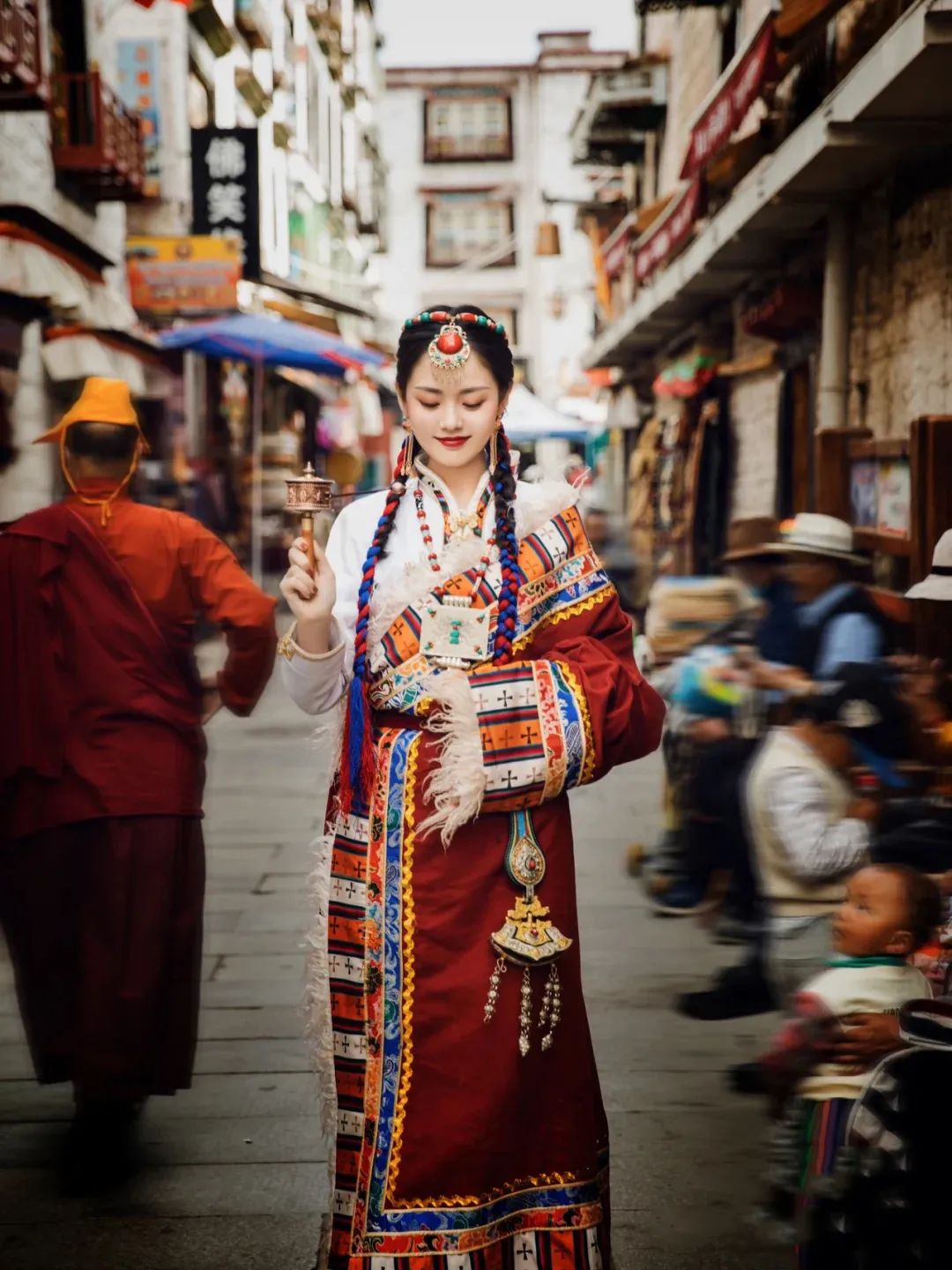
Section 7 Historical and Cultural Heritage and Scenic Tourism Planning
Forty-fourth historical and cultural heritage protection planning
(1) Planning one national historical and cultural city and one historical and cultural village, three provincial historical and cultural towns and four historical and cultural villages, 12 national key cultural relics protection units, 38 provincial cultural relics protection units, 15 municipal cultural relics protection units and 275 county (city, district) cultural relics protection units; There are 4 national intangible cultural heritages and 4 provincial intangible cultural heritages. See Table 3-7 for details.
List of cultural relics protection units at all levels in the city Table 3-7
|
Category
|
quantity
|
Mingxi
|
|
National historical and cultural city
|
one
|
Yueyang urban area
|
|
National historical and cultural village
|
one
|
Zhangguying village
|
|
Provincial historical and cultural towns
|
three
|
Yuantan Town (formerly Nie City), Changle Town and Changshou Town
|
|
Provincial historical and cultural villages
|
four
|
Jinjiabian Village (Xiangsi Township), Watermelon Village (Mujin Township), Huangqiao Village (Dongta Township) and Yingji Village (Wengjiang Town)
|
|
National key cultural relics
Protection unit
|
twelve
|
Yueyang Tower, Yuezhou Confucian Temple, Quzi Temple (including Qu Yuanmu), Zhang Guying’s ancient buildings in Ming and Qing Dynasties, Ren Bishi’s former residence, site of the pingjiang uprising, cishi Tower, Dajitou, Du Fu’s Tomb and Du Wenzhen’s Gong Temple, Longjiao Mountain Site, Xiangyin Confucian Temple and Zuo Wenxiang Gong Temple.
|
|
Provincial cultural relics protection units
|
38
|
Luozi State Site, Yueyang Church School, Yuezhou Pass, Luoshui Women’s Bridge, the former site of Pingjiang County Committee of the Communist Party of China, Yu’s Family Temple, the Rock Carving of Three Wars and Three Jiemo in Dayun Mountain, Guo Songtao’s former residence, Lujiao Kiln Site, Lu Su Tomb, the former site of Pingjiang Communication Office of the New Fourth Army, Liu Mansion Tomb, Liu Yijing and Chuanshu Pavilion, the former site of Soviet in Hunan, Hubei and Jiangxi Province, the tomb of Yu Di’s Second Concubine, Pingtian archway and Yue Zhouyao. Kanliang Dawu, Huilongmen, Linxiang Pagoda, Wenxing Pagoda-Champion Pagoda, Shuangjiangkou Bridge, Cheqi Mountain Site, Zhang Yueling’s former residence, Huangniwan Dawu, No.5 Tall Building, Quyuan Arch Warehouse, Junshan Cliff Stone Carving, Tomb of the Martyrs Killed in the War of Resistance Against Japan, Yushi Ancestral Hall and Lee Ancestral Hall.
|
|
Municipal cultural relics protection units
|
15
|
Zhou Yiqun Martyrs’ Tomb, Lanze Martyrs’ Tomb, Former Site of Xiangbei Special Committee, Fang Ancestral Hall, Fushanyuan-Huangjiayuan Site, Fenshanbao Site, Gaojiazui Site, Majiazui Site, Macheng Site, Xu Anzhen’s Tomb, Lee Tae’s Tomb, Li Chun’s Tomb, Fang Blunt’s Tomb, Guo Songtao’s Tomb, and Tamkang Cliff Stone Carvings.
|
|
County (city, district) level
Cultural relics protection unit
|
275
|
omit
|
|
national intangible cultural heritage
|
four
|
Baling Opera, Miluo Dragon Boat Festival custom, Yueyang Flower Drum Opera, Dragon Dance (Kowloon Dance)
|
|
Provincial intangible cultural heritage
|
four
|
Huarong clip leaves ideas, Dongting fishing songs, stories (Miluo Changle Story Club), Pingjiang Lantern Festival.
|
(2) Protective measures
In accordance with the relevant provisions of the "People’s Republic of China (PRC) Cultural Relics Protection Law" and the "Regulations on the Protection of Famous Historical and Cultural Cities, Towns and Villages", and according to the level of cultural relics protection units, the scope of protection and peripheral control zones are delineated, and protection signs are established; Any changes to cultural relics buildings must be reported to the competent department of cultural relics for approval according to legal procedures, and no unit or individual may dismantle, modify or rebuild cultural relics buildings at will; The restoration, repair and daily maintenance of historical sites and buildings must ensure the authenticity of cultural relics, and the restoration and repair of cultural relics must be planned and designed in detail under the guidance of experts; Comprehensively evaluate all kinds of cultural relics resources and distinguish their historical, scientific and artistic values; Implement fire control measures and eliminate potential safety hazards; The management of temples engaged in religious activities should be strictly strengthened, and the authenticity and integrity of cultural relics buildings should not be destroyed in the name of religious activities, and religious personnel’s awareness of cultural relics protection should be enhanced through education; Intangible cultural heritage should be well protected, sorted out and passed on.
Forty-fifth scenic area planning
(1) General layout
Two national scenic spots are planned, namely Dongting Lake-Yueyang Tower and Fushoushan-Miluo River scenic spots; There are five provincial-level scenic spots, namely Longjiao Mountain, Mufu Mountain-Shiniuzhai, Dayun Mountain, Wujian Mountain and Lianyun Mountain. There are two municipal-level scenic spots, namely Taohua Mountain and Bajingdong.
(2) Dongting Lake-Yueyang Tower Scenic Area
Scope: It includes five scenic spots, including Yueyang Tower, Junshan, Nanhu, Quzi Temple and Tieshan, and two independent scenic spots, Tuanhu and Chenglingji, with a total area of 332.96 square kilometers.
Scope of the core scenic spot: including the special protection point and the first-class protection area in the scenic spot, with a total area of 200.82 square kilometers.
Scope of peripheral protection zone: including some mountains, landscape control areas and some Dongting Lake waters outside the scenic area, with a total area of 1,355.07 square kilometers.
Nature: Lake-type national scenic spot with national cultural and natural heritage resources such as Yueyang Tower, Quzi Temple and Dongting Lake waterscape as its main features, and with multiple functions such as sightseeing, history education, cultural exchange, popular science investigation and leisure vacation.
(3) Fushou Mountain-Miluo River Scenic Area
Scope: It includes Fushou Mountain and Miluo River scenic area, as well as site of the pingjiang uprising, the former site of Pingjiang County Committee of the Communist Party of China, Hunan-Hubei-Jiangxi Revolutionary Memorial Hall and Dufu Tomb, with a total area of 165.8 square kilometers.
Scope of peripheral protection zone: including some mountains and landscape control areas outside the scenic area, with a total area of 144 square kilometers.
Nature: a national scenic spot with beautiful, deep and steep natural scenery as the main body and rich historical culture and red culture as the connotation, which can be used for sightseeing, leisure vacation, adventure drifting, patriotism education and cultural scientific research.
Article 46 Tourism planning
(A) to build a butterfly-shaped tourism spatial pattern
Butterfly-shaped tourism spatial pattern with buildings, islands and lakes as the leader, Hunan-Chu cultural tourism line as the trunk, Dongting ecology and Xiangyin leisure trip as the left wing, general’s hometown and mysterious trip to Hunan as the right wing.
(B) the implementation of the "11730" project
A faucet: the tourist center area with Yueyang Tower, Junshan Island and Dongting Lake as the main body is the faucet.
A boutique tourist route: Yueyang Tower (Dongting Lake, Junshan Island)-Zhang Guying-Quzici Xiangchu cultural tourist route.
Seven tourist attractions: the construction of famous buildings and famous waters, ancient folk villages, dragon boat customs, Dongting ecology, mysterious Linxiang, the hometown of generals, Xiangyin leisure and other seven tourist attractions.
Thirty tourist attractions: Yueyang Tower, Junshan Island, Nanhu Lake, Zhang Guying, Dayun Mountain National Forest Park, Acacia Garden, Gongtian Hot Spring, Quzi Temple, Miluo River Industrial and Agricultural Demonstration Park, Ren Bishi Memorial Hall, Bajing Cave, East Dongting Lake Wetland Bird Watching, Tuanhu Lake, Taohua Mountain, 6501 Silver Beach, Longjiao Mountain Qianjiadong and Wujianshan Forest Park.
(3) Tour routes
Special tourist routes: including Dongting scenery tour, Xiangchu culture tour, wetland environmental protection tour, folk customs tour, red hot land tour, general’s hometown tour and forest exploration tour.
Comprehensive tourist routes: including one-day tour of Junshan and Yueyang Tower; Two-day special tour of picking lotus in Yueyang and Tuanhu; Two-day bird watching tour in Yueyang and Dongting Lake; Three-day tour of Yueyang, Linxiang and Chibi; Three-day tour of Yueyang, Dayun Mountain and Zhangguying Village; Three-day tour of Yueyang, Zhangguying Village and Quzi Temple; Three-day tour of Yueyang and Miluo River; Yueyang, Zhang Guying, Pingjiang and other eight tourist routes.
Regional tourist routes: The tourist routes with surrounding cities include Yueyang-Changsha-Shaoshan Xiangchu Cultural Tour, Changsha-Zhangjiajie-Yueyang Famous Mountain and Water Tour, Chongqing-Yichang-Yueyang Three Gorges Tour, Yueyang-Wuhan-Nanchang Three Famous Buildings Tour, Yueyang-Chibi-Jingzhou Historical Sites Tour, etc. Tourist routes with surrounding areas include Yueyang-Hong Kong, Macao and Taiwan, Yueyang-South China, Yueyang-East China, Yueyang-Southwest China, Yueyang-Northwest China, Yueyang-Northeast China, etc. International tourist routes include Yueyang-Japan, Yueyang-Korea, Yueyang-America, Yueyang-European countries and other international tourist routes.
Section 8 Urban Ecological and Environmental Protection Planning
Article 47 Protection targets
Adhere to the concept of sustainable development, establish environment-friendly industries and ecological urban and rural systems, coordinate urban and rural development, optimize urban layout, strengthen environmental protection, use scientific means, strengthen the protection and governance of the existing ecological environment, control and slow down the deterioration of the ecological environment, and create a benign ecological environment system of "beautiful mountains and beautiful waters, suitable for work and livable".
Forty-eighth ecological construction planning
(1) Ecological functional areas: including ecological scenic spots, nature reserves, large rivers and lakes and their waterfront protection areas within the city.
Ecological scenic spots: including Longyao Mountain, Fushou Mountain, Wujian Mountain, Dayun Mountain, Mufu Mountain-Shiniuzhai, Lianyun Mountain, Taohua Mountain, Bajingdong Scenic Spot and urban ecological green space;
Nature reserve: mainly refers to Dongting Lake Nature Reserve (including Dongting Lake Wetland Reserve);
Large-scale waters: including Tieshan Reservoir, Lanjiadong Reservoir, Long Yuan Reservoir, Tuanwan Reservoir, Zhongfang Reservoir, Huanggai Lake, Nanhu Lake, Bajiao Lake, Songyang Lake, Baini Lake, Donghu Lake, West Lake and Collapsed West Lake, and their waterfront protection range of 50-500m.
(2) Ecological corridors: including waterfront corridors and traffic corridors.
Waterfront corridor: it mainly includes the Yangtze River, Xiangjiang River, Miluo River, Xinqiang River, Taolin River, Chang ‘an River, Huarong River, Ouchi River, etc., and 50-500 meters on both sides of the waterfront are used as ecological construction land;
Traffic Corridor: The traffic ecological corridor shall be built in combination with the protection areas on both sides of railways (including intercity tracks), expressways and national highways, including 50m on both sides of high-speed railways, 20m on both sides of railway trunk lines, 50m on both sides of expressways and 50m on both sides of national highways. Traffic corridors mainly include Beijing-Guangzhou Railway, Wuhan-Guangzhou Passenger Dedicated Line, Jingyue Railway, Yuejin Railway, Yuechang Railway, Yueji Railway, YueChangCheng International, Yiping Intercity, Beijing-Hong Kong-Macao Expressway, Suiyue Expressway-Beijing-Hong Kong-Macao Expressway Double Line, Hangrui Expressway, Pingru Expressway, Yiping Expressway, 107 and 106 National Roads and other traffic ecological corridors.
Article 49 environmental protection planning
(1) Atmospheric environment
Focusing on the control of sulfur dioxide, we will continue to implement its total emission control permit system, and implement measures such as the combination of source control and terminal treatment and emission trading to control the emission of smoke and industrial dust.
Implement the Clean Production Promotion Law and optimize the urban energy structure; Adjust the fuel structure, control and prohibit the use of high-sulfur coal, and promote the use of clean energy such as electricity, gas and solar energy.
Eliminate backward and heavily polluted fuel processes and equipment.
Adopt new technology to strengthen the control of automobile exhaust pollution.
The plan divides the city into two functional areas, one of which is ecological scenic spots, nature reserves and vast rural areas, and the air environmental quality maintains the first-class standard; The second-class area is urban area, and the air environmental quality maintains the second-class standard.
(2) Water environment
Strengthen the standard treatment of "industrial three wastes" and the construction of domestic sewage treatment and treatment facilities, rectify the wastewater discharge outlets in the city, and thoroughly remove the sewage outlets in urban and rural drinking water protection reaches.
Actively build urban sewage treatment plants and residential sewage treatment facilities, complete key treatment projects, and vigorously develop environmental protection industries.
Strengthen the comprehensive improvement of Xiangjiang River, Miluo River, Xinqiang River, Huarong River, Ouchi River and Chang ‘an River.
The water quality of the first-class protected area, precious fish protected area and fish and shrimp spawning ground of centralized drinking water source reaches the national class II standard; the water quality of the second-class protected area, general fish protected area and swimming area of centralized drinking water source reaches the national class III standard; the water quality of the general industrial water area and recreational water area which is not in direct contact with human body reaches the national class IV standard; and the water quality of agricultural water area and general landscape requires the water quality to reach the national class V standard.
(3) Acoustic environment
Harnessing industrial noise pollution sources in urban areas; Control the noise pollution of buildings; Strengthen traffic noise management, improve road traffic structure, limit the development of two-wheeled and three-wheeled motorcycles, control the time when large trucks enter the city, and formulate measures to ban the sound in urban areas.
(4) Solid waste
Focus on controlling the total amount of solid waste, vigorously develop the comprehensive utilization of solid waste, and strengthen the management and treatment of hazardous waste.
As soon as possible, Yueyang hazardous solid waste disposal center, medical and health waste centralized treatment center and waste battery storage will be built.
Classified collection and processing of urban domestic waste, establish and improve the old material recovery system, and realize the harmless, reduction and recycling of urban domestic waste treatment.
By the end of the planning period, the daily output of urban garbage in the city will be 4,350 tons, with the harmless treatment rate reaching 100% and the resource utilization rate reaching over 90%.
According to the principle of co-construction and sharing of infrastructure, it is planned to set up garbage disposal plants in towns above the central town, garbage transfer stations in general towns, and 25 garbage disposal plants, including 17 new garbage disposal plants, including 3 in the central city and 1 in each of the 14 central towns.
Section 9 Comprehensive Disaster Prevention Planning
Fiftieth flood control project planning
(A) planning objectives
The recent flood control is mainly based on the construction of dike projects; In the long term, it will be a flood control project that combines reservoir and dike and simultaneously discharges and stores.
(2) Urban flood control
The flood control standard for the central city and Xiaomoshan nuclear power station is once every two hundred years; Huarong county is once in a hundred years; Miluo, Linxiang City, Xiangyin, Yueyang, Pingjiang County, Yingtian, and the central towns meet once every 50 years; Other towns meet once every 20 years.
(3) embankment flood control
Ensure that the flood control standard of embankment (including Yonggu, Gucheng, Sanhe, Nanhu, Xiangzi, Xiangbin, Lingbei, Shatian, Matang, Junshan and Dongfeng Lake embankment) is once in a hundred years; Flood control standards for flood storage embankments (including Integration, Anhe, Xinhua, Xintai, Xinsheng, Qianliang Lake, Tuanzhou, Xinzhou, Tuanshan, Longxi, Jianxin, Construction, Lucheng, Jiangnan, Quyuan, Sancha Port, Beihu, Chengxi and Yitai alloy chicken embankments) are once every 50 years; General embankment (including Renmin, Zhongzhou, Leishi, Songbai, Donghu, Shi Niu embankment) flood control standard is once every 50 years.
Fifty-first waterlogging control project planning
(1) General policy: combining storage regulation with self-discharge and pumping.
(2) The waterlogging control reserve should be combined with urban drainage, and a gravity drainage gate should be set up, so that when the water level of the outer river is lower than the waterlogging level in the reserve, it will be drained by the drainage gate, and when the water level of the outer river is higher than the waterlogging level in the dike, it will be used as a flood control gate; The rainwater drainage system makes full use of topographic conditions and natural canals, and combines with flood control and drainage planning, and dispersedly arranges a ditch network, which is discharged into Xihe River nearby.
Fifty-second civil air defense project planning
(1) Planning principle: civil air defense should be combined with air defense in key areas and field operations, with emphasis on the protection of population and key targets. Through protection, rescue and emergency repair, the safety of people’s lives and property will be protected and the war potential will be preserved.
(2) Protection of key targets
A class of targets: municipal party committee, municipal government, military sub-district, county party committee, county government, and municipal (county) civil air defense headquarters;
Second-class targets: power supply bureau, telecommunication bureau, water supply company, radio station, TV station, hospital, school;
Three types of targets: various chemical plants, railway stations, long-distance bus stations and important bridges, highways, grain depots, oil depots, liquefied gas depots, dangerous goods warehouses, etc.
Article 53 Planning of fire control facilities
There are 26 new fire stations in the central city planning, with a total of 30, including 1 special fire station, 1 water fire station, 28 ordinary fire stations and 1 new fire training base.
In the planning and construction area of the county town and the central town, fire stations will be set up within a service radius of 7km2 within 5 minutes to reach the edge of the responsibility area, and in the suburban area with a service radius of 15km2. There are 42 planned fire stations, including 5 in Miluo, 5 in Linxiang and Xiangyin, 4 in Huarong, Yueyang and Pingjiang, and 1 in Yingtian and Central Town.
General town set up a full-time fire brigade or voluntary fire brigade, equipped with a certain level of fire fighting technology and facilities, and networked with the fire brigade in the central town, responsible for the fire safety of the town.
Taohua Mountain, Wujian Mountain, Longyao Mountain, Dayun Mountain, Mufu Mountain, Bajing Cave Mountain and Lianyun Mountain are identified as key forest fire prevention areas.
Article 54 Earthquake prevention and seismic planning
The seismic fortification intensity of Yueyang Tower District and Junshan District in the central city, Miluo City, Yueyang County and Xiangyin County and Yingtian Town is 7 degrees, and the seismic fortification intensity of Linxiang City, Yunxi District, Huarong County and Pingjiang County is 6 degrees. The seismic fortification intensity of urban lifeline and important projects (such as urban water supply, power supply, major hospitals, schools, large public buildings, transportation facilities, etc.) is increased by one level.
In urban planning, resource exploitation, road construction and land use layout, we should avoid and reduce the direct and indirect effects caused by earthquake disasters as much as possible, and it is strictly forbidden to choose sites in dangerous areas such as fractures and landslides and areas where earthquakes may cause secondary disasters such as fires, floods and mudslides.
Factories and warehouses that produce and store flammable, explosive and toxic products must leave residential areas in accordance with regulations; Set up the necessary safe evacuation land to ensure the smooth evacuation and rescue channels during the earthquake.
Special seismic safety evaluation must be carried out for the following projects, and the seismic fortification requirements shall be determined according to the evaluation results: major projects with seismic requirements higher than those specified in the current national seismic intensity or ground motion parameter zoning map and projects that may cause serious secondary disasters; Large-scale projects located in the 8 km area on both sides of the seismic intensity dividing line; Large-scale projects located in areas with poor seismic data research and detail; New large-scale projects in urban areas and large industrial and mining enterprises and economic and technological development zones covering a large area and spanning different geological regions; The construction of cities and towns around the country and the construction of evacuation passages along the city area should be conducive to both peacetime use and wartime evacuation, and the retreat distance of buildings on both sides should be sufficient so that the passage of motor vehicles will not be affected after the collapse of buildings during the earthquake.
Fifty-fifth lightning protection and disaster reduction planning
According to the seasonal climate, topography and lightning protection level of buildings (structures), give prominence to key points, give consideration to both urban and rural areas, base on the present and focus on the long term, and strengthen supervision and technical services.
(a) for the buildings (structures) that have been put into use, the safety inspection of lightning protection devices shall be carried out according to law, and the rectification of hidden dangers shall be supervised.
(two) to strengthen the risk assessment and preliminary design review of new buildings (structures) such as dangerous chemicals, key projects and infrastructure, and to strengthen the construction drawing review and construction inspection of construction projects.
(3) Strengthen the construction of lightning early warning capacity, improve the lightning location monitoring in the whole city, and add a lightning locator in Pingjiang, Xiangyin, Miluo, Huarong, Linxiang, Junshan, Yunxi and Quyuan counties (cities, districts), and add a wpr in Yueyang Fengyushan radar station to build a lightning early warning center; Assess and divide the lightning disasters in the whole city (counties and cities); Establish a lightning information collection, transmission, early warning and release system covering urban and rural areas; Strengthen the publicity of lightning protection and disaster reduction knowledge and practical methods of lightning protection, and improve public awareness and basic skills of lightning protection.
Article 56 Other emergency plans
Strengthen the prevention and control of geological disasters in the construction area, and do a good job in geological disaster risk assessment for urban construction, engineering construction in geological disaster-prone areas and other engineering construction projects that may lead to geological disasters, so as to reduce the occurrence of artificially induced geological disasters; Strengthen the construction of geological disaster monitoring information system and epidemic situation monitoring information system, establish a disaster (epidemic situation) monitoring network system for hidden danger points of cities, counties (cities), townships and villages, timely release geological disasters and epidemic situation monitoring and forecasting, and guide grassroots prevention work.
Section 10 Construction Planning of "Two-oriented Society Comprehensive Reform Area"
Fifty-seven basic principles
(A) the people-oriented principle: "two-oriented" social construction, we must pay attention to people’s livelihood, people-oriented.
(2) the principle of giving priority to the environment: to develop the economy, we must give priority to the ecological environment and prevent pollution; When various interests conflict, priority should be given to ecological and environmental benefits.
(3) The principle of sustainable development: The economic model of the "two-oriented" society is an important part of the national sustainable development strategy, which must reflect the idea of sustainable development and adhere to the main line of development.
(D) Principle of structural optimization: To build a "two-oriented" society, we should speed up the adjustment of industrial structure and change the mode of economic growth in economic development.
Article 58 and the docking planning of "Changsha-Zhuzhou-Xiangtan" urban agglomeration and Wuhan urban circle
(A) industrial docking
Primary industry: guided by market demand, actively serve the two major urban agglomerations while consolidating the existing market, vigorously develop green ecological agriculture and deep processing industries of agricultural and sideline products, focus on building large vegetable and fruit bases such as Huanggai, Yanglousi, Dajing, Zhangshu and Wushi, accelerate the construction of standardized production bases of agricultural and sideline products for the two major urban agglomerations, and extend the food industry chain.
Secondary industry: While strengthening advantageous industries such as petrochemical paper-making, renewable resources and electric machinery, we will actively absorb industries such as food processing, paper-making, medicine, textile and building materials that are about to move out of Changsha-Zhuzhou-Xiangtan urban agglomeration and Wuhan urban agglomeration.
Tertiary industry: docking the tourism market, integrating into its tourism industry chain, focusing on the construction of tourism routes such as Xiangchu culture, the hometown of the Three Kingdoms, famous buildings in the south of the Yangtze River, and developing leisure and recreation bases such as farmhouse music and fisherman music; Docking real estate industrial clusters, building livable cities and developing characteristic real estate projects; Dock the modern logistics market, actively introduce advanced circulation formats and business models, and build an important logistics base between Changsha and Wuhan.
(B) major infrastructure and social service facilities docking
Highways: Focus on the construction of Beijing-Hong Kong-Macao Expressway double track, Pingru Expressway, Yanjiang Highway and Yuelu Highway.
Railways: Focus on the construction of Wuhan-Guangzhou passenger dedicated line, Yue Great Wall International Railway and its stations.
Waterways and ports: focus on improving the waterways of the Yangtze River and Xiangjiang River, improve navigation capacity, and coordinate the development of shoreline resources and port functions.
Energy facilities: focus on the construction of Xiaomoshan nuclear power plant and Huaneng power plant phase III project.
Social service facilities: Make full use of the advantages of the two urban agglomerations in education, culture, medical care and sports, and form a complementary system of social service facilities to share regional resources.
(3) Information docking
Taking public information resources such as e-government, economic information, transportation, talents and enterprise credit as the starting point, we will improve the government public information network and speed up the construction of backbone networks such as investment promotion, comprehensive economic information, transportation and enterprise credit; Jointly develop and build a comprehensive and specialized public information exchange platform with the two major urban agglomerations to realize the interconnection of public backbone networks.
(D) ecological environment docking
Promote cooperation with the two major urban agglomerations in environmental protection industry, and focus on strengthening the comprehensive management of boundary rivers (such as the Yangtze River and Xiangjiang River) and boundary lakes (such as Dongting Lake and Huanggai Lake) to achieve co-governance of ecological environment.
Section 11 New Rural Construction Planning
Article 59 guiding ideology
Carry out the spirit of the 17th National Congress of the Communist Party of China, take Scientific Outlook on Development as the guide, follow the requirements of "development of production, affluent life, civilized rural customs, clean village appearance and democratic management", take developing production and promoting agricultural modernization as the fundamental task, respect farmers’ dominant position and improve farmers’ quality as the core, take comprehensive, coordinated and sustainable development as the basic requirement, take overall consideration as the fundamental method, and establish the "promoting agriculture by industry and taking the city as the driving force".
Sixtieth principles of village layout
(a) according to the principle of planning first, the county (city) village system planning should be worked out. Village planning should be made for expanded, newly built and protected villages. Village planning should be made for other villages according to development needs, and the layout system of county towns-central towns-general towns-central villages and grass-roots villages should be gradually improved, so as to promote the orderly development of urban and rural areas and guide the rational construction of villages.
(two) in accordance with the principle of "upgrading a batch, protecting a batch, transforming a batch, and absorbing a batch", comprehensively improve the existing villages and rationally distribute rural settlements.
(three) adhere to the principle of intensive and economical, and promote the construction of safe, economical, applicable and well-off housing.
(four) in accordance with the principle of focused, beautiful environment and convenient life, supporting the construction of infrastructure and social service facilities.
(5) In accordance with the principle of "acting according to local conditions and capabilities", strengthen the comprehensive improvement of rural environment, organically combine environmental beautification with house decoration, highlight local characteristics, and build a beautiful new countryside.
Sixty-first village construction guidance
(1) Extended villages: properly handle the relationship between reconstruction, protection, development and construction of old and new areas, continue the spatial pattern of the original villages, make overall arrangements for the supporting construction of public facilities and infrastructure in the old and new areas, and build new villages in an orderly manner; Village reconstruction should attach importance to the protection and utilization of historical and cultural resources, and strengthen the supporting construction of infrastructure and public service facilities; The new and expanded villages should be well connected with the original villages in terms of social network, road system, spatial form, etc., and organically coordinated in architectural style, landscape environment, etc., and try to form a compact layout in groups to avoid disorderly spread.
(2) Newly-built villages: consideration should be given to the harmony with the natural environment, fully reflecting the characteristics of the customs and people’s feelings in the hometown of Longyu and the characteristics of the times; Intensive and economical use of land; Reasonable supporting infrastructure and public facilities in construction of the village; Formulate environmental construction requirements and implementation measures for new villages.
(3) Protected villages: adhere to the principle of protection first, combining protection with scientific utilization, scientifically delimit strict protected areas, general protected areas and environmental coordination areas, and strictly protect the overall style of historical and cultural ancient villages; Make full use of natural conditions, tap local cultural connotation and protect local characteristics; On the premise of protecting the traditional style, we can decorate the interior of traditional houses, change water, kitchen and toilet to meet the requirements of modern life; Within the environmental impact scope of village protection, it is strictly forbidden to build new construction projects that affect the protection style; Formulate the steps and measures to implement protection and utilization.
(4) Controlled villages: give priority to renovation of existing residential areas and strictly control new residential areas; When villagers build new houses, they must concentrate on the newly planned residential areas.
(5) Relocation-type villages: No construction activities (including the renovation of dangerous houses) shall be carried out except the reinforcement and maintenance of dangerous houses; Its construction activities should be incorporated into the incorporated villages for planning and construction, so as to ensure the gradual demolition and cancellation of such villages.
Article 62 Implementation measures
(1) Vigorously promote agricultural modernization, adjust rural industrial structure and cultivate leading industries.
(2) Actively promote urbanization, accelerate the transfer of rural surplus labor, and expand the space for farmers to obtain employment and increase their income.
(3) Accelerate the development of social undertakings such as culture, education and health in rural areas and the construction of municipal infrastructure such as water, electricity, roads and gas.
(4) Strengthen training and education to improve the comprehensive quality of farmers.
(5) Protecting the environment and coordinating development.
(6) Strengthening the construction of rural social security system.
(7) Expand grassroots democracy and promote the construction of democracy and legal system in rural areas.
Section 12 Recent Construction Planning
Article 63 planning principles
(a) prioritize, according to the first urgent and then slow arrangements;
(two) infrastructure first, rolling development into pieces;
(3) Combination of distance and sustainable development.
Spatial layout of sixty-four key development areas
Actively cultivate "Yue-Lin-Rong Metropolitan Area" and "Mi-Xiang-Qu Town Group"; Guide urban industries, population, land, infrastructure and other elements to focus on the central region, and create conditions for the formation and development of the central urban economic belt. The central village shall formulate village planning, and other villages shall formulate village planning according to the development needs. See Table 3-8 for the scale of key cities and towns.
Table 3-8 for the scale of key development towns
|
Town name
|
Town planning model
|
Town name
|
Town planning model
|
|
Population size (ten thousand people)
|
Land use scale (km2)
|
Population size (ten thousand people)
|
Land use scale (km2)
|
|
Yueyang city
|
115
|
115
|
Miluo city
|
twenty
|
twenty
|
|
Linxiang city
|
18
|
18
|
xiangyin county
|
twenty
|
twenty
|
|
Huarong county
|
15
|
15
|
yueyang county
|
15
|
15
|
|
pingjiang xian
|
18
|
18
|
Yingtian town
|
five
|
five
|
Article 65 Support system construction plan (see Annex 5 for details)
(1) Comprehensive transportation facilities
Port shipping: It is planned to build 11 port areas, including Huarong, Junshan, Yueyang Tower, Qilishan, Chenglingji, Daorenji, Lucheng, Linxiang, Xiangyin, Miluo and Yueyang County, with 43 operation areas and 352 berths. Among them, there are 102 planned berths in the port area of the central city, 31 new berths (18 freight berths above 1000t) and 71 reserved berths. There are 128 berths in the port area of the county under the jurisdiction of the city, 8 are newly built, 27 are reserved and 93 are reserved; Complete the first phase project of Songyang Lake in Chenglingji and start the second phase project; New construction and renovation of 28 berths above 1,000 tons, and construction of a number of 1,000-ton and 500t-ton docks connecting county industrial parks; Complete the construction of Dongting Lake water emergency rescue command center; Dredging and regulating waterway is 52Km, including Huarong River waterway 18Km, Ouchi River waterway 24Km and Dongting Lake waterway 10Km.
Railway: complete the construction of Wuhan-Guangzhou passenger dedicated line and its station; Start the construction of Jingyue Railway; Complete the route selection of Yuejiu, Yueji and Yuechang railways, and strive to start construction.
Highway: Complete the construction of Suiyue, Yuechang and Pingru expressways, start the construction of Yuechang section of Beijing-Hong Kong-Macao double-track expressway, and build 13 new expressway connecting lines. Completed 12 reconstruction and construction projects of national and provincial trunk lines in the city, with a total mileage of 459.6Km. 447 reconstruction projects of Tongxiang Highway were completed, with a total mileage of 4443.9Km, including 25 county roads leading to provincial roads, accounting for 617.0Km, 82 township roads leading to provincial roads, accounting for 1003.3Km, 77 economic trunk roads, accounting for 1035.9Km and 263 general county roads, accounting for 1787.6Km. It is planned to build 16 urban passenger stations, including 4 in the central city, namely East Bus Station, South Bus Station, Guozhen Bus Station and Yunxi Bus Station. It is planned to build or rebuild 38 logistics parks and freight stations, including 3 logistics parks in the central city.
(2) Electric power engineering
Electricity consumption forecast: the electricity load is about 16.3 billion kWh.
Power supply: 7 power plants including Huarong Xiaomoshan Nuclear Power Plant, Quyuan Kaidi Bio-power Plant, Junshan Heping Mufushan Wind Power Plant, Pingjiang Pumped Storage Power Plant, Huaneng Yueyang No.2 Plant and Miluo Fanjiayuan Thermal Power Plant were started.
Power grid planning: 15 220KV substations will be built or rebuilt, with a total capacity increase of 3060MVA. Construction and renovation of 220KV power lines for 610km; There are 53 new and renovated 110KV substation projects, including 16 in the central city.
(3) Water supply and drainage works
Water supply project: Improve the construction of urban waterworks and supporting water supply pipe network, including seven main water supply channels, including Huarong and Junshan Yangtze River water supply trunk canal, Linxiang Tuanwan Reservoir water supply trunk canal, Miluo Lanjiadong Reservoir water supply trunk canal, Pingjiang Yaotang Reservoir water supply trunk canal, Zhang Guying Tongmu Reservoir water supply trunk canal and Changshou Huangjinyan Reservoir water supply trunk canal. It is planned to build 12 waterworks.
Drainage project: the collection and treatment rate of urban domestic sewage reaches over 65%, and the discharge standard rate of industrial wastewater reaches 90%. Gradually establish a sound urban drainage system and sewage treatment system to improve the popularity of drainage pipe network; 11 new sewage treatment plants are planned.
(4) Gas engineering
We will improve the construction of gas pipe networks in large, medium and small cities, and the coverage rate of gas use will reach 100%.
(5) Communication engineering
Expand and upgrade the communication facilities in large, medium and small cities, and uniformly arrange the communication lines in the urban areas of large, medium and small cities in the integrated communication pipeline.
(6) Education
Develop vocational education and adult education to promote the development of secondary specialized schools; Implement compulsory education in junior high school with high standards and popularize education in senior high school; Township primary schools mainly merge and expand the scale of running schools; Add kindergartens in urban areas and rely on social forces to develop child care.
(7) Medical and health care
With the goal of improving the comprehensive utilization rate of health resources and the overall benefit of health services, with the focus on developing rural medical and health care networks, the layout of medical and health facilities should be rationally adjusted, and a three-level medical and health network with complete specialties, advanced technology, reasonable distribution, moderate planning and perfection should be established to expand the scale of existing medical institutions.
(8) Cultural facilities
Further improve the supporting construction of municipal cultural facilities such as cultural centers, libraries and local theaters, and build community-level cultural centers in combination with community centers. Develop public cultural places such as cultural squares.
(9) Sports facilities
Improve the existing sports activity center and the supporting construction of sports facilities in schools and communities; Set up some community sports facilities in combination with the layout of residential areas and main public green spaces in urban areas; Build a sports center in the central city and build a number of sports venues in various towns.
The second part of the central city planning
Chapter IV City Nature and City Scale
Article 66 the nature of the city
Yueyang is a national historical and cultural city and an excellent tourist city. Petrochemical energy base in central China; Tongjiang Dahai Port and Modern Logistics Center in Hunan Province; Livable lakeside cities in the middle reaches of the Yangtze River.
Article 67 Population size: 1.15 million in 2015; 1.4 million in 2020; 1.6 million in 2030.
Article 68 Scale of land use
In 2015, the scale of construction land will be 115km2, and the per capita construction land will be controlled within 100 m2.
In 2020, the scale of construction land will be 140km2, and the per capita construction land will be controlled within 100 m2.
In 2030, the scale of construction land will be 155 km2, and the per capita construction land will be controlled within 97 m2.
Chapter V Spatial Control of Urban Planning Areas
Section 1 Space Control Planning
Article 69 the boundary of spatial growth
It starts from the lakeside in the south and the flat terrain in the south of the mountain, and reaches the Wuhan-Guangzhou Passenger Dedicated Line and Huangmao Mountain in the south of Guozhen; North to Yangxi Lake and Yangtze River; East from Tuohe Mountain, Huangmao Mountain, Ancient Niu Shan, Wuhan-Guangzhou Passenger Dedicated Line, Suiyue Expressway and Yuechang Expressway; West to Dongting Lake and Yangtze River; Junshan section is within the flood control levee where Liulin Town and Xicheng Office are located, with a total land area of 622 km2 (including 62 km2 water surface).
Article 70 Space control zoning
(1) Built-up area: It is the built-up land in the current towns, including the built-up land in Yueyang Tower, Yunxi and Junshan District, with a total land area of 90.75km2.
(2) No-building areas: areas that give priority to protection and strictly control development and construction. It mainly includes basic farmland protection areas, cultural sites, ecological spaces, scenic spots, water source protection areas, underground mineral resources and military facilities protection areas, with a total area of 907.35km2.. The specific scope is the basic farmland, rivers and lakes and surrounding protection zones in Junshan District. South Lake, Dongfeng Lake, Jijia Lake, Bajiao Lake, Songyang Lake, Baini Lake and its branches and surrounding protected areas in Yueyanglou District and Yunxi District; Tuohe Mountain, Huangmaoshan Mountain, Kunshan, Jinfengqiao Reservoir water source protection sites in the east of the central city, and other reservoirs around the mountain; Basic farmland and water system of Sanhe Township in Economic Development Zone; South Huangmao Mountain, Yingzui Mountain, Hemp Mountain, conservation zone, a newly opened underground mineral.
(3) Construction-restricted area: refers to an area with ordinary ecological environment conditions, low development density, few and scattered secondary and tertiary industries, poor transportation facilities, with one industry as the mainstay, less development and construction activities and slow development, with a total area of 286.94km2.. It mainly includes some low-lying areas in junshan Liulin and linjiaolao areas; East of National Highway 107 and Wuhan-Guangzhou Passenger Dedicated Line; Kang Wang, Sanhe area part of the topography is more complex land.
(4) Suitable construction area: it is an area that is mainly based on efficient land use and should be given priority to development and construction according to the plan, with a total land area of 214.96km2. It mainly includes the intersection, Lucheng, Daorenji Town, the northwest and south of Yunxi Town, and the west side of Songyang Lake near the Yangtze River. Wuhan-Guangzhou Passenger Dedicated Line from the east of National Highway 107 in Bajiao Lake; Jinfeng Bridge and Muligang area east of National Highway 107; Qijialing and Guozhen area to the west of National Highway 107; Part of the land in Junshan District; Planning airport reservation; Part of the land on the lakeside except Nanhu Scenic Area.
Section 2 Urban Four-Line Control
Article 71 The urban blue line refers to the geographical boundaries for the protection and control of urban surface water bodies, such as rivers, lakes, reservoirs, canals and wetlands, which are planned and determined in the central city. Specifically, it includes Nanhu Lake, Dongfeng Lake, Jijia Lake, Bajiao Lake, Songyang Lake, Baini Lake, Xiaojia Lake, Leigong Lake, Moon Lake and its branches, Jinfengqiao Reservoir, etc.
Relevant construction within the urban blue line must conform to the approved urban planning. Prohibit construction activities that violate the control requirements of the urban blue line; Prohibit unauthorized landfill, occupation of urban blue line water construction activities; It is forbidden to carry out construction activities such as blasting, quarrying and earth borrowing that affect the safety of water systems; It is forbidden to build all kinds of sewage facilities without authorization; Other activities that damage the protection of urban water systems are prohibited.
Seventy-second city green line: refers to the control line of all kinds of urban green space. Including urban public green space, protective green space, production green space, residential green space, unit attached green space, road green space, scenic woodland and so on.
Land within the urban green line shall not be used for other purposes, and shall not be developed and constructed in violation of laws, regulations, mandatory standards and approved plans. No unit or individual is allowed to intercept rivers and streams, borrow soil and stone, set up garbage dumps, discharge sewage and other activities that damage the ecological environment within its scope.
Article 73 The urban yellow line refers to the control boundary of urban infrastructure land that has an impact on the overall urban development and is determined in urban planning and must be controlled. Specifically, it includes urban public transportation, water supply, drainage, sanitation, gas, heating, power supply, communication, fire protection, flood control, earthquake prevention and disaster prevention facilities and other urban infrastructure that have an impact on the overall development of the city.
Once the city yellow line is approved, it shall not be adjusted without authorization. Construction within the urban yellow line shall conform to the approved urban planning.
It is forbidden to construct buildings, structures and other facilities in violation of the requirements of urban planning in the yellow line of the city; It is forbidden to carry out construction in violation of relevant national technical standards and norms; It is forbidden to modify, relocate or demolish the original urban infrastructure without approval; Other acts that damage urban infrastructure or affect the safety and normal operation of urban infrastructure are prohibited.
Article 74 City Purple Line refers to the protection scope of historical and cultural blocks in national historical and cultural cities and historical and cultural blocks announced by the provincial people’s government, as well as the boundaries of the protection scope of historical buildings outside historical and cultural blocks announced by the people’s governments at or above the county level. Specifically, it includes two historical and cultural blocks in Dongting South Road and Dongting North Road, Yueyang Tower, a national cultural relic, and Yueyang Confucian Temple. Twelve provincial cultural relics; Forty-nine cultural relics at the city and county levels.
The maintenance and renovation of historical buildings must maintain the original appearance and style, and the construction within the scope of protection shall not affect the display of historical buildings. The people’s governments at the city and county levels shall, in accordance with the protection plan, renovate and update historical and cultural blocks in order to improve the living environment and strengthen the transformation and construction of infrastructure and public facilities. Construction activities within the scope of the purple line of the city, involving cultural relics protection units, shall comply with the relevant national laws and regulations on cultural relics protection. After the approval of this master plan, the protection plan of historical and cultural cities should be compiled separately.
Chapter VI Overall Layout of Cities
Section 1 Overall Urban and Rural Planning
Article 75 Planning scope
Urban and rural planning scope: the urban planning area determined in this plan, with a total area of 1500km2.
Article 76 Overall objectives
Standardize the behavior of urban and rural construction, strive to improve the urban and rural economic structure, actively adjust the urban and rural economic layout, protect the ecological environment, rationally use land resources, promote the development of rural industrialization, and accelerate urban construction. Encourage farmers to concentrate in towns and residential areas, improve public facilities and infrastructure, make urban and rural environment integrate, have a good ecology and live a prosperous life, realize the unified and coordinated development of urban and rural areas, and build Yueyang into a modern civilized city with developed economy and prosperous urban and rural areas.
Main contents of article 77
Coordinate urban and rural spatial layout, infrastructure construction, employment and social security, industrial development, social development, and ecological environment construction and protection.
Article 78 Urban population and construction land
By 2030, the total population of the planning area will reach 1.849 million, including 1.715 million urban residents, and the urbanization level will be 92.75%. See Table 6-1 for details.
List of urban population and construction land planning in the planning area Table 6-1
|
|
Present town
Population (ten thousand)
|
Land for construction of existing towns (km2)
|
Guihuacheng town
Population (10,000)
|
Planning and construction
Land used (km2)
|
|
Planning and construction area
|
84.83
|
86.32
|
160
|
155
|
|
Shuangtang town
|
0.32
|
0.32
|
2.0
|
2.2
|
|
Qianlianghu town
|
1.60
|
1.5
|
4.0
|
4.4
|
|
Guangxingzhou town
|
0.48
|
0.78
|
2.5
|
2.8
|
|
Xinkai town
|
0.38
|
0.32
|
1.5
|
1.7
|
|
Xushi town
|
0.32
|
0.1
|
1.5
|
1.7
|
|
Combined plan
|
87.61
|
89.24
|
171.5
|
167.8
|
Seventy-ninth urban spatial layout structure
The urban spatial layout structure is a four-level tower town group of "One Heart, Five Towns, Nine Market Towns and Twenty Central Villages".
One heart: the central city.
Five towns: Shuangtang, Qianliang Lake, Guangxingzhou, Xinkai and Xushi Town.
Jiuji Town: Changlingtou, Doupeng and Sanhe in the Economic Development Zone; Baijing in Yunxi District; Conscience Fort, Caisang Lake, Yinjiapu, Liumenzha and Matang Market Town in Junshan District.
Twenty central villages: Wujiang, Jiapu, Jinjia, Lanqiao, Gaocheng, Yingfeng, Huayuan and Pingdi villages in the Economic Development Zone; Xingang, Heping and Huanggao villages in Yunxi District; Hongshi, Hexing, Huangjin, Chongqing, Xiaotai, Qiankou, Friendship and Zhenxing Villages in Junshan District; Binhu Village, Matang Town, Yueyang County. See Schedule 6 List of Village Planning for details.
Article 80 Planning of rural residential areas
(A) the division of construction areas
The urban planning area is divided into forbidden construction, strict control and general control areas, so as to speed up the process of urban-rural integration, improve the urban-rural living environment and realize urban-rural overall planning.
(2) Prohibited construction area: refers to the area where villagers are prohibited from building self-occupied houses, including:
Green land and water land determined by the overall urban planning: Nanhu Lake, Dongfeng Lake, Jijia Lake, Bajiao Lake, Songyang Lake, Baini Lake, Xiaotian Lake, Yangxi Lake, Haohe River and other lakes and their ecological green space control areas; There are 26 urban parks such as Yueyang Tower Park, Jin ‘e Park, Nanhu Park and Junshan Park. Lake scenery belt, Daqiaohe scenery belt, Changkang Road (National Highway 107) protective belt, high-voltage power corridor, ecological corridor, and protective belts on both sides of railways and expressways.
Basic farmland in urban planning area: high-yield cultivated land for cash crops such as grain crops, oil crops, cotton and vegetables.
Forest land in urban planning area: Yingzui Mountain, Huangmao Mountain, Kunshan Mountain, Pipa Mountain, Huangmao Mountain, Tuohe Mountain, Bijia Mountain and forest land determined by provinces, cities, districts and towns.
100-year flood inundation area and Dongting Lake wetland protection area: the urban flood control levee faces the beaches, slopes and wetlands on the Yangtze River and Dongting Lake side, as well as the islands and beaches in the Yangtze River and Dongting Lake.
The ecological protection scope of the 30m section inside the flood control levee of the Yangtze River and Dongting Lake (dike protection area), the section of the inner lake river not less than 30m (ecological protection area), and the reservoirs, ponds and water sources; Rivers and water sources in the area: Xinqiang River, Nanhu Lake, Bajiao Lake and Baini Lake; Tieshan reservoir to Jinfengqiao reservoir canal (urban water source) on both sides of the section of not less than 30m.
The main scenic spots and scenic spots in the scenic area are controlled and protected: Yueyang Tower, Junshan, Nanhu Scenic Area and Tuanhu and Chenglingji independent scenic spots.
Not less than 20m along both sides of railway trunk line, 50m along both sides of Wuhan-Guangzhou high-speed railway, and not less than 10m along both sides of railway branch lines and special lines; 50m along both sides of the expressway, not less than 50m along both sides of the national highway, not less than 20m on both sides of the provincial highway and the first-class highway, and not less than 10m on both sides of the secondary and below highways; 500KV high-voltage power line corridor is 40m wide, 220KV high-voltage power line corridor is 30m wide and 110KV high-voltage power line corridor is 20m wide; 10m along both sides of other engineering pipelines (optical cables, natural gas, oil pipes, etc.).
(3) Strictly controlled area: refers to the villagers’ area where self-built houses by villagers must be approved by planning, that is, residential quarters and residential groups, which are multi-storey unit houses and limited to one household, including:
Residential land, public facilities land, industrial land, storage land, external traffic land, road square land, municipal public facilities land, special land, etc. as determined by the overall urban planning.
Villagers’ self-built housing must be in the strictly controlled area (urban planning and construction area), and the current situation of residential land belongs to rural collective land and there is a large open space in the village. It is planned to choose some as construction land for villagers’ residential areas.
(4) General control area: refers to the villagers’ points where self-built houses must be approved by the planning, and one building is limited to one household. The specific scope is other land except the forbidden construction area and strictly controlled area, and villagers are allowed to build their own houses in the land selected by the plan.
The overall layout of the central city in the second quarter
Article 81 The development strategies of urban construction are: eastward expansion, northward advancement, southward extension, western alliance and China promotion. The leading development direction of urban land use is: eastward expansion, northward advancement and southward extension.
Article 82 Urban spatial structure
According to the guiding factors of urban space and the present spatial form, the spatial layout mode is a strip-like structure along Dongting Lake and Yangtze River, and the ecological green spaces of Dongting Lake, Bajiao Lake, Songyang Lake and Baini Lake alternate among the groups.
Article 83 Layout structure of land use
The layout structure of land use is "one master and three deputies": one master is the main urban area, and three deputies are Yunxi, Lukou and Junshan urban areas.
(1) Main urban area: from Hubin and Qijialing in the south, to Chenglingji Huaneng Power Plant and Taigelin Paper in the north, Dongting Lake in the west and Suiyue Expressway in the east. It focuses on residence, business finance, administrative office, culture and education, high-tech industries, tourism services and leisure vacations, and adopts a compact development model. The land layout is Jinfengqiao Municipal Commercial Center, Dongmaoling Municipal Commercial Sub-center, Chenglingji Port and Industry, Qilishan-Lengshuipu Industry, Muligang-Kang Wang Industry, Qijialing-Guozhen Cultural and Educational Six Areas, with a land area of 90km2.
(2) Yunxi City: including Yunxi, Songyang Lake, Bajiao Lake and Daorenji. Mainly based on port logistics and industry, the land layout is seven areas, namely Songyang Lake Port Logistics, Songyang Lake Harbor Industry, Yunxi Fine Chemical Industry, Baling Petrochemical Industry, Daorenji Residence, Yunxi Residence and Bajiao Lake Residence, with a land area of 41.7km2.
(3) Crossroads: including crossroads, Wenqiao and Lucheng. Mainly industrial, the land layout is Changling petroleum industry, Lucheng residence, intersection residence, Wenqiao residence and supporting service area, with a land area of 9.3km2..
(4) Junshan City: including Liulinzhou, Linjiaolao, Haohe and Junshan Island. Tourism, leisure, residence and ecological agriculture are the main areas, and the land layout includes four areas: Hangkou residence, nine kilometers public service, Haohe and Junshan Island tourism and leisure, and Linjiaolao industry, with a land area of 14 km2.
Chapter VII Urban Land Layout Planning
Article 84 Principles of land use layout
(A) is conducive to the sustainable development of social economy.
(2) Conducive to the protection of the ecological environment.
(3) Conducive to the long-term development of the city.
(four) conducive to the efficient use of urban infrastructure.
(five) is conducive to the life and work of urban residents.
Eighty-fifth urban construction land structure (see table 7-1)
Table 7-1 Structure of Urban Construction Land
|
serial number
|
Land use code
|
Land name
|
Area (km2)
|
Occupy urban construction
Land use (%)
|
national standard
((%)
|
per capita
(m2/ person)
|
national standard
(m2/ person)
|
|
one
|
R
|
residential estate
|
45.68
|
29.47
|
20—32
|
28.55
|
18—28
|
|
2
|
M
|
industrial land
|
35.27
|
22.75
|
15—25
|
22.04
|
10—25
|
|
three
|
S
|
roads and squares land
|
19.40
|
12.52
|
8—15
|
12.13
|
7—15
|
|
four
|
G
|
green
|
20.12
|
12.98
|
8—15
|
12.58
|
≥9
|
Article 86 Planning of residential land
(A) planning principles
The construction of the new district should respect nature, rational layout, piece-by-piece development and centralized construction in order to form a scale;
The transformation of old urban areas is mainly to relieve population, improve infrastructure and service facilities, and comprehensively improve the living environment level of old urban areas.
The planning concept of "people-oriented" should be emphasized in the construction of residential areas, with the goal of creating a healthy and beautiful living environment, and the construction of "ecological and intelligent" should be vigorously promoted.
(2) Planning objectives
Take the construction of the new district as the leading factor, improve the environment of the old district, adjust the living structure, and build a modern residential area with perfect facilities, beautiful environment and unique characteristics. The per capita residential land is 28.55m2, and the green rate is not less than 35% in the new area and 30% in the old area; The per capita public green area in residential areas (including residential areas and groups) is not less than 2.0m2.
(3) Planning and layout
The planned residential land area is 45.68km2, accounting for 29.47% of the total planned construction land area.
Fourteen residential areas are planned, including Tiexi, Jin ‘e Mountain, Huabanqiao, Lengshuipu, Bazimen, Jinfeng Bridge, Xinhua, Qijialing, Hubin, Chenglingji, Bajiao Lake, Yunxi, Lukou and Junshan. See Table 7-2 for the population land in each residential area.
Table 7-2 List of Population and Land Use Planning in Residential Areas
|
order
number
|
Section name
|
residential estate
Area (ha)
|
human population
(ten thousand)
|
order
number
|
Section name
|
residential estate
Area (ha)
|
human population
(ten thousand)
|
|
one
|
Tiexi residential area
|
528
|
19.55
|
eight
|
Qijialing residential zone
|
164
|
3.30
|
|
2
|
Jin’ eshan residential zone
|
300
|
13.80
|
nine
|
Lakeside residential area
|
355
|
11.72
|
|
three
|
Huabanqiao residential zone
|
651
|
28.47
|
10
|
Chenglingji residential area
|
203
|
5.01
|
|
four
|
Lengshuipu residential area
|
241
|
10.72
|
11
|
Bajiaohu residential zone
|
466
|
14
|
|
five
|
Bazimen residential zone
|
264
|
11.82
|
twelve
|
Yunxi residential area
|
204
|
6.12
|
|
six
|
Jinfeng brg residential zone
|
124
|
4.95
|
13
|
Intersection residential area
|
152
|
3.04
|
|
seven
|
Xinhua residential area
|
156
|
6.24
|
14
|
Junshan residential area
|
515
|
13.4
|
(four) land classification and control standards
1) Residential land is divided into Class I and Class II residential land.
2) Residential construction is divided into low-rise, multi-storey, middle-high-rise and high-rise.
Among them: low floor: 1-3 floors; Multi-layer: 4-6 layers; Middle and high floors: floors 7-9; Top floor: ≥10 floors
(5) Construction control indicators
According to national standards, we will build modern residential areas with complete facilities of different grades and types. Land use indicators of various facilities should be strictly in accordance with the requirements of the National Code for Planning and Design of Urban Residential Areas (GB 50180-93). See table 7-3.
Table 7-3 Related Control Indicators of Planning Residential Area
|
category
|
Population density (person /ha)
|
volume fraction
|
|
Low-rise residence
|
200-280
|
0.4-0.7
|
|
multi-storey residential building
|
280-420
|
1.0-1.5
|
|
semi-high-rise housing
|
350-450
|
1.6-2.0
|
|
high-rise housing
|
400-700
|
2.0-3.5
|
Article 87 housing construction plan
(A) planning objectives
Establish a perfect housing construction and supply system; Focus on promoting the construction of low-priced and medium-sized ordinary commercial housing, affordable housing and low-rent housing, and solve the housing problem of low-and middle-income people in a planned and step-by-step manner; Gradually transform the old residential areas and "villages in the city" to continuously improve the comprehensive environment; The per capita housing construction area in the central city reaches 30 square meters.
(B) affordable housing planning
Affordable housing refers to the policy commodity housing that the government provides preferential policies, limits construction standards, supply targets and sales prices, and has the nature of security. The average household construction area shall be controlled within 85m2, and the maximum single-family construction area shall not exceed 90 m2. According to the principle of total control and district construction, the housing difficulties of low-income families should be solved step by step in a planned way, and priority should be given to ensuring the land supply for their construction. Affordable housing is mainly distributed in Tiexi, Jin ‘e Mountain, Huabanqiao, Lengshuipu, Bazimen, Qijialing, Hubin, Chenglingji, Yunxi and Junshan residential areas.
(3) Low-rent housing planning
Gradually establish a scientific and orderly, standardized, efficient, open and transparent low-rent housing management mechanism, continuously improve the standardized management level, strengthen the government’s housing security function, and effectively solve the housing difficulties of the lowest-income families.
Establish a stable and standardized fund raising and management system based on financial budget arrangements.
Low-rent housing construction land is supplied by administrative allocation. Its land use is mainly combined with the planning of restructured enterprises to solve the housing problem of laid-off workers in restructured enterprises. It is mainly distributed in the Second Company of China Construction Fifth Bureau, Zhanqian Road, Luowang, Xiataizi Temple, Chenglingji Taigelin Paper, between nitrogen fertilizer plant and cement plant, Mahao, between winery and chemical plant, east of Xianfeng Road in the old railway station, 3517 Coal Stack, Jiulong Dike, Mafang Factory, west of Yuezhou Road, Taizi Temple, Dongfang, south of Wangyue Road, Huatie, west of Desheng North Road and lakeside garden. Qijialing Electromagnet Factory, north of Qixi Road, east of Baishiling Road, west of Daqiaohe Road, east of Baishiling Road, near Changjiang Machinery Factory, near Chenglingji Cold Storage, Huaguofan and west of Chenglingji Road.
Eighty-eighth public facilities land planning
(A) objectives and layout
The land area of public facilities is 17.11km2, accounting for 11.04% of the total planned construction land area.
Overall goal: social justice, reasonable gradation and balanced layout, and gradually form an efficient, reasonable and sustainable operation mechanism to meet the diversified needs of urban development. The planned per capita land area is 10.7m2.
Land use layout: two axes and three centers. The "second axis" is the public facilities axis of Baling Road and Jin ‘e Road-Yueyang Avenue. Baling Road is a public comprehensive axis with business as the main part, and Jin ‘e Road-Yueyang Avenue is a public axis with administrative office as the main part. The "three centers" are Dongmaoling, Jinfeng Bridge and Qijialing Public Center. Dongmaoling and Jinfeng Bridge Public Center are organically linked by the common axis of Baling Road.
(2) Administrative office land: mainly concentrated in Qingnian Middle Road, Nanhu Avenue, Jin ‘e Middle Road, both sides of Yueyang Avenue and the west side of the south section of Fenshuilong Road. Planning district-level administrative office land in Chenglingji, lakeside area and various peripheral groups. The per capita land area is 0.9m2.
(3) Land for commercial and financial industry: the commercial network system of "two municipal commercial centers and six district commercial centers" is planned. The per capita land area is 3.5m2.
(4) Land for culture and entertainment: the press and publication, radio and television center, playground, book exhibition, museum, press and publication, cultural exhibition center and other cultural and entertainment facilities in Nanhu Avenue are reserved. Small comprehensive cultural and entertainment facilities will be built in Jinfeng Bridge, various groups and residential centers, the Workers’ Cultural Palace will be rebuilt, the Youth Cultural Palace will be located in Muyu Mountain, and a radio, film and television center will be built north of Hubin Gardening Road. The per capita land area is 1.0m2..
(5) Sports land: Improve the existing sports facilities, and plan the city sports center east of National Highway 107 and north of Baling East Road. Each group and residential area shall be equipped with corresponding sports facilities. The per capita land area is 0.7m2.
(6) Medical and health land: While improving epidemic prevention, occupational disease prevention, maternal and child health care, rehabilitation and other health and epidemic prevention facilities, a city-wide health supervision and monitoring system supporting medical treatment, prevention and scientific research will be formed. While retaining and expanding the existing medical facilities, all kinds of hospitals, especially specialized hospitals, are planned according to the standard of 65 beds per 10,000 people, with a total number of 10,400 beds. In Hubin, Dongfeng Lake, Lengshuipu, Chenglingji, Songyang Lake, Bajiao Lake, Jinfeng Bridge, Muli Port, Qijialing and Junshan, comprehensive hospitals with corresponding scale are planned, and the per capita land area is 0.8m2.
(7) Land for education, scientific research and design: the cultural and educational center will be planned in Qijialing and Guozhen areas. The scale of educational land currently located in the business center is strictly controlled, and it is gradually moved to the cultural and educational center, with a per capita land area of 3.5m2.. In 2030, the number of nine-year compulsory education schools in the central city will reach 273, with a service radius of 500-1000 meters.
(8) Land for social welfare facilities: mainly including facilities for the aged (such as nurseries and activity centers for the aged), children’s welfare and assistance management, with a per capita land area of 0.2m2. Two social welfare facilities, namely, Guakou in Junshan and Luowang, will be retained, and a land for social welfare facilities will be planned in lakeside Dabishan, Qijialing, east of Pearl Mountain Park, Jiuhuashan, Jinfeng Bridge near Meixi Port Water System, east of Chenglingji Liangang Road, Yunxi, Lukou and Junshan, 9 kilometers each.
Eighty-ninth industrial land planning
The industrial land area is 35.27km2, accounting for 22.75% of the total planned construction land area. Gradually form six industrial groups:
Intersection Petroleum Refining and Chemical Industry Group: Located at the intersection, it includes long refining and "eight constructions and two reforms" projects, focusing on upgrading and upgrading, so as to expand the refining capacity to 15 million tons.
Yunxi Chemical Industry Group: Including Baling Petrochemical and its "five reforms, seven constructions and one supporting project", focusing on developing the chemical industry and upgrading it.
Songyang Lake Port Industry and Fine Chemical Industry Group: On the basis of Songyang Lake Deepwater Port and Hunan Fine Chemical Industrial Park, relying on Yangtze River shipping and sufficient electricity, develop equipment manufacturing and port processing industry or undertake some industries transferred from coastal areas and some enterprises in the central city.
Chenglingji Power Paper Industry Group: With Huaneng Power Plant and Taigelin Paper Group as the core, increase coal and fertilizer industries, focus on developing thermal power and forest paper, moderately develop coal chemical industry, and build the largest base of thermal power, forest paper and coal chemical industry in Hunan Province.
Muli Port Industrial Cluster: It includes Kangwang and Muli Port Industrial Zone, and the planning focuses on high-tech industries such as electronic information technology.
Qilishan-Lengshuipu Industrial Cluster: located in Qilishan and Lengshuipu, including caprolactam, Dongnitrogen, Changjiang Power Machinery Factory and Hongri Machinery Factory. In principle, the Qilishan lot will no longer expand its scale development, and the Lengshuipu lot will expand its scale development appropriately.
The industry in Baishiling section of Yueyang Economic and Technological Development Zone is gradually "retreating two into three".
Article 90 Planning of storage land
The storage land area is 6.62km2, accounting for 4.27% of the total planned construction land area.
Combined with the old city reconstruction and land use layout, the planning includes six storage areas, namely Songyang Lake, Chenglingji, Lengshuipu Railway Marshalling Station, Junchangchang Oil Refining Reservoir Area, Qilishan Production Materials, Xiaogang Grain Depot and Timber Yard, and a bonded warehouse is arranged on the east side of Songyang Lake Port near Changjiang Road, with a land area of 3km2.
Songyang Lake storage area: located in the deep area of Songyang Lake port and along the west side of Changjiang Road, it is mainly used for supporting port services.
Chenglingji storage area: located between Guihuayuan Road and the special railway line in Chenglingji, it is mainly a national warehouse for grain, frozen materials and living materials.
Lengshuipu Railway Marshalling Yard Storage Area: Located on the south side of Lengshuipu Railway Marshalling Yard, Hanjiawan and Qingniandi Warehouse Area are moved to the vicinity of the railway marshalling yard by taking advantage of the advantages of the railway marshalling yard, and are planned as living materials warehouses in the central city.
Junchangchang Oil Refinery Reservoir Area: Located at the intersection, adjacent to Changling Oil Refinery, it is mainly an oil depot and a production material warehouse serving Changling Oil Refinery.
Qilishan means of production storage area: located on the north side of Qilishan Dongting Nitrogen Fertilizer Plant, it is used for the storage of means of production in the main city.
Xiaogang Grain Depot and Timber Yard Storage Area: Located on the west side of Dongting South Road, near Dongting Lake, it mainly stores grain.
Article 91 See Table 7-4 for the balance table of planned construction land (2030).
Balance Table of Planning and Construction Land (2030) Table 7-4
|
serial number
|
Land use code
|
Land name
|
Area (km2)
|
Urban construction land (%)
|
Per capita (m2/ person)
|
|
one
|
R
|
residential estate
|
45.68
|
29.47
|
28.55
|
|
2
|
C
|
Land for public facilities
|
17.11
|
11.04
|
10.69
|
|
that
middle
|
C1
|
Administrative office land
|
1.44
|
0.93
|
0.90
|
|
C2
|
Commercial and financial land
|
5.60
|
3.61
|
3.50
|
|
C3
|
Cultural and recreational land
|
1.60
|
1.03
|
1.00
|
|
C4
|
Sports land
|
1.12
|
0.72
|
0.70
|
|
C5
|
Medical and health land
|
1.28
|
0.83
|
0.80
|
|
C6
|
Land for educational research and design
|
5.60
|
3.61
|
3.50
|
|
C7
|
Land for cultural relics and historic sites
|
0.15
|
0.1
|
0.09
|
|
C9
|
Land for other public facilities
|
0.32
|
0.21
|
0.20
|
|
three
|
M
|
industrial land
|
35.27
|
22.75
|
22.04
|
|
four
|
W
|
Storage land
|
6.62
|
4.27
|
4.14
|
|
five
|
T
|
intercity transportation land? [3]?
|
6.34
|
4.09
|
3.96
|
|
six
|
S
|
roads and squares land
|
19.40
|
12.52
|
12.13
|
|
seven
|
U
|
Land for municipal public facilities
|
4.12
|
2.66
|
2.58
|
|
eight
|
G
|
green
|
20.12
|
12.98
|
12.58
|
|
Among them: public green space
|
15.36
|
9.91
|
9.6
|
|
nine
|
D
|
Special land use
|
0.34
|
0.23
|
0.21
|
|
total
|
Urban construction land
|
155.00
|
100.00
|
96.88
|
Note: The planned urban population is 1.6 million.
Chapter VIII Industrial Layout Planning
Article 92 Functional zoning
The planning area is divided into six industrial functional areas: three industrial clusters, Yunxi-Lukou industrial zone, Chenglingji-Songyang Lake port logistics industrial zone, Muli Port-Kang Wang high-tech industrial zone, Xitang-Sanhe leisure agricultural zone and Junshan sightseeing agricultural zone.
Article 93 Agricultural layout
Suburban agricultural circle: It consists of Guozhen, Kang Wang West, Meixi, Yongji, Liulinzhou Town of Junshan District, Xicheng Office and Jinfeng Bridge Management Office, focusing on horticultural agriculture, sightseeing and leisure agriculture, special aquaculture, seasonal vegetables, high-quality fruits and flower seedlings.
Outer suburb agricultural circle: including the area west of Liulinzhou Town in Junshan District, Xitang, Matang, Xinkai, Sanhe, the east of Kangdong, Lucheng, Daorenji, Wenqiao, crossroads and other places, focusing on developing large-scale, professional and standardized agricultural production.
Article 94 Industrial layout
According to the structure of "two axes, two districts and six industrial groups", the industrial layout is carried out. The "two axes" are along the east bank of Dongting Lake, the south bank of the Yangtze River and National Highway 107. "Two zones" refer to the northern petrochemical industrial zone and the eastern high-tech industrial zone.
Article 95 Layout of tertiary industries
Commercial circulation industry: it is planned to form a three-level commercial network system of "two city-level commercial centers, six district-level commercial centers and fourteen residential district-level commercial centers".
Tourism: With buildings, islands and lakes as the leading factors, three scenic spots and four scenic spots are formed. Three scenic spots, namely Yueyang Tower, Junshan and Nanhu Scenic Area; The four scenic spots are East Dongting Lake Wetland, Tuanhu Lake, Lucheng Ancient Town and Wujiadong-Liujiawan-Lanqiao Reservoir.
Chapter IX Urban Comprehensive Transportation Planning
Article 96 Overall strategic objectives
(a) to build an efficient, integrated and humanized urban comprehensive transportation system that is compatible with the development of the central city, support the realization and improvement of the layout structure of planned land, and promote the rapid development of urban economy.
(II) Development goal of external transportation: Relying on the national and regional transportation framework, build a comprehensive external transportation system of railways, highways, waterways and aviation, organically link external transportation with urban transportation, build a national highway transportation hub city, and enhance Yueyang’s status as a transportation hub.
(3) Urban traffic development goal: take the urban dominant development direction and layout structure as the guide, take the overall coordinated development of urban traffic and land use layout as the center, speed up road traffic construction, improve urban road network, give priority to the development of public transportation, and implement effective urban traffic management and traffic demand management; Gradually form an urban transportation system with clear functions, reasonable structure, perfect road network, convenient transfer, efficient operation and advanced management.
Section 1 Foreign Traffic
Article 97 Railways
Retain the existing Beijing-Guangzhou Railway yueyang railway station (first-class station), Yueyang South Station, Lukoupu Station (second-class station), Yunxi Station and Hubin Station (fourth-class station) in the central city, and expand Yueyang North Station and Yueyang East Station of Wuhan-Guangzhou Passenger Dedicated Line. Yueyang East Station mainly handles passenger transportation in the direction of passenger dedicated line, intercity, Jiujiang and Ji ‘an, and yueyang railway station mainly handles passenger transportation on Beijing-Guangzhou line; Decomposing operation is mainly concentrated in Yueyang North Station, and a technical operation station will be reserved at the intersection of Yuejiu and Yueji railways (Wujiang) in the long term.
(a) planning for "three vertical and one horizontal". "Three verticals": Beijing-Guangzhou Railway, Wuhan-Guangzhou Passenger Dedicated Line, Yue Great Wall International Railway, and "One horizontal": Jingyue-Yuechang-Yueji Railway.
(2) Beijing-Guangzhou Railway: The existing electrified Beijing-Guangzhou Railway will be retained, and the long-term Beijing-Guangzhou Railway will gradually transition to freight transportation.
(3) Wuhan-Guangzhou Passenger Dedicated Line: It obliquely passes through the eastern part of the central city, and Yueyang East Station is built at the end of the extension of Baling East Road. It is a secondary station and belongs to the passenger dedicated line station.
(4) Yue Great Wall International Railway: from Yueyang to Changsha. The intercity railway enters the central city from the south of the city and is arranged in parallel along the east side of the Wuhan-Guangzhou Passenger Dedicated Line, and it is introduced into Yueyang East Station to build a new intercity parking lot on its east side.
(5) Jingyue Railway: It is built according to the first-class railway standard. The planned route passes through the north of Junshan City, and a bridge across Dongting Lake is built in Jijiahu, about 4 kilometers north of the existing Dongting Bridge, and it is connected with Yuebei Railway Marshalling Station.
(6) Yue-Chang Railway: Yueyang to Changde, with the downtown section on the same line as Jingyue Railway, and going west via Junshan and Huarong to Changde.
(7) Yue-Jiu Railway: from Yueyang to Jiujiang, Jiangxi. The central city section is arranged along the south of the Beijing-Zhuhai connecting line, next to the west of Huangju Mountain, and then the east side of the north-south Lingwu-Guangzhou passenger dedicated line is arranged to be collinear with the Yue Great Wall International Railway, and the Yue-Jiu Railway is introduced to Yueyang East Station.
(8) Yue-Ji Railway: From Yueyang to Ji ‘an, Jiangxi, the line direction in the central city is the same as that of Yue-Jiu Railway.
(9) Songyanghu Railway Dedicated Line: It is reserved for the expansion of Huaneng Power Plant and the development of Songyanghu Port and Port Industrial Zone. The line is planned to be expanded and transformed on the basis of the existing dedicated line, passing between Huaneng Power Plant and Paper Mill in the north, and reaching the port cargo terminal via the west side of the port supervision building. The prospect is to reach the ports of Daorenji and Lucheng in the north, and a 17-million-ton cargo terminal will be set up in Songyanghu.
Article 98 Highway
(a) planning for "three vertical and one horizontal". The "three verticals" are Suiyue Expressway (Beijing-Hong Kong-Macao Expressway double track), Beijing-Hong Kong-Macao Expressway and National Highway 107, and the "one horizontal" is Hangrui Expressway.
(2) Suiyue Expressway: it is one of the "five verticals and seven horizontals" expressway networks in Hunan Province. The Suiyue Expressway under construction passes through the Yangtze River Bridge in Daorenji, passes through the Yunxi-Songyang Lake-Daorenji group, and intersects with the connecting line of Beijing-Hong Kong-Macao Expressway in Sanhe Township.
(3) Double track of Beijing-Hong Kong-Macao Expressway: Suiyue Expressway extends southward through Miluo and Xiangyin to Changsha, and is built into the double track of Beijing-Hong Kong-Macao Expressway.
(4) Beijing-Hong Kong-Macao Expressway: the expressway from Beijing to Macao will be preserved in the eastern part of the city.
(5) National Highway 107: In the long-term planning, the existing National Highway 107 will be transformed into an expressway in the central city, and a new National Highway 107 will be built on the west side of Suiyue Expressway.
(6) Hang-Rui Expressway: This expressway crosses the Dongting Lake Bridge to Junshan District from the north side of Hongguang Interchange to the west via Jijiahu, and the central city section runs close to the south side of Jingyue Railway, to the north side of Hongguang Interchange of National Highway 107 in East longitude and Sanhe Township, and connects with Suiyue Expressway and Beijing-Hong Kong-Macao Expressway. Extending the urban trunk road paved with cold water to the east for about 1.2 kilometers, and building Yueyang connecting line and high-speed entrance and exit of Hangrui Expressway to realize the rapid connection between Chenglingji Port and Hangrui Expressway.
Article 99 Ports
(1) Yueyang Port is the main inland port in China, one of the hub ports along the Yangtze River and the feeding port of Shanghai Port; The water transport transit hub of Hunan "3+5 urban agglomeration"; It is an important support for modern logistics in Hunan and an important support for opening up and developing export-oriented economy. The main functions include loading and unloading storage, multimodal transport and water-to-water transfer, transportation organization, comprehensive services, integrated logistics, port-based industry and a window for Yueyang and Hunan to show their good image to the outside world.
(2) Other port functions
Yueyang Tower Port Area is a comprehensive port area with passenger transportation as the main part, as well as groceries, mining materials and aquatic products.
Qilishan Port Area is a comprehensive port area for shippers who provide raw materials, refined oil and petrochemical products for large-scale Linjiang industries and transportation services for mining materials for urban flood control and construction.
Chenglingji Port Area (including Songyang Lake Port) is a large-scale public comprehensive port area with combined transportation of iron, public and water, which is mainly composed of containers, groceries, bulk cargoes and grain. It is the symbol and core port area of Yueyang Port as the main inland river port and the first-class national port.
Daorenji Port Area is a comprehensive port area for shippers, which mainly includes oil products and petrochemical finished products, liquefied dangerous goods, low-risk chemical goods and a small amount of mining materials.
Lucheng Port Area is a comprehensive port area for shippers who transport crude oil and refined oil from petrochemical enterprises.
Junshan Port Area is a comprehensive social public port area, which mainly provides coal blending, general groceries and reeds export, and transportation services for local mining materials.
(C) integration of ports and terminals
Integrate the existing operational areas for mining materials such as sand and gravel, and build the operational areas for mining materials of Jijiahu in Qilishan Port Area, Daorenji Mining Materials Wharf in Daorenji Port Area, Ferry Warfare Wharf in Junshan Port Area and Haohe Wharf of Junshan Water Resources Committee. Hanjiawan Wharf will be restricted in the near future and cancelled in the long term.
Section 2 Urban Passenger and Freight Traffic
Article 100th Planning of Highway Passenger Station
Rebuild and expand the existing Yueyang Dongting Bus Station, build new Yueyang East Bus Station, South Bus Station, Yunxi Bus Station and Guozhen Bus Station, and relocate the existing Yueyang Bus Station, Baling Bus Station, Intermodal Bus Station and West Passenger Station.
Article 101 Planning of freight stations and yards
Build Chenglingji, Taiyangqiao, Hongshan Logistics Park, Wangyue Road Highway Freight Station, Wuzhaosong Freight Station and Junshan Logistics Center.
Article 102 Pipeline transportation
A 100-200-meter pipeline corridor is planned along the east side of the existing National Highway 107, mainly laying natural gas and refined oil pipelines, 110kv and 220kv high-voltage lines, optical cables and water pipelines.
Rebuilding the existing natural gas pipeline buried on the east side of National Highway 107; Retain the existing Yueyang-Zhuzhou refined oil pipeline buried along the east side of National Highway 107; Planning Lanzhou-Zhengzhou-Changsha refined oil pipeline; Yueyang-Yunxi-Linxiang long-distance pipeline and Yueyang-Yueyang county rong family Bay long-distance pipeline are arranged along the existing 107 national highway.
103rd freight roads
The connecting line of Xinggang Road-Suiyue Expressway is located in the south of Lingang Industrial New District, and it is planned to be a dedicated freight passage in the port area, completing the mutual conversion between waterway and land transportation of goods in the port area.
Section 3 Urban Road Traffic
Article 104 Planning objectives
Strengthen the connection between internal and external traffic in the central city; Improve the urban road network, speed up the construction of urban expressway and trunk road system, and form a safe, efficient, convenient and environmentally friendly modern urban transportation system.
The road network density of urban trunk roads is not less than 1.2km/km2, the secondary trunk roads are not less than 1.4km/km2, the branch roads are not less than 3.5km/km2, and the per capita land area for roads is not less than 12m2;;
According to the principle of "public transport priority", give priority to the development of large-capacity and fast-paced urban public transport. The bus trip rate in the central city reached 32% in 2015, 37% in 2020 and 45% in 2030;
Consider the needs of long-term urban development and plan urban rail transit system.
Article 105 Road system planning
(1) In order to adapt to the strip-shaped urban spatial structure along the river and lake, the urban road structure planning is "three vertical and eight horizontal" ladder.
(2) The three verticals are west verticals, middle verticals and east verticals.
West vertical: Leigonghu Road-Jianshe Road-North section of Yanhu Avenue-Guihuayuan Road-Customs Road-Changjiang Avenue, which functions as the urban trunk road.
Middle vertical: transform the original 107 national highway into Chang (Lian) Kang (Wang) road, and its function is urban expressway.
East and vertical: The new National Highway 107 is planned on the west side of Linsuiyue Expressway, and its function is urban expressway (national highway).
Baheng: Shuangtang Road-Huangmao Mountain Road, Jin ‘e Road-Yueyang Avenue, Baling Road, Junshan Section of Dongting Avenue-Dongting Bridge, Liangang Road-Xujiaqiao Road, Xinggang Road, Daorenji Road and Bainihu Road.
(3) Road grades are divided into four levels: expressway, trunk road, secondary trunk road and branch road.
106th road network planning indicators are shown in table 9-1.
List of road network planning indicators Table 9-1
|
serial number
|
project
|
expressway
|
Trunk road
|
secondary trunk road
|
remarks
|
|
one
|
Road network density
|
0.3~0.4
|
0.8~1.2
|
1.2~1.4
|
national standard
|
|
2
|
|
0.34
|
1.57
|
1.65
|
Planning index
|
Article 107 List of planned roads. See attached table 2 for details.
Article 108 Rail Transit Planning
Planning the long-term rail transit line, that is, starting from yueyang railway station of Beijing-Guangzhou Railway, passing Nanhu Avenue and Baling Road to Yueyang East Station, and extending north to Yunxi City and Lukou City along Jinfengqiao Road at Yueyang East Station.
Article 109 Public transport planning
(1) Development scale: By 2030, the number of public transport vehicles will be 1,600 standard units, with 10 standard units per 10,000 people. The number of taxis is 25/10,000, and the planned number of taxis is 4,000.
(2) Network planning index: The density of public transportation network in the main urban area is 3-4 km/km2, and that in the urban fringe area is 2-2.5 km/km2, covering all urban trunk roads and some secondary trunk roads. 95% residents’ maximum one-way travel time is no more than 50 minutes; The density of bus network is not less than 3.0 km/km2; The average passenger transfer coefficient is not greater than 1.5; The non-linear coefficient of bus lines is not greater than 1.4; The distance between bus stops in the central city is 300-500m;; The service area of bus station (calculated by 500m radius) accounts for more than 95% of urban land;
The layout structure of public transport network includes five levels: bus backbone network, secondary trunk network, transfer hub, general line network and suburban line network.
(3) Priority measures for public transport
Establish a reasonable passenger transport structure, standardize and improve the passenger transport market; Do a good job in traffic demand management; Policy support; Public transport priority management; Planning and setting up bus lanes; Planning bus lanes at the entrance of some road intersections, and setting bus priority signals; Strengthen road traffic management; Road and intersection reconstruction; Reasonably adjust the line layout; Promote technological progress.
(D) bus station facilities planning
Scale of the first and last stations (hub stations): the average land use is calculated as 150m2/ standard platform.
Parking lot size: 150m2 per standard car.
Maintenance yard scale: the maintenance yard occupies 200m2/ standard platform, and the maintenance vehicles account for 20% of the total planned parking vehicles.
Size of repair shop: planned land area is 250m2/ standard platform. See Table 9-2 and Table 9-3 for the planning indicators of bus station land.
Table 9-2 Standard for Site Land Use
|
Station type
|
Land use standard
|
|
First and last station (hub station)
|
150 m2/ standard platform is taken as the control standard, and the land for the terminal station is 20% of that for the first station.
|
|
Maintenance yard
|
The maintenance area is 200 m2/ standard platform, and the parking area is 150 m2/ standard car.
|
|
repair factory/shop
|
250 m2/ standard platform
|
Table 9-3 of the scale of station land in 2030
|
Land for the first and last stations (hub stations) and parking lots
|
288000m2
|
|
Maintenance site land
|
64000m2。
|
|
Repair shop production land
|
60000m2
|
|
total area
|
412000 m2
|
The total land scale of the bus station is planned to be 41.2 hectares, and the land area of each standard station is 257.5m2.
Article 110 Planning of public parking lots
The total land area is 144ha, including 120ha for motor vehicle public parking lot and 24 ha for bicycle public parking lot. Public parking lots for motor vehicles are divided into foreign and local parking lots.
Article 111 Planning of city squares
According to the layout planning of two types of squares: traffic distribution square and recreational gathering square, there are 8 traffic distribution squares with a total land area of 13.72 hectares; There are 20 recreational assembly squares with a total land area of 55.82 hectares. See Table 9-4 and Table 9-5 for details.
List of Urban Traffic Distribution Square Table 9-4
|
region
|
serial number
|
Square name
|
area
|
location
|
remarks
|
|
(hectare)
|
|
Jinfengqiao subzone
|
one
|
Wuhan-Guangzhou Passenger Station Station Square
|
3.01
|
East end of Baling East Road
|
new-built
|
|
Main urban area
|
2
|
Yueyang Railway Station Square
|
2.75
|
North end of Nanhu Avenue
|
reserve
|
|
three
|
Yueyang railway station back square
|
2.01
|
Southern end of Yuezhou Road
|
new-built
|
|
four
|
Yueyang North Station Station Square
|
1.84
|
North end of Beizhan Road
|
rebuild
|
|
five
|
Chenglingji Laogang Tonghai Road Square
|
0.63
|
Customs road west end
|
new-built
|
|
Yunxi subzone
|
six
|
Yunxi station station square
|
1.01
|
West of the intersection of Yunzhong Road and Xing Chong Wang Road
|
rebuild
|
|
Nanhu subzone
|
seven
|
Hubin station square
|
1.43
|
South of Gardening Road and west of Chezhan Road
|
rebuild
|
|
Junshan subzone
|
eight
|
Junshan Railway Station Square
|
1.04
|
Junshan boulevard north end
|
new-built
|
|
|
|
total
|
13.72
|
|
|
List of Urban Recreation and Assembly Square Table 9-5
|
region
|
serial number
|
Square name
|
grade
|
area
|
location
|
remarks
|
|
(hectare)
|
|
Main urban area
|
one
|
Baling square
|
municipal level
|
3.10
|
Nanyuepo
|
rebuild
|
|
2
|
Louqian square
|
municipal level
|
3.34
|
Fengqiaohu road west end
|
new-built
|
|
three
|
Nanhu square
|
municipal level
|
12.04
|
South end of Nanhu Avenue
|
reserve
|
|
four
|
Minben square
|
District level
|
0.58
|
South of south gate of Yueyang Tower Park
|
reserve
|
|
five
|
Dongfeng plaza
|
District level
|
2.57
|
Yunmeng road
|
reserve
|
|
six
|
Dongmaoling square
|
municipal level
|
1.00
|
Dongmaoling pedestrian street
|
rebuild
|
|
seven
|
Wenmiao square
|
District level
|
0.34
|
South of the gate of Yueyang Confucian Temple
|
rebuild
|
|
eight
|
Dongfenghu recreation cultural square
|
District level
|
2.39
|
West of Yuezhou Road and East Bank of Dongfeng Lake
|
new-built
|
|
nine
|
Bajiao huyu cultural square
|
District level
|
2.84
|
West Bank of Bajiao Lake and East End of Customs Road
|
new-built
|
|
10
|
Qijialing science education cultural square
|
District level
|
2.03
|
Qijiacun road north end
|
new-built
|
|
Nanhu subzone
|
11
|
Hubin Buddhist cultural square
|
District level
|
3.54
|
Intersection of Hubin Avenue and Baxiantai Road
|
new-built
|
|
twelve
|
Lengcangshan tourism cultural square
|
District level
|
0.52
|
East end of Huxingshan Road
|
new-built
|
|
13
|
Qianmuhu square
|
District level
|
1.92
|
West bank of Qianmu Lake east of Hubin Avenue
|
rebuild
|
|
Economic development zone
|
14
|
Xinhua plaza
|
District level
|
1.83
|
North of Huoxiamiao Road, Xinhua District
|
new-built
|
|
15
|
Zhenzhushan square
|
District level
|
2.78
|
South of Yueyang Avenue and south of Tonghai Road
|
new-built
|
|
Lingang new area
|
16
|
Geshiling park entrance square
|
District level
|
2.45
|
Southern end of Leigutai Road
|
new-built
|
|
17
|
Songyanghu ecological cultural square
|
District level
|
2.87
|
North end of Juyuan Road
|
new-built
|
|
Intersection zoning
|
18
|
Bajiaohu ecological tourism plaza
|
District level
|
4.55
|
Banana lake south bank
|
new-built
|
|
19
|
Leigongzui Qinshui Recreation Square
|
District level
|
3.08
|
Banana lake south bank
|
new-built
|
|
Junshan subzone
|
twenty
|
Junshan district-level citizen square
|
District level
|
2.05
|
Junshan District Park Central
|
new-built
|
|
|
total
|
|
55.82
|
|
|
Chapter X Planning of Urban Municipal Public Facilities
Article 112 Planning development goals
By 2030, a safe and efficient modern municipal public facilities system will be built, focusing on the supply of water resources and energy, ensuring the safety of information and communication, and providing support and guarantee for the sustainable development of urban and rural economy and society in Yueyang.
The first section water supply project planning
Article 113 Water consumption forecast
At the end of the planning period, the maximum daily water consumption is 1.6 million t/d.
Article 114 Water source planning
The water sources are taken from Tieshan Reservoir, Yangtze River, Dongting Lake and Shuanghua Reservoir (standby water sources). The water source of the first and second waterworks is Tieshan Reservoir, and the water source of the lakeside waterworks is Dongting Lake. The water sources of Junshan No.1 and No.2 Water Plants, Songyang Lake Water Plant, Daorenji Water Plant, Changlian Water Plant and Lukou Water Plant are the Yangtze River.
Article 115 Water Plant Planning
(1) Retain the existing No.1 Water Plant with a capacity of 200,000 t/d and expand the No.2 Water Plant to 400,000 t/d in the long term; Plan a water plant at the lakeside and intersection respectively, with the scale of 100,000 t/d; Expand the existing No.1 and No.2 water plants in Junshan to 100,000 t/d;
(2) Newly-built Songyang Lake Water Plant with a capacity of 230,000 t/d; Reserved 170,000 t/d of Renji Waterworks in Yuehua Road, 100,000 t/d of Changlian, 80,000 t/d of Taigelin Paper, 50,000 t/d of Yingshan Petrochemical, 50,000 t/d of Cave Nitrogen, 10,000 t/d of Cave Spinning and 10,000 t/d of Huaneng, etc. Its water supply scale is 700,000 t/d, and all of them are industrial water. A green belt with a width of not less than 10 meters should be set around the water plant, and the land for the water plant should be determined according to the water supply scale during the planning period. See Table 10-1 for details.
Table 10-1 List of Land Use Planning Control Indicators for Water Plants
|
serial number
|
Name of water plant
|
scale of construction
(ten thousand t/d)
|
Land use scale
(ha)
|
Reserve note
|
|
one
|
Yishuichang
|
twenty
|
3.4
|
Preserve the status quo
|
|
2
|
Ershuichang
|
40
|
16.4
|
extend
|
|
three
|
Hubin Waterworks
|
10
|
5(7)
|
Newly built, considering the long-term development of the land around the water plant, the land for the water plant is controlled to 7 ha according to the scale of 150,000 tons.
|
|
four
|
Junshan No.1 and No.2 Waterworks
|
10
|
five
|
Expand and change the Yangtze River water.
|
|
five
|
Lukou waterworks
|
10
|
5(8)
|
Newly built, considering the long-term development of the land around the water plant, the land for the water plant is controlled to 8 ha according to the scale of 200,000 tons.
|
|
six
|
Songyang lake water plant
|
23
|
nine
|
New construction, industrial water use
|
|
seven
|
Daorenji Waterworks
|
17
|
|
Keep the status quo, industrial water.
|
|
eight
|
Changlian waterworks
|
10
|
|
Keep the status quo, industrial water.
|
|
nine
|
Taigelin paper factory
|
eight
|
|
Keep the status quo, industrial water.
|
|
10
|
Yingshan petrifaction waterworks
|
five
|
|
Keep the status quo, industrial water.
|
|
11
|
Dongdan Waterworks
|
five
|
|
Keep the status quo, industrial water.
|
|
twelve
|
Dongfang waterworks
|
one
|
|
Keep the status quo, industrial water.
|
|
13
|
Huaneng waterworks
|
one
|
|
Keep the status quo, industrial water.
|
|
total
|
|
160
|
|
|
Note: The indicators in this table do not include the green belt land around the factory.
Article 116th the layout of water supply system adopts partition water supply system. In the near future, the pipe network layout adopts the combination of ring and tree, and in the long term, the pipe network is all connected into ring.
Article 117 The existing Jinfengqiao Reservoir-No.1 Water Plant and No.2 Water Plant water pipeline corridors shall be reconstructed, and the control widths of the water pipeline corridors to No.1 Water Plant and No.2 Water Plant shall be 20m and 40m respectively.
Section 2 Drainage Project Planning
Article 118 Drainage system
The built-up area adopts intercepting combined system, intercepting sewage along the river bank and lake shore, all sewage is intercepted and enters the sewage treatment plant in sunny days, and some combined sewage is intercepted and enters the sewage treatment plant in rainy days; When the conditions are ripe, we can gradually implement the transformation of the combined system in the old city. The new area and the newly-built area are completely separated, and all the sewage enters the sewage treatment plant for treatment, and the rainwater is discharged into rivers and lakes nearby.
The intercepting combined system area includes Tiexi partition and Nanhu partition, and the interception multiple is 1.0.
The complete diversion system includes Jinfeng Bridge, Bazimen, Hubin, Qijialing, Qilishan, Chenglingji, Songyang Lake, Bajiao Lake, Yunxi, Daorenji, Lukou, Lucheng and Junshan.
Article 119 Drainage zoning
There are 10 rainwater drainage systems in the central urban area, including Nanhu Lake, Bajiao Lake, Songyang Lake, Dongfeng Lake, Jijia Lake, Baini Lake, Huangnigou Lake, Leigong Lake, Moon Lake, Haohe Lake and Xiaojia Lake, with a total water area of 354.8km2. . The formula of rainstorm intensity is:

The runoff coefficient is 0.5 ~ 0.70; q=167i; Design recurrence period P=1 year, overpass, square and other important areas P=3 years; The design precipitation duration is t=t1+mt2, the surface water collection time is t1=10 minutes, and the reduction factor m is 2.0 for underground pipes and 1.2 for channels.
There are 10 sewage drainage systems in the central urban area, including Nanjin Port, Mahao, Luojiapo, Hubin, Jijiahu, Songyang Lake, Bajiao Lake, Lukou, Linjiaolao and Haohe.
Article 120 Prediction of sewage volume
It is predicted that the total amount of urban long-term sewage will be 1.28 million t/d.
Article 121st the planning of sewage treatment plant
Retain five existing sewage treatment plants and plan eight new sewage treatment plants, with a total sewage treatment scale of 1.28 million t/d, and the scale of each sewage treatment plant is:
Nanjin Port sewage treatment plant was expanded to 170,000 t/d, Changling Refinery sewage treatment plant was expanded to 80,000 t/d, Baling Petrochemical sewage treatment plant was 80,000 t/d, Taigelin Paper sewage treatment plant was 80,000 t/d, and caprolactam sewage treatment plant was 10,000 t/d..
Newly built Mahao (170,000 t/d), Jijiahu (80,000 t/d), Lakeside (130,000 t/d), Luojiapo (200,000 t/d), Songyang Lake (150,000 t/d), Junshan Linjiaolao (50,000 t/d) and Hangkou Sewage Treatment Plant (30,000 t/d) See Table 10-2 for details.
Table 10-2 List of Control Indicators for Land Use Planning of Sewage Treatment Plants
|
serial number
|
Name of water plant
|
scale of construction
(ten thousand t/d)
|
Land use scale
(ha)
|
Reserve note
|
|
one
|
Nanjin Port Sewage Treatment Plant
|
17
|
9.5
|
extend
|
|
2
|
Changlian sewage treatment plant
|
eight
|
eight
|
extend
|
|
three
|
Baling petrifaction sewage treatment plant
|
eight
|
eight
|
Keep the status quo, including 20,000 t/d of Yunxi Sewage Treatment Plant.
|
|
four
|
Taigelin Paper Sewage Treatment Plant
|
eight
|
nine
|
Preserve the status quo
|
|
five
|
Caprolactam sewage treatment plant
|
one
|
|
Preserve the status quo
|
|
six
|
Mahao sewage treatment plant
|
17
|
13
|
new-built
|
|
seven
|
Jijiahu Sewage Treatment Plant
|
eight
|
nine
|
new-built
|
|
eight
|
Hubin sewage treatment plant
|
13
|
10(15)
|
Newly built, considering the long-term development of the land around the plant, the land for the treatment plant is controlled to be 15 ha according to the scale of 200,000 tons.
|
|
nine
|
Luojiapo sewage treatment plant
|
twenty
|
10
|
new-built
|
|
10
|
Songyanghu Sewage Treatment Plant
|
15
|
10(15)
|
Newly built, considering the long-term development of the land around the plant, the land for the treatment plant is controlled to be 15 ha according to the scale of 200,000 tons.
|
|
11
|
Linjiaolao Sewage Treatment Plant
|
five
|
five
|
new-built
|
|
twelve
|
Guakou sewage treatment plant
|
three
|
4(6)
|
Newly built, considering the long-term development of the land around the plant, the land for the treatment plant is controlled to 6ha according to the scale of 80,000 tons.
|
|
13
|
Bajiaohu Taoli Sewage Treatment Plant
|
five
|
five
|
Newly built, considering the long-term development of the land around the plant, the land for the treatment plant is controlled to 7 ha according to the scale of 100,000 tons.
|
|
total
|
|
128
|
|
|
Note: The indicators in this table do not include the green belt land around the factory.
Section 3 Power Engineering Planning
Article 122 Planning objectives
The development of power grid should serve the electricity demand of Yueyang’s national economic and social development, with the focus on ensuring the electricity demand of petrochemical, textile and other industries; To ensure the demand of residents’ living electricity, Yueyang power grid will be built into an advanced power grid with modern power technology and equipment and high automation, which is suitable for the modern central city in the middle reaches of the Yangtze River in Yueyang.
Article one hundred and twenty-three the central city load and electricity forecast.
Load forecast: 1.5 million kilowatts in 2015, 2.1 million kilowatts in 2020 and 3 million kilowatts in 2030.
Electricity forecast: 8.3 billion kWh in 2015, 11.3 billion kWh in 2020 and 16.3 billion kWh in 2030.
Article 124 Power grid planning
The voltage level of the central city is planned to be 500 kV /220 kV /110 kV /10 kV /380 V /220 V..
The planned 500 kV, 220 kV and 110 kV lines are mainly overhead lines, and high-voltage corridors are reserved in the planned built-up area. Underground cables should be used for the 220 kV and 110 kV lines in the densely built area in the downtown area, and underground cables should be used for the lines below 10 kV.
500KV power grid planning: a 500 kV Bainihu substation is planned to be added;
220KV power grid planning: It is planned to add seven 220kV substations, namely, Lukou Substation, Yijiang Substation, Songyang Lake Substation, Chenglingji Substation, Nanhu Substation, Sanhe Substation and Wujiang Substation;
110KV power grid planning: Fifteen 110 kV substations are planned to be added, namely Jinfeng Bridge Substation, Jiatianzhuang Substation, Xinhua Substation, Muligang Substation, Caijia Substation, Guozhen Substation, Baxiantai Substation, Songyang Substation, Baiyang Lake Substation, Lingjiaolao Substation, Four modernizations substation, Fengqiao Lake Substation, Pingdi Substation, Erwang Substation and Taoli Substation. See Table 10-3 for details.
Table 10-3 of Yueyang City Network Substation Planning
|
serial number
|
transformer substation
name
|
voltage class
(KV)
|
substation capacity
(MVA)
|
Land use area
(hectare)
|
location
|
|
one
|
Bainihu change
|
500
|
1×1000,
1×750
|
4.0
|
Bainihu road
|
|
2
|
Yijiangbian
|
220
|
2×180
|
2.0
|
Yunxi industrial park
|
|
three
|
Intersection change
|
220
|
2×180
|
2.0
|
North of Changkang Road
|
|
four
|
Songyang lake change
|
220
|
1×180
|
2.0
|
South of Huangnigou Road
|
|
five
|
Chenglingji substation
|
220
|
1×180
|
2.0
|
West side of Lianhuatang Road
|
|
six
|
Nanhu substation
|
220
|
1×180
|
2.0
|
Nanhu Avenue Yuanyue University
|
|
seven
|
Three-load transformer
|
220
|
1×180
|
2.0
|
Sanheji town
|
|
eight
|
Wujiang substation
|
220
|
1×180
|
2.0
|
Wujiang village
|
|
nine
|
Jinfeng bridge substation
|
110
|
50
|
0.5
|
Jinfengqiao South Road and FangHe Cun Road
|
|
10
|
Zhi Tian Zhuang bian
|
110
|
50
|
0.5
|
Between Tianzhuang Road and Qianjiapo Road
|
|
11
|
Xinhua substation
|
110
|
50
|
0.5
|
Between Xinhua Road and Huoxiamiao Road
|
|
twelve
|
Muligang substation
|
110
|
50
|
0.5
|
Between Xinyuan Road and Huoxiamiao Road
|
|
13
|
Caijiabian
|
110
|
50
|
0.5
|
Northeast of the intersection of Qijiacun Road and Muyushan Road
|
|
14
|
Guo zhenbian
|
110
|
50
|
0.5
|
North of Ganshan Road, Guozhen
|
|
15
|
Baxiantai substation
|
110
|
50
|
0.5
|
Mujiapo road
|
|
16
|
Songyang lake change
|
110
|
50
|
0.5
|
Songyanghu Yongji town
|
|
17
|
Baiyang lake change
|
110
|
50
|
0.5
|
Between Songyuan Road and Xinyuan Road
|
|
18
|
Lin jiao Lao bian
|
110
|
50
|
0.5
|
Linjiaolao Industrial Park South
|
|
19
|
Four modernizations, construction and transformation
|
110
|
50
|
0.5
|
Sihuajian road
|
|
twenty
|
Fengqiao lake substation
|
110
|
50
|
0.5
|
Yanshou temple road
|
|
21
|
Flat ground change
|
110
|
50
|
0.5
|
Pingdi village
|
|
22
|
Erwangbian
|
110
|
50
|
0.5
|
Erwang village
|
|
23
|
Taolibian
|
110
|
50
|
0.5
|
Taoli village
|
Article 125 Planning of High-voltage Corridor
Ten high-voltage corridors are planned: Huaneng Power Plant to Baling High-voltage Corridor is controlled by 150m; along the west side of Liangang Road; Baling to Qijialing high-voltage corridor is controlled for 200 m along the east side of Changkang Road (the former 107 National Road, including other pipeline corridors); Baling to Kunshan high voltage corridor is controlled 150m; north of Liujiafan Road; The high voltage corridor from Kunshan to Sanhe and Baling is controlled by 150m; along the east side of Suiyue Expressway. Kunshan to Qijialing high voltage corridor is controlled by 150m; along the north side of Caijiachong Road; The high voltage corridor from Huaneng Power Plant to Yijiang Substation is controlled by 70m along the north side of Bajiao Lake and 50m; along the west side of Suiyue Expressway. The high-voltage corridor from Yijiang to intersection is controlled for 60m; along the north side of Changkang Road (the former National Highway 107); The high voltage corridor from Chenglingji to Baling is controlled by 50m; along the north side of Jingyue Railway; Luowang to Baling high voltage corridor control 50 m; From Bainihu to Kunshan, the high-voltage corridor is controlled for 80m along the west side of the new 107 National Road.
Section 4 Telecom Engineering Planning
Article 126 Planning objectives
The capacity of switches in the city telephone network reaches 800,000;
The urban local telephone penetration rate reached 50/100 people;
Urban residential telephone penetration rate reached 100/100 households;
The capacity of long-distance exchange reaches 700,000 lines;
The penetration rate of mobile phones will reach 45/100 people and 80/100 people in urban areas;
There are 110,000 Internet users in 2015, 160,000 in 2020 and 350,000 in 2030.
Article 127 Postal planning: Establish a postal communication network with postal hubs and post offices as the framework. In addition to the existing railway station and Dongmaoling postal hub, it is planned to build a new postal hub next to Yueyang East Station in Jinfeng Bridge to form an efficient postal network system in Yueyang.
Article 128 Telecommunications planning
Telecom demand forecast: the total number of telephones in the near future is 480,000 in 2015, 570,000 in the medium term and 800,000 in the long term in 2030, with a penetration rate of 50%; In the near future, there will be 730,000 mobile phone users in 2015, 880,000 mobile phone users in 2020 and 1.28 million mobile phone users in 2030, with a penetration rate of 80%.
Establish a telecommunication network with tandem office and modular office as the framework. It is planned to build a new tandem office next to the East Yueyang Station of Jinfeng Bridge, and together with the existing six tandem offices, they will form the telecommunications network of Yueyang downtown after expansion (see attached table). A modular office is added under each tandem office, and the service radius of the modular office is about 0.5km. See Table 10-4 for details.
Table 10-4 Planning List of Telecommunication Tandem Office
|
serial number
|
name
|
Position
|
remarks
|
|
one
|
Dongmaoling tandem office
|
Dongmaoling
|
existing
|
|
2
|
Railway station tandem office
|
train station
|
existing
|
|
three
|
Jiefang road tandem bureau
|
Jiefang Road
|
existing
|
|
four
|
Bazimen tandem office
|
Bazimen
|
existing
|
|
five
|
Jinfeng bridge tandem office
|
Jinfeng bridge
|
plan
|
|
six
|
Yunxi tandem office
|
Yunxiyun middle road
|
existing
|
|
seven
|
Jun shan hui Jie ju
|
Junshan boulevard
|
existing
|
Actively develop broadband networks, improve transmission efficiency, split and recombine relay networks by using existing network resources, expand network bandwidth, and form a new ring network. The communication pipe network should gradually implement "light enters copper and retreats" to realize optical cables entering the community.
Article 129 CDMA mobile communication network planning: improve the capacity and density of mobile base stations, realize mobile communication without blind areas, and the number of mobile base stations will reach about 300; The number of mobile users reached 448,000, including 224,000 mobile Internet users.
Article 130 Radio and television communication planning: The long-term planning is to build a radio, film and television center north of Hubin Gardening Road, covering an area of 30 hectares.
Section 5 Gas Engineering Planning
Article 131 Planning objectives: The gasification rate in the near future will reach 74%, the gasification rate in the medium term will reach 81%, and the gasification rate in the long term will reach 95%.
Article 132 Prediction of gas source and gas consumption level: in the long term, pipeline natural gas will be used as the main gas supply mode, supplemented by liquefied gas; The recent annual demand for natural gas in the central city is 11.6×10⁷ cubic meters, and the annual demand for liquefied petroleum gas is 1.84×10⁷ cubic meters. In the medium term, the total annual demand for natural gas is 14.1×10⁷ cubic meters, and the total annual demand for liquefied petroleum gas is 2.24×10⁷ cubic meters. The long-term annual demand for natural gas is 16.1×10⁷ cubic meters, and the annual demand for liquefied petroleum gas is 2.56×10⁷ cubic meters.
Article 133 Planning of gas pipeline network system and facilities: It is planned to adopt a four-level pressure system of high pressure (B), secondary high pressure (A), medium pressure (A) and low pressure, in which the high pressure (B) is 2.5Mpa, the secondary high pressure (A) is 1.6Mpa and the medium pressure (A) is 0.4Mpa.
A reserve station is planned in the north of century avenue on the west side of 9 kilometers, and one pressure regulating station is added in Jinfeng Bridge, Lengshuipu, Chenglingji, Hubin, Muligang, Songyang Lake, Intersection, Changling and Lucheng, one in Yunxi and two in high and medium pressure regulating stations. The pipe network layout is mainly ring-shaped and combined with ring branches. Keep Taiyangqiao, Jin ‘e West Road and bus company gas stations, and add two gas stations, namely Fengqiaohu, Jianxiang Road, Yuexing Road, Jinfeng Bridge, Chenglingji, Luowang, Yunxi and Junshan.
Yueyang-Yunxi-Linxiang long-distance pipeline and Yueyang-Yueyang county long-distance pipeline are planned along the existing National Highway 107.
Section 6 Environmental Sanitation Planning
Article 134 Planning objectives
The central city will be built into a clean and civilized modern city with perfect sanitation system, advanced facilities and equipment, sound laws and regulations and complete base construction.
135th sanitation facilities planning
(1) Public toilets: By 2030, there should be more than 620 public toilets in the central city, all of which are required to be three-compartmentalized fecal flushing toilets, and barrier-free design should be considered.
(2) Garbage collection and transportation facilities: By the end of the planning period, there should be three large-scale garbage transfer stations in the central city, each with a land area of not less than 8000m2;; 64 small garbage transfer stations, each with a land area of not less than 800m2;; 80 garbage collection stations, each with a land area of not less than 80m2;; 400 sealed garbage trucks should be equipped in the long term.
(3) Layout of garbage disposal facilities: keep the existing Huaguofan garbage disposal site with a daily processing capacity of 500 tons; Newly-built Wenqiao, Xinkai and Junshan gold garbage disposal sites. A 500-ton garbage disposal site is planned in Sanhe Township after the Huaguofan garbage disposal site is used in 2018. See Table 10-5 for details.
List of garbage disposal facilities planning Table 10-5
|
serial number
|
Nominal name
|
Position
|
Scale (ton)
|
Land use (hectare)
|
Reserve note
|
|
one
|
Huaguofan garbage disposal site
|
Huaguofan
|
500
|
40
|
status
|
|
2
|
Newly opened garbage disposal site
|
new opening
|
500
|
twenty
|
Xinjian
|
|
three
|
Yunxi garbage disposal site
|
Yunxi
|
500
|
twenty
|
Xinjian
|
|
four
|
Junshan gold garbage treatment plant
|
Junshan gold village
|
300
|
10
|
Xinjian
|
|
total
|
|
|
1800
|
|
|
Section 7 Planning of Funeral Facilities
Article 136 Planning goal: By the end of the planning period, the cremation rate of the dead population in the central city will reach 100%.
Article 137 Facilities planning: Retain the existing city funeral parlour in Guozhen, and gradually build a comprehensive, multifunctional and garden-style funeral parlour integrating cremation, mourning, burial, Taling and funeral services, and control the land use to 10ha;; Planning to build a new funeral home in Junshan and Yunxi respectively.
Chapter XI Urban Comprehensive Disaster Prevention Planning
Article 138 Planning principles and objectives
(1) Planning principles: combining peacetime with wartime, combining peacetime with disasters, and giving priority to prevention.
(2) Planning objective: Improve the emergency system for disaster prevention and mitigation, build a disaster prevention and mitigation system, and comprehensively enhance the comprehensive disaster prevention and mitigation capability.
Section 1 Flood Control and Waterlogging Control Planning
Article 139 Planning principles
(a) urban flood control is mainly based on dikes, with reasonable layout, short-term and long-term, flood control and beautification, construction and management, so as to minimize the losses caused by floods to the city.
(2) Urban waterlogging control is mainly based on drainage, combining drainage, skimming and storage, and combining sluice drainage and electricity drainage; Comprehensive treatment principle of combining sewage drainage with rainwater drainage.
Article 140 Strengthen Junshan embankment, build new embankment and weak dikes such as lakeside Moon Lake, Guanmen Lake and Nanjin Port, build new dikes in brick and tile factory section and weak dikes in Hanjiawan section, and raise the standard of all flood control dikes in the central city to once in two hundred years;
Article 141 The standard for waterlogging control shall be once every 20 years. See Table 11-1 for the control water level (Wusong elevation) of each inner lake.
Table 11-1 List of Control Water Level (Wusong Elevation) in each Inner Lake
|
Control water level (m)
|
Nanhu
|
Dongfenghu
|
Jijiahu
|
Bajiaohu
|
Songyanghu
|
|
Lowest
|
28.0
|
27.0
|
28.0
|
27.5
|
26.0
|
|
Highest
|
29.5
|
28.0
|
29.0
|
28.0
|
27.5
|
Article one hundred and forty-two the new moon lake busbar 2*360kw, Guanmen lake busbar 3*750kw, nitrogen fertilizer plant busbar 2*220kw, Hanjiawan busbar 2 * 220 kw; Expand the Xianggugang busbar, Baihu sleeve busbar, Nanhu busbar 4*3200kw and Jijiahu busbar 2*660kw in Songyang Lake section to improve the original installed capacity; Transform the moon lake culvert gate and the Dongfeng Lake electric row 8*1440kw.
Section 2 Fire Protection Planning
Article 143 Planning principles
(a) to implement the policy of "prevention first, combining prevention with elimination" and combining it with urban water supply, communication and road planning;
(2) The layout of fire stations should be based on the principle that the fire brigade can reach the edge of the area of responsibility within five minutes of alarm, and the area of responsibility of each fire station is generally not more than 7km2. ;
(three) the overall planning of the layout and land use of the fire brigade, and the rational allocation of firefighters and equipment;
(four) the composition of the public security fire brigade as the main body, the government full-time fire brigade, enterprises and institutions full-time fire brigade, voluntary fire brigade and volunteer fire brigade, security fire brigade and other forms of fire brigade based on the fire force system.
Article 144 General layout of fire station
The fire command center is located in the existing fire brigade and the training center is located in the north of the existing Jiazishan special fire station, covering an area of 2.6 hectares. According to the city scale of 1.6 million people in 2030, 30 fire stations will be set up in the central city with an area of 155 km2. See Table 11-2 for details.
Table 11-2 List of Planning Fire Stations in Central City
|
number
|
Nominal name
|
Ground point
|
cover an area
(HA)
|
Scope of responsibility area
|
grade
|
remarks
|
|
one
|
Secret service fire station
|
Jiazishan
|
|
Baling East Road, former National Highway 107, Tonghai Road, Beijing-Guangzhou Railway, Leifeng Mountain Road and Daqiao River are all around the area.
|
special duty
|
Built
|
|
2
|
Fengqiaohu fire station
|
Fengqiaohu
|
|
The area surrounded by Baling East Road, Dongting Avenue, Yanhu Avenue and Bianheyuan Road.
|
class A
|
Built
|
|
three
|
Qilishan fire station
|
Qilishan
|
0.48
|
The area surrounded by Dongting Avenue, Lake Avenue, Hangrui Expressway and Beijing-Guangzhou Railway.
|
class A
|
Relocation and new construction
|
|
four
|
Chenglingji fire station
|
Chenglingji
|
0.48
|
Surrounded by Lake Avenue, Luojiashan Road, Liangang Road, Changjiang Road, Leigutai Road and the Yangtze River coastline.
|
class A
|
extend
|
|
five
|
Qianmuhu fire station
|
560 mu lake
|
0.48
|
Baling Road, Beijing-Guangzhou Railway, Nanhu Avenue and the North Shore Line of Nanhu Lake are surrounded by lots.
|
class A
|
plan
|
|
six
|
Shijiafan fire station
|
Shijiafan on the east side of Jianxiang Road
|
0.48
|
Baling Road, Daqiaohe, Nanhu Avenue, and the section surrounded by the north shore line of Nanhu Lake.
|
class A
|
plan
|
|
seven
|
Luowang fire station
|
West side of lengshuipu road
|
0.48
|
Beijing-Guangzhou Railway, Station Road, Tonghai Road, Leifeng Mountain Road, Daqiaohe Road, Baling Road and Dongting Avenue.
|
class A
|
plan
|
|
eight
|
Beigang fire station
|
Pearl Shandong side
|
0.48
|
The area surrounded by Daqiaohe, Baling Road, the former 107 National Road and Beigang River.
|
class A
|
plan
|
|
nine
|
Fenshuilong fire station
|
Fenshuilong road west
|
0.48
|
Baling East Road, former National Highway 107, Hangrui Expressway and Jinfengqiao Road.
|
class A
|
plan
|
|
10
|
Jinfeng brg fire station
|
Jinfengqiao road west
|
0.48
|
Baling East Road, former National Highway 107, Beijing-Zhuhai Connecting Line and Daigongzui Road.
|
class A
|
plan
|
|
11
|
Muligang fire station
|
Kang Wang road north
|
0.48
|
The original 107 national highway, Beijing-Zhuhai connecting line, Zaozishan road and Muligang road are surrounded by lots.
|
class A
|
plan
|
|
twelve
|
Jianshenqiao fire station
|
Kangwang road east
|
0.48
|
The area surrounded by Zaozishan Road, Muligang Road, Jianshenqiao Road and Jinfeng Road.
|
class A
|
plan
|
|
13
|
Qijialing fire station
|
Qijialing
|
0.48
|
The east bank of Nanhu Lake, the south bank of Beigang River, the original 107 National Road and the section surrounded by Caijiachong Road.
|
class A
|
plan
|
|
14
|
Guozhen fire station
|
Guozhen
|
0.48
|
South of Caijiachong Road
|
class A
|
plan
|
|
15
|
Hubin fire station
|
lakeside
|
0.48
|
East of Hubin Beijing-Guangzhou Railway
|
class A
|
plan
|
|
16
|
Liulin fire station
|
osier bed
|
0.48
|
Liulin section
|
class A
|
plan
|
|
17
|
Leigutai fire station
|
Changjiang boulevard east
|
0.48
|
The area surrounded by Leigutai Road, Xinggang Road, Yungang Road, Yongji Avenue and the Yangtze River coastline.
|
class A
|
plan
|
|
18
|
Yongji fire station
|
Changjiang boulevard east
|
0.48
|
The area surrounded by Yungang Road, Liancheng Road, Huanhu Road and the Yangtze River coastline.
|
class A
|
plan
|
|
19
|
Baiyanghu fire station
|
Yunxin boulevard north section west
|
0.48
|
The section surrounded by Xinggang Road, Suiyue Expressway, Xingye East Road, Yunxin Avenue, Yungang Road and Yongji Avenue.
|
class A
|
plan
|
|
twenty
|
Yunxi fire station
|
Xima middle road west side
|
0.48
|
Suiyue Expressway, National Highway 107, Baling Company Connecting Line, Liancheng Road and the section surrounded by Baling Company.
|
class A
|
plan
|
|
21
|
Aquatic fire station
|
Gui Huayuan
|
0.48
|
Scope of the Yangtze River and Dongting Lake in urban areas
|
class A
|
plan
|
|
22
|
Cishi tower fire station
|
West of Dongting South Road
|
0.48
|
Bianheyuan Road, Beijing-Guangzhou Railway, Nanjin Port, Dongting Lake shoreline.
|
class A
|
plan
|
|
23
|
Huangshawan fire station
|
Leigong Lake
|
0.48
|
The section surrounded by Beijing-Guangzhou Railway, Nanjin Port, Moon Lake and Dongting Lake coastline.
|
class A
|
plan
|
|
24
|
Linjiaolao fire station
|
Linjiaolao
|
0.48
|
Linjiaolao section
|
class A
|
plan
|
|
25
|
Leigongzui fire station
|
North side of Xinling Road
|
0.48
|
The area surrounded by Luojiashan Road, Bajiaohu Road, Jinfeng Bridge North Road, National Highway 107, Jingyue Railway and Special Railway Line.
|
class A
|
plan
|
|
26
|
Jiugongli fire station
|
Jiugongli
|
0.48
|
Nine kilometers section
|
class A
|
plan
|
|
27
|
Daorenji fire station
|
Daorenji town
|
0.48
|
Daorenji town
|
class A
|
plan
|
|
28
|
Road junction fire station
|
lukou town
|
0.48
|
lukou town
|
class A
|
plan
|
|
29
|
Lucheng fire station
|
lu town
|
0.48
|
lu town
|
class A
|
plan
|
|
30
|
Taoli fire station
|
East side of south section of Yunxin Avenue
|
0.48
|
Land around Bajiao Lake surrounded by Xinggang Road, Jinfengqiao North Road and National Highway 107.
|
class A
|
plan
|
Article 145 It is planned to establish a fire brigade, an emergency rescue brigade and an urban fire remote monitoring system. The urban fire remote monitoring system mainly includes urban remote monitoring center, networked users and user transmission devices, alarm transmission network, alarm acceptance system, information inquiry system and user service management system.
Section III Planning for the Development and Utilization of Civil Air Defense and Underground Space
Article 146 Planning principles
Carry out the strategic policy of active defense of the Central Military Commission and the twelve principles of "long-term preparation, key construction and combination of peacetime and wartime" in civil air defense work, and the principle of combining urban economic development with urban construction, so that it can not only serve urban economic construction, but also improve the overall protection ability of the city in wartime.
Article 147 Planning objectives
Establish a unified and efficient organization and command system, a well-laid civil air defense engineering system, a sensitive and reliable communication and alarm system, a capable and excellent professional team system, a strong population evacuation system, a modern scientific research and personnel training system, enhance the self-development ability of civil air defense, enhance citizens’ national defense concept and civil air defense awareness, and improve the overall anti-destruction ability of the city, so as to help civil air defense cope with modern wars and major disasters and accidents and effectively protect the lives and property of the country and people.
Article 148 Development and utilization of underground space
(1) Building an air defense basement in combination with civil buildings. In the residential area, air defense works are set up according to 2% of the total construction area, or 6% of the total investment of ground buildings are built in different places.
(two) the construction of civil air defense reserve command post in the municipal government building.
(three) combined with the railway station, bus station square, underground commercial city and high-rise building construction, the construction of civil air defense shelter and underground parking.
(four) combined with the underground passage of the main intersection, the construction of civil air defense shelter.
Article 149 Overall protection layout
Divide three air defense zones based on the three administrative districts in the central city. Every 5 ~ 6 streets (towns) in the air defense zone are divided into an air defense film, and the civil air defense projects in each district are gradually matched to form an independent and mutually supportive command, protection and living security system.
Article 150 Important economic protection targets
Including important industrial and mining enterprises, scientific research bases, transportation hubs, communication hubs, bridges, reservoirs, warehouses, power stations, etc. First-class important protection targets: civil air defense command post, Changlian, Yuehua, Dongting Lake Bridge, Dongting Lake Highway and Railway Bridge, Chenglingji Wharf, Huaneng and Yueyang Railway Station. Secondary important protection targets: Nanjin Port Railway Bridge and Tunnel, Municipal Radio and Television Bureau, Yueyang Telecom Branch, Yueyang Mobile Communication Command Center, Yueyang Unicom Command Center, Tieshan Reservoir, Chenglingji Grain Depot and Qilishan Oil Depot. Three important protection targets: No.1 waterworks, No.2 waterworks, gas storage station of China Resources Gas Company, Mahao substation and Luowang substation.
Article 151 Evacuation areas: Emergency hidden areas are planned in parks, squares and natural mountains in cities. Main evacuation areas: the main urban area is evacuated to Pingdi, Longshan and Kang Wang areas; Yunxi and Lukou urban areas were evacuated to Huangmaoshan and Wujianshan areas; Junshan city was evacuated to Xushi area.
152nd civil air defense project planning
The total area of long-term civil air defense projects in the central city is 96 hectares.
Section 4 Earthquake-resistant Planning
Article 153 Planning principles
(a) adhere to the principle of giving priority to prevention, combining prevention with resistance, and combining peacetime with earthquakes;
(two) the principle of synchronization between urban earthquake disaster prevention and enterprise earthquake disaster prevention;
(3) The principle of synchronization between fortification and seismic reinforcement of new projects.
Article one hundred and fifty-four the planning content
(a) to strengthen and improve local laws and regulations, emergency rescue mechanism construction, strong earthquake observation and dynamic decline research, earthquake fault exploration, earthquake detection site facilities construction and other work; Strengthen earthquake propaganda and personnel training; Actively carry out seismic reinforcement;
(two) to speed up the construction of fire infrastructure, the implementation of unified command, dispatch, fire fighting and disaster relief responsibility system;
(three) earthquake evacuation sites including parks, gardens, nurseries, botanical gardens and other landscaping sites; Sports venues, squares, skating rinks and other cultural and sports sites; Parking lots, farmers’ markets, and open spaces for public facilities; Schools, enterprises and institutions, stadiums, squares, stadiums, green spaces, basements with safe entrances and exits, civil air defense projects and other open spaces of more than 1000m2.
(4) The per capita effective refuge area of emergency earthquake-proof evacuation places is not less than 1.0m2, and that of fixed earthquake-proof evacuation places is not less than 2.0m2..
(five) the main and secondary roads in the city are used as evacuation and rescue channels, and eye-catching signs are set up for evacuation channels at all levels. The effective width of the evacuation passage inside and outside the emergency evacuation place should not be less than 4m, and the effective width of the main evacuation passage inside and outside the fixed evacuation place should not be less than 7m. The main road for disaster relief connected with urban entrances and exits, central earthquake-proof evacuation places and the earthquake relief command center of the municipal government should not be less than 15m.
(6) Yueyang is a national key earthquake-resistant city, and all Class B buildings (structures) of lifeline projects are fortified according to the fortification intensity of 8 degrees, and other buildings (structures) are fortified according to the fortification intensity of 7 degrees.
Chapter XII Urban Green Space System Planning
Section 1 Ecological Planning
Article 155 Planning objectives
Relying on natural landscapes, we should rationally arrange various functions of the city, form an urban spatial form with reasonable structure, perfect functions, beautiful environment and orderly development, promote the coordinated development of the city and nature, gradually realize a virtuous circle of urban and rural ecosystems, and strive to build a livable city.
Article 156 Division of functional areas
Areas with ecological service functions, such as river and lake wetlands, water conservation and biodiversity, should be clearly divided and protected, and corresponding ecological environment construction policies should be formulated to guide urban construction to develop in the direction of ecological virtuous circle, which should be specifically divided into ecological protection, ecological control and ecological coordination areas.
Article 157 Ecological spatial structure
The ecological spatial structure is "two bodies, three belts, eight lakes and three rows".
The "two bodies" are the natural green mountains in the east and the waters of the Yangtze River and Dongting Lake in the west.
The "three belts" are the scenic belt along the river and the lake, the protective green belt of Changkang Road (the former National Highway 107), the planned new National Highway 107 and the protective green belt of Suiyue Expressway.
"Eight Lakes" are Nanhu Lake, Dongfeng Lake, Jijia Lake, Bajiao Lake, Songyang Lake, Baini Lake, Yangxi Lake and Haohe River.
"Three rows" refers to the outline of three rows of hills wedged into the urban area, that is, Zhuanshan-Zhenbishan-Bianshan-Junshan; Geshiling-Maquepo; Castle Peak-Ma On Shan.
Article 158 Shoreline planning
(1) Adjust the land use function along the river and lake, improve traffic conditions, comprehensively control pollution, strengthen flood control facilities, open up green leisure space, plan the coastline of the Yangtze River and Dongting Lake as a green vein that runs through the central city, connects the life axis and connects natural and cultural attractions in series, and shape a green skeleton of the city with pleasant ecology, beautiful landscape and suitable for leisure and sightseeing.
(2) Protect and utilize all kinds of shoreline resources, focus on building production coastlines, increase living coastlines, protect natural ecological coastlines, and make unified planning for water areas and land areas.
(3) Adjusting the industrial layout between Nanjin Port and Dongting Lake Bridge, removing Hanjiawan Wharf, and combining with the planning of green space system, focusing on renovating and expanding the lakeside pedestrian space to form a continuous urban life coastline; Planning and construction of the lakeside living coastline and the living coastline from the corner of Junshan Mountain to Dongting Lake, a tourist road; The production coastline is mainly planned in Qilishan Port, Chenglingji Port, Songyang Lake Port, Daorenji Port, Lucheng Port and Junshan Port; The natural coastline is mainly distributed between Junshan, Daorenji and Lucheng.
Article 159 Water system planning
(A) planning objectives
Through the construction of ecological shoreline and comprehensive improvement of water environment, a water ecological environment system with coordinated water safety, water environment, water landscape, water culture, water economy and water ecology will be built, so that the water ecology in the central city will present a scene of "clean water, green shore, beautiful lakes, birds and flowers". By 2030, the diversity of rivers and lakes wetlands will come back to life, and the quality of water environment will return to a quasi-primitive state.
(2) Overall layout of water system
Using the existing river network water system, highlighting hydrophilicity and culture, embodying nature and ecology, we will build a water system pattern of "one core, two corridors and seven pieces".
"One core": namely, Nanhu Lake, Bajiao Lake and Wangjiahe River are connected with each other through water bodies or greening, and the Yangtze River, Dongting Lake and Nanhu Lake, Bajiao Lake and Wangjiahe River are spatially connected into a ring, which becomes the core ring of the urban water network structure.
"Two Corridors": Taking Tongjiang, Lianhu and Chuanjing as the goal, we will focus on creating a landscape corridor along the river and lake and an ecological landscape corridor around the city.
The landscape corridor along the Yangtze River and Dongting Lake is a riverside landscape belt and leisure tourism belt with the characteristics of urban prosperity in the west of Linjiang and Linhu, which uses the natural coastline landscape and humanistic and historical landscape of the Yangtze River and Dongting Lake to organically connect some inner lake coastlines.
The ecological landscape corridor around the city connects the urban lakes such as Yangxi Lake, Baini Lake, Songyang Lake, Bajiao Lake, Dongfeng Lake and Nanhu Lake through water system or greening, maintains biodiversity through winding water bodies and greening corridors, and becomes an ecological corridor for animal migration.
"Seven pieces" refer to the water landscape pieces of Yangxi Lake, Baini Lake, Songyang Lake, Bajiao Lake, Dongfeng Lake, Jijia Lake, Haohe River and Nanhu Lake in the central city.
(C) Waterfront planning control
The water body and a certain range of surrounding land together constitute a waterfront area that undertakes the functions of a specific city. The functional areas of waterfront cities include waterfront public activity areas, operation areas, ecological protection areas and scenic spots. Waterfront is divided into I, II, III and IV control zones: Zone I includes urban center, port and waterfront industrial land, which can be developed with high intensity; Area II includes general urban residential comprehensive land, which is a medium-intensity development; Area III, including low-density residential areas and parks, is low-intensity development; Area ⅳ is a waterfront area where regional ecological green space passes through, and it belongs to a prohibited development zone. In addition to the port operation area and the waterfront production area, the higher the development intensity, the more public it should be.
(4) Water system protection
Strictly protect the water quality of urban water sources, and in the development and construction of waterfront, the historical and cultural key protected areas, historical and cultural blocks and cultural relics involved in the water system should be protected according to the protection plan of historical and cultural cities. This plan determines the main surface water bodies within the scope of the central city and delineates its urban blue line.
(5) Water source protection
Jinfeng Bridge drinking water source protection set up a three-level protection zone.
Section 2 Green Space System Planning
Article 160 Planning principles: implement the principles of respecting natural landscape forms, highlighting cultural characteristics, strengthening ecological protection, balanced layout, integration of urban and rural areas, biodiversity, networking and systematicness.
Article 161 Planning objectives
Give full play to the advantages of famous buildings, celebrities and famous waters, combine the needs of urban development and ecological construction, adjust measures to local conditions, make scientific plans, make overall plans, have a high starting point and high standards, and create a unique landscape garden city.
By 2030, the green rate in the built-up area will be 39%, the green coverage rate will be 44.5%, and the per capita park green area will reach 9.6m2.
162nd planning layout structure
The urban garden green space system adopts the method of "leaving mountains to divert water, mountains and rivers around the city, separating green spaces, connecting with networks, combining large and small, and balancing allocation", and constructs a green space system layout structure based on natural landscapes and other ecological substrates, which is "linking the ring with the network and combining points, lines and areas".
163rd park green space planning
The total area of park green space is 1536 hectares.
There are 26 parks, including 15 municipal parks, 5 district parks and 6 residential district parks.
In addition to the existing five municipal parks (Yueyang Tower Park, Jin ‘e Park, Nanhu Park, Junshan Park and Yueyang Paradise) and one residential district park (Changlian Park), it is planned to add:
There are three municipal comprehensive parks: Daqiaohe Park, Pearl Mountain Park and Lake Scenic Belt Park.
There are seven special parks: Dabi Mountain Animal and Botanical Garden, lakeside park, Bajiao Lake Fishery Culture Park, Baxiantai Park, Shangshushan Park, Dongfeng Lake Park and Martyrs Cemetery.
There are five district parks: Qilishan Park, Jiuhuashan Park, Jiazishan Park, Yunxi Park and Lukou Park.
There are five residential district parks: Yuehua Park, Xianggong Temple Park, Baiyang Lake Park, Jiukm Park and Jinfeng Park. See Table 12-1 for details.
Roadside garden construction: according to the layout with a radius of 300-400m, the area of each garden is not less than 3000㎡.
List of Planned Parks Table 12-1
|
serial number
|
Park name
|
Park type
|
grade
|
Area (hectare)
|
remarks
|
|
one
|
Yueyang tower park
|
Comprehensive park
|
municipal level
|
7.02
|
Present situation park
|
|
2
|
Jin ‘e Park
|
Comprehensive park
|
municipal level
|
55.9
|
Present situation park
|
|
three
|
south lake park
|
Comprehensive park
|
municipal level
|
25.26
|
Present situation park
|
|
four
|
Junshan park
|
Comprehensive park
|
municipal level
|
96
|
Present situation park
|
|
five
|
Daqiaohe park
|
Comprehensive park
|
municipal level
|
69.31
|
Add a park
|
|
six
|
Zhenzhushan park
|
Comprehensive park
|
municipal level
|
93
|
Add a park
|
|
seven
|
Yueyang amusement park
|
Specialized park
|
municipal level
|
8.4
|
Present situation park
|
|
eight
|
Dabishan Animal and Botanical Garden
|
Specialized park
|
municipal level
|
105
|
Add a park
|
|
nine
|
Baxiantai park
|
Specialized park
|
municipal level
|
80
|
Add a park
|
|
10
|
Bajiao huyu cultural park
|
Specialized park
|
municipal level
|
70.9
|
Add a park
|
|
11
|
Shangshushan park
|
Specialized park
|
municipal level
|
6.33
|
Add a park
|
|
twelve
|
Dongfenghu park
|
Specialized park
|
municipal level
|
58.49
|
Add a park
|
|
13
|
Perdana Botanical Garden
|
Sports park
|
municipal level
|
30.48
|
Add a park
|
|
14
|
revolutionary martyrs’cemetery
|
Memorial park
|
municipal level
|
15
|
Add a park
|
|
15
|
Lake scenery belt park
|
Comprehensive park
|
municipal level
|
114
|
Expand the park
|
|
16
|
Qilishan park
|
Comprehensive park
|
District level
|
34.18
|
Add a park
|
|
17
|
Jiuhuashan Park
|
Comprehensive park
|
District level
|
11.54
|
Add a park
|
|
18
|
Jiazishan park
|
Comprehensive park
|
District level
|
9.35
|
Add a park
|
|
19
|
Yunxi park
|
Comprehensive park
|
District level
|
72.05
|
Add a park
|
|
twenty
|
Lukou park
|
Comprehensive park
|
District level
|
41.15
|
Add a park
|
|
21
|
Yuehua park
|
Residential park
|
Residential district level
|
9.9
|
Add a park
|
|
22
|
Changlian park
|
Residential park
|
Residential district level
|
8.34
|
Present situation park
|
|
23
|
Xianggongmiao park
|
Residential park
|
Residential district level
|
81
|
Add a park
|
|
24
|
Baiyanghu park
|
Residential park
|
Residential district level
|
116
|
Add a park
|
|
25
|
Jiugongli park
|
Residential park
|
Residential district level
|
247
|
Add a park
|
|
26
|
Jinfeng park
|
Residential park
|
Residential district level
|
70.4
|
Add a park
|
|
|
Haohe wetland park
|
|
|
|
Not included in the planning index
|
|
|
total
|
|
|
1536
|
|
164th planning of scenic belt along the lake
The scenic belt along Dongting Lake includes the main urban area and Junshan urban area. Among them, the scenic belt along the lake in the main city is located in some land adjacent to Dongting Lake and Yangtze River, about 45km; long; The scenic belt along the lake in Junshan City is located in some land adjacent to Dongting Lake and Yangtze River, with a length of about 10 km.
165th production and protection of green space planning
Production green space planning: 98 hectares of Junshan nursery, 160 hectares of Huangju nursery, 85 hectares of Kangwang nursery and 50 hectares of Matang Jinshan nursery are planned. The total nursery area is 393 hectares, accounting for 2.54% of the total planned construction land area.
Protection green space planning: divided into urban group structural isolation green space, traffic trunk line landscape isolation green space and pipeline protection green space.
Structural isolation green belt of urban cluster: the controlled isolation green belt from Huangmao Mountain to Dongting Lake; A group of structural isolated green space formed between Baini Lake to the east and Huangmao Mountain; The structural isolation green belt of Bajiao Lake along Suiyue Expressway and Hangrui Expressway to the east; Tuohe Mountain extends westward to the controlled isolated green belt along the Yangtze River.
Traffic trunk line landscape isolation green space includes Beijing-Guangzhou Railway, Wuhan-Guangzhou Passenger Dedicated Line, Jingyue Railway, Hangrui Expressway, Changkang Road, Suiyue Expressway and the newly planned control green space on both sides of National Highway 107.
The pipeline protection green space includes the pipeline protection green space on both sides of the southern section of Changkang Road (formerly National Highway 107); Protective green space for water pipelines from Jinfengqiao Reservoir to No.1 and No.2 water plants; Protect the green space along the high-voltage corridor on the west side of Liangang Road; Protect the green space along the high-voltage corridor on the east side of Changkang Road (formerly National Highway 107); Protect the green space along the high-voltage corridor north of Liujiafan Road; Protect the green space along the high-voltage corridor on the east side of Suiyue Expressway; Protect the green space along the high-voltage corridor on the north side of Caijiachong Road; Protect green space along the high-voltage corridor from the north side of Bajiao Lake to the east side of Suiyue Expressway; Protective green space along the high-voltage corridor on the north side of the northern section of Changkang Road (formerly National Highway 107).
Article 166 Road greening planning
Eight landscape roads are planned, including Nanhu Avenue, Baling Road, Jin ‘e Road-Yueyang Avenue, Yungang Road, Changjiang Avenue, Dongting Avenue-Xueyuan Road-Yuexing Road, Hubin Road and Jinfengqiao Road-Xinhua Road.
Chapter XIII Protection Planning of Historical and Cultural Heritage and Scenic Spots
Section 1 Historical and Cultural Heritage Protection Planning
Article 167 Planning objectives and principles
(1) Planning objective: To establish a framework for in-depth protection planning and its gradual implementation by excavating and sorting out the existing historical and cultural remains; Through the compilation and implementation of protection planning, Yueyang’s historical and cultural resources will be protected and made a veritable historical and cultural city.
(2) Planning principle: adhere to the principle of protecting the real carrier of history, historical environment, rational utilization and sustainable utilization.
Article 168 Main contents
(A) the protection of historical and cultural cities
Yueyang is a national historical and cultural city, and the protection of the famous city should include the maintenance and continuation of the urban pattern and traditional features, the maintenance and improvement of historical blocks and buildings, and the confirmation of cultural relics.
Delineate the protection boundaries of historical blocks, historical buildings, cultural relics and underground cultural relics burial areas, and put forward planning control and construction requirements.
Control the building height in the historic city. On the basis of determining the building height zoning, the building height in the sight corridor and the building height in the protection scope respectively, the building height control regulations in historical urban areas are formulated.
(B) the protection of historical and cultural blocks
The planning will divide the relevant areas of Dongting South Road and Dongting North Road into historical and cultural blocks, strictly protect the historical features of the historical blocks, maintain their overall spatial scale, and put forward specific protection requirements for the streets and surrounding landscapes in the protected areas.
Historical buildings in historical and cultural blocks shall not be demolished; The protection methods of environmental elements that constitute historical features are repair and maintenance; Renovation and transformation are the ways to rectify the environmental elements that conflict with historical features; The protection methods of historical buildings outside the area are maintenance and improvement; The reconstruction of demolished buildings should meet the requirements of historical features; The greening layout and plant configuration of additional facilities should meet the requirements of historical features.
(3) Protection of cultural relics protection units: Yueyang Tower, Yueyang Confucian Temple and cishi Tower, national key cultural relics protection units in the central city; Provincial cultural relics protection units Pingtian Zhenjie archway, Liuyijing Chuanshu Pavilion, Yudi Erfei Tomb, Lusu Tomb, Yueyang Church School, Yuezhou Pass, Sanyanqiao, Tonggushan, Dajitou, Peifeng Tower and Lingyun Tower; There are 49 cultural relics protection units at the city and county levels. In accordance with the provisions of the Law of People’s Republic of China (PRC) on the Protection of Cultural Relics, the construction around cultural relics protection units at all levels shall be protected and controlled, the scope of protection, construction control zones and environmental coordination zones shall be delineated, and planning measures shall be put forward according to the protection requirements of protected cultural relics protection units.
(4) Protection of intangible cultural heritage. The protection of intangible culture includes Yueyang’s traditional operas such as Baling Opera and Yueyang Huagu Opera. Snacks with local flavor, local products, handicrafts, time-honored brands such as Baling whole fish banquet, silver needle tea, whitebait, tortoise and snake wine, orchid radish, bean sesame ginger salt tea, Yuezhou porcelain, Yuezhou fan, sweet and sour onion, Nanzheng Street drugstore, and Weiwei restaurant; Religious culture such as Yueyang Christian Church, Dayun Mountain Buddhist and Taoist resort, etc. Dragon Boat Race, a folk activity held in memory of the great patriotic poet Qu Yuan.
Section 2 Protection Planning of Scenic Spots
Article 169 Protection targets
Strictly protect the originality of natural heritage, protect lake landscape and wetland landscape, ecological environment and water quality, strive to eradicate schistosomiasis, comprehensively improve forest coverage and enrich biodiversity; Strictly safeguard the authenticity of cultural relics, their historical and cultural landscape environment, and the historical inheritance of Yueyang Tower and other scenic spots; Within the control limits of tourists’ capacity and environmental carrying capacity, give full play to the potential of scenic resources according to local conditions and enhance the self-generation, self-control and development capabilities of scenic spots; Coordinate the coordinated development of scenic tours, tourist facilities and residents’ society, coordinate the coordinated development of cities and landscapes, and strengthen the construction of ecological civilization, so that scenic spots will gradually become world-famous scenic spots from domestic famous ones.
Article 170 General Protection Provisions
Strictly protect the scenic spots, natural topography, forest and grass vegetation, water shoreline, wild animals and their ecological landscape environment in the scenic area.
It is forbidden to cut mountains, quarry, mine, reclaim land, build graves and erect monuments in scenic spots and other activities that destroy landscapes, vegetation and topography.
It is forbidden to build facilities for storing explosive, flammable, radioactive, toxic and corrosive substances in scenic spots.
It is forbidden to set up various development zones, tourist resorts, factories and real estate development in scenic spots. Those who have violated the rules should be revoked within a time limit.
The construction of cable cars, ropeways, urban trunk roads, transit railways, highways and other major construction projects in the scenic area must be reported to the construction administrative department of the State Council for approval. Other construction activities and all kinds of activities must be approved by the city scenic area management agencies, and reported to the competent authorities for examination and approval in accordance with the provisions of relevant laws and regulations.
Comprehensively control the soil erosion in the scenic area, strengthen the supervision of development and construction activities, and the road traffic, tourism services and infrastructure construction projects in the scenic area must strictly implement the examination and approval system of soil and water conservation programs, reduce the destruction of landscape vegetation and possible soil erosion, and effectively protect the ecological environment and scenic resources.
Article 171 Protected areas at all levels
(1) Special protection site: refers to the national key cultural relics protection unit of Yueyang Tower in Yueyang Tower Scenic Area and its surrounding environment, with an area of 4ha.
(2) First-class protected areas: including the first-class protected areas of various scenic spots, with a total area of 47.18km2. Among them:
Yueyang Tower Scenic Area includes a banded area of 80-250m along the lake, a water area of about 1200m from the shore, and a certain range around Jiuhua Mountain, Confucian Temple and Lusu Tomb, with an area of 6.80 km2.
Junshan Scenic Area covers an area of 14.25 km2, including waters and areas with good forest vegetation and many historical and cultural attractions.
South Lake Scenic Area is centered on South Lake and Longshan Mountain, including the first heavy mountain and Zhenbi Mountain around the lake, with an area of 26.13km2..
(3) Secondary protected areas: including the secondary protected areas of various scenic spots, with a total area of 13.38km2.
Yueyang Tower Scenic Area refers to Jiuhua Mountain, with an area of 0.07km2. Among them:
Junshan Scenic Area includes areas with concentrated scenic spots for tourists to visit, with an area of 0.19 km2.
Nanhu Scenic Area includes Nanhu Square, the second mountain on the Hunan side of Sanyanqiao, and the foothills on the south side of Longshan, covering an area of 2.7km2.
Tuanhu independent scenic spot is classified as a second-class protected area with an area of 2.14km2..
Chenglingji independent scenic spot is classified as a second-class protected area with an area of 8.28km2.
(4) Third-level protected areas: including the scope of third-level protected areas in various scenic spots, with a total area of 2.19km2. Among them:
Yueyang Tower Scenic Area is mainly the land around Lu Su Tomb and Confucian Temple, covering an area of 0.10km2..
Junshan Scenic Area includes the entrance area of Junshan Island and the area where service facilities are concentrated, with an area of 0.06km2..
Nanhu Scenic Area is mainly the existing land for construction and the boundary between the second mountain on the south side of Longshan and the scenic area, covering an area of 2.03km2..
(5) Construction control area: including the land for tourist facilities and residential community in Yueyang Tower Scenic Area, with an area of 0.47 km2;; Hunan Institute of Science and Technology and its southern block in Nanhu Scenic Area cover an area of 1.86km2.
(6) Peripheral protection zones: including some mountains, landscape control zones and Dongting Lake waters outside the boundaries of various scenic spots.
(7) Core scenic spots: including the special protection points and first-class protection areas of scenic spots, with an area of 47.22km2..
172nd protection of scenic waters
(1) Protection of Dongting Lake waters: It is forbidden to discharge sewage and waste water that do not meet the discharge standards into Dongting Lake, and it is forbidden to dump wastes, and measures are made to shut down and demolish existing polluting industrial and mining enterprises along the lake; Large-scale infrastructure, railways and highways across the lake shall not be built on the surface of Dongting Lake within 5000m from Yueyang Tower and Junshan. It is forbidden for high-tonnage cargo ships to drive near the east bank of the lake, and it is forbidden to build buildings that hinder flood discharge within the prospective design water level (35.8m) of the Dongting Lake flood dike; Strengthen the prevention and control of schistosomiasis, reduce the harm of schistosomiasis, and strive to eradicate schistosomiasis.
(2) Protection of South Lake waters: It is forbidden to discharge sewage into South Lake, and all sewage discharged into South Lake shall be intercepted; It is forbidden to carry out industrial production activities within 500m of scenic spots and lakeside land to avoid surface sewage runoff; Water for residents and service facilities in Nanhu Scenic Area is supplied centrally, and domestic sewage is brought into the urban sewage pipeline system for unified treatment, and it is forbidden to be directly discharged into Nanhu; Strengthen the prevention and control of schistosomiasis, closely cooperate with relevant departments, and eradicate schistosomiasis in Nanhu Lake as soon as possible.
Chapter XIV Urban Environmental Protection Planning
Article 173 Environmental protection objectives
With the goal of building an eco-city, we will improve the urban and rural ecological environment, control the total amount of pollution, comprehensively prevent and control environmental pollution, and strengthen the urban and rural ecological environment construction. By 2030, the urban environmental protection infrastructure system will be relatively perfect, industrial pollution will reach the standard in an all-round way, and the central city will be built into a resource-saving and environment-friendly national eco-city and environmental model city.
174th environmental function zoning
(A) water environment functional zoning
According to the standard of surface water environmental function zoning of main river systems in Hunan Province, the water body in the central city is planned as three functional areas: Tieshan Reservoir and Jinfengqiao Reservoir are the first functional areas, and the second standard of GB3838-2002 Surface Water Environmental Quality Standard is implemented; Dongting Lake, from the lakeside to the Yangtze River estuary, is a kind of functional area, and the standards above Class III are implemented. All inner lakes, including Nanhu Lake, Dongfeng Lake, Jijia Lake, Bajiao Lake, Songyang Lake, Baini Lake and Haohe River, are Class III functional areas, and the standards above Class III are implemented.
(2) Functional zoning of atmospheric environment
The first-class functional area of ambient air quality (the first-class area) includes Yueyang Tower, Junshan and Nanhu Scenic Area, as well as two independent scenic spots, Tuanhu and Chenglingji, and Jinfengqiao Reservoir Protection Area.
Class II environmental air quality functional areas (Class II areas): all residential areas, commercial, transportation, residential mixed areas, cultural areas, general industrial areas and rural areas except those classified as Class I functional areas.
(3) Functional zoning of acoustic environment
According to the planning land layout, the standard area of environmental noise is divided into the following five categories, as shown in Table 14-1.
Standard Classification Table of Urban Environmental Noise Unit: Equivalent Sound Level Leq[db(A)] Table 14-1
|
category
|
Daytime [db(A)]
|
At night [db(A)]
|
|
0
|
50
|
40
|
|
one
|
55
|
45
|
|
2
|
60
|
50
|
|
three
|
65
|
55
|
|
four
|
70
|
55
|
Class 0 standard: suitable for areas that need special quiet, such as convalescent areas, senior villas and senior hotels.
L-class standard: applicable to areas with residential, cultural and educational institutions as the mainstay.
Class 2 standard: applicable to residential, commercial and industrial mixed areas.
Class 3 standards: applicable to industrial areas.
Class 4 standard: It is applicable to the areas on both sides of roads in urban traffic trunk lines and the areas on both sides of inland waterways passing through urban areas. This kind of standard is also applied to the limits of background noise (which refers to the noise level when the train does not pass) in the areas on both sides of the main and secondary railway lines passing through the city.
Article 175 Pollution prevention and control measures
(A) improve the central city sewage treatment system, rational allocation of sewage pipes.
(two) to speed up the construction of domestic waste disposal sites, effective recycling of domestic waste.
(3) Adjust the industrial layout and develop environment-friendly green and clean industries.
(4) Reduction and recycling of industrial solid waste.
(5) Focus on rectifying polluting enterprises.
(6) Comprehensively improve the polluted water system and create a pleasant waterscape system.
(seven) to promote the use of clean energy, reduce vehicle exhaust emissions.
Chapter 15 Urban Landscape Planning
Article 176 Types of urban features
The comprehensive style type of natural style+human style.
Article 177 The urban landscape structure
Main urban area: natural+cultural landscape area
Junshan city: a scenic area
Yunxi City and Lukou City: Pastoral Landscape Area
178th main city natural features zoning.
It is divided into two types: lake view area and park green space area. Among them, the lake landscape area includes the landscape area composed of mountains and lakes. The lake landscape area includes five natural water landscape areas: Dongting Lake, Nanhu Lake, Daqiao River and Lake Branch, Dongfeng Lake and Bajiao Lake.
Park green features include Jin ‘e Mountain Park, Yueyang Tower Park, Nanhu Park, Jiazishan Park, Pearl Mountain Park, Xianggong Temple Park, Bajiao Lake Park, Daqiaohe Park, Yueyang Paradise, cishi Tower Park and Yueyang Botanical Garden.
179th main city building (form) style zoning.
It is divided into eight architectural features: ancient city architectural features, local architectural features, modern business-one-office architectural features, modern business-one-residence architectural features, modern residential architectural features, modern industrial architectural features, modern industry-one-storage architectural features, and modern science-one-education architectural features.
180th building height zoning in the main city.
The building height of the whole scenic area can be divided into five types, namely, suitable low-rise area, suitable multi-storey area, suitable high-rise area, suitable multi-high-rise area and suitable low-multi mixed area.
Suitable low-rise areas are mainly distributed in the ancient architectural areas of the city, following the provisions of ancient architectural protection; Suitable multi-storey areas are mainly distributed in modern residential and scientific and educational areas of the city, which mainly meet the nature and function of the area and reflect its characteristics; Suitable high-rise buildings are mainly distributed in Jinfengqiao area of the city and the development zone of the city to reflect the characteristics and image of the new urban area; The multi-high-rise mixed zone suitable for construction is mainly distributed in the surrounding areas of urban high-rise areas, mainly distributed in the two sides of urban secondary roads; The suitable low-multi-storey mixed zone is mainly distributed in the lakeside area of the city to ensure the openness of the lake.
Article one hundred and eighty-one the main city building color zoning.
Planning determines that the main color of buildings in Yueyang city is warm gray. Under the warm gray tone, the main urban area is divided into five color zones: cold color zone, warm color zone, gray color zone, cold gray color zone and warm gray color zone.
The cool tone area is mainly the area near the mountain and lake, and it pays attention to the coordination and integration with the blue, green and gray of the natural basement; Warm color zone is the main modern commercial-office building zone, which shows the efficient use of public buildings; Gray tone area is composed of local architectural style area and industrial area not facing the lake. Gray tone reflects the harmonious main color of local architectural style area and its high degree of integration with ancient buildings and modern buildings, and at the same time expresses the simple and efficient characteristics of industrial buildings. The cold gray tone area is composed of the ancient architecture style area and the waterfront new town group. The ancient architecture area reflects the ancient city style, and the waterfront new group expresses the comfortable environment and livability of waterfront residential buildings. Warm gray tone area is two residential buildings in the old city, which reflects the affinity and comfort of residential buildings in the old city.
Chapter 16 Old City Renewal and Reconstruction Planning
Article 182 the scope of the old city
The protection scope of the old city is a section enclosed by Dongting Lake, Nanjin Port, Beijing-Guangzhou Railway, Jianshe North Road and Jiuhuashan Road, with a land area of 4.63km2.
Article 183 Planning objectives
Through comprehensive renovation, we will update and transform the old city, adjust the population distribution, improve the living environment, enhance economic vitality, restore historical and cultural features, and optimize and improve its infrastructure and social service facilities.
Article 184 Main measures
(1) Adjust and optimize the layout and structure of land use.
Relocation of wineries, daily chemical plants, fertilizer plants, Tianrun chemical plants, pharmaceutical plants, 3517 factories, grain packaging plants, Guanyinge oil depots, Hanjiawan wharf warehouses, and Youth Dike warehouses to build a large-scale and well-equipped residential area.
Increase the land for cultural and sports facilities. With the adjustment of industrial storage land in the old city to residential land, sports facilities will be arranged in Jiuhuashan Park in the north of Bianheyuan Road, and cultural facilities will be arranged in the north of Linfengqiaohu Road and the south of Nanyuepo Square.
Strengthen the construction of scenic belt along the lake, consider the construction of riverside green space together with cultural relics such as cishi Tower and Lv Xianting, and create urban riverside greening with accumulated culture and local characteristics;
Integrate port land. It is planned to relocate the working area of mining construction materials such as sand and gravel in Nanyue slope. Considering that the traffic volume of Hanjiawan Wharf is small and it has a great blocking effect on the scenery along the lake, it is suggested to limit its scale in the near future and cancel Hanjiawan Wharf in the long term.
(2) Improve the road system and strengthen the construction of traffic facilities.
Build Fengqiaohu Road, Jianshe North Road, Jiuhuashan Road, Bianheyuan Road, widen Dongting South Road, extend South Road from north to south, and improve the branch system; Planning and construction of Baling Square and Qianlou Square; Supporting five social parking lots and three bus stops.
(3) improving infrastructure conditions and raising the level of public service facilities.
Reform the water supply and drainage pipe network system, increase the diameter of the main pipe of water supply and drainage, and build a new gas pipe network system.
Newly-built first-class general fire station of cishi Tower, Yueyang Tower, post sub-office of timber yard and four garbage transfer stations.
Retain No.1 Middle School and Xuri Primary School, demolish existing Lv Xianting Primary School, Railway Primary School and Qiaoxi Primary School, expand No.2 Middle School, No.3 Middle School, Yueyang Tower Primary School, Dongting Lake Primary School and Jiuhuashan Primary School, and build Baimamiao Primary School.
(4) Renovating the surrounding environment of cultural relics buildings and strengthening cultural functions.
Protect Yueyang Tower and Yueyang Confucian Temple, national cultural relics; Provincial cultural relics cishi Tower and Lusu Tomb; City and county-level cultural relics such as Lv Xianting, Ganming Temple, Guanyin Well and Yuqing Guanjing will improve the environment around cultural relics and enhance cultural taste.
(five) to strengthen the construction of green space, improve the quality of living environment, and build a new residential area in the city.
Construction of scenic belt along the lake, Jiuhuashan Park and cishi Tower, Confucian Temple, Lu Su Tomb, Lv Xian Pavilion and 3517 Small Garden; Building a protective green belt along the Beijing-Guangzhou railway; After reconstruction, the green space rate shall not be less than 30%, so as to improve the living environment of the old city.
(six) to strengthen the transformation of shantytowns.
By improving the road system (including building Fengqiaohu Road, Jianshe North Road, Jiuhuashan Road, Bianheyuan Road, widening Dongting South Road, extending Jianshe South Road from north to south, and improving the branch road system), fire exits will be increased; Reforming the water supply network system and increasing the diameter of the water supply network; At the same time, in the future construction, improve the fire resistance rating of urban buildings.
Chapter 17 Planning of Economic and Technological Development Zones
Article 185 Planning principles
Adhere to the principles of integrity, intensification and unified management.
Article 186 Planning objectives
Accelerate the strategic adjustment of industrial structure, vigorously develop leading industries such as electronic information, photovoltaic, biopharmaceuticals, new materials, trade and logistics, and make it an important high-tech industry and trade and logistics base in our city; It will be developed into an industrial sub-center and a national development zone in Yueyang City.
Article 187 Functional layout
The construction land of the Development Zone takes the existing National Highway 107 and Yueyang Avenue (the connecting line between Beijing, Hong Kong and Macao) as the vertical and horizontal axes, and is planned as "three zones" which are relatively independent and organically connected. Namely Yueyang East Station District, comprehensive supporting areas on both sides of Yueyang Avenue and Muligang Industrial Park. The total land area is 34.8km2.
Yueyang East Station District: Located to the east of the existing National Highway 107 and to the north of the connecting line between Beijing, Hong Kong and Macao, the planning focuses on commerce, finance and external transportation, with appropriate supporting residential areas, with a land area of 7.6 km2.
Comprehensive supporting areas on both sides of Yueyang Avenue: located in the west of the existing National Highway 107 and south of Baling East Road to Daqiaohe, the planning focuses on administrative office, business logistics and residence, with a land area of 11.5km2..
Muligang Industrial Park: It includes Kang Wang Industrial Zone and Xinhua Industrial Zone, with a land area of 15.7km2. It is planned to focus on electronic information and biopharmaceutical industries, and appropriately develop green food, agriculture and forestry processing, machinery and building materials and electronic packaging industries.
Article 188 Road network planning
The road network structure is "three verticals and five horizontals". The "three verticals" are Baishiling Road, Changkang Road and Jinfengqiao Road-Xinhua Road, and the "five horizontals" are Baling East Road, Yueyang Avenue, Qixi Road-Muligang Road, Wangjiafan Road-Jiatianzhuang Road and Qikang Road. Other roads include Bazimen Road, Qingnian East Road, Wangjialong Road, Meizishi Road, Fenshuilong Road, Liujiafan Road, Jianshenqiao Road, Huoxiamiao Road, Zaozishan Road, Xinyuan Road and Changlingtou Road.
Article 189 Industrial planning
(A) industrial function orientation and development direction
An important high-tech industrial base and an industrial sub-center in the central city.
Leading industries: actively develop electronic information, photovoltaics, new materials, biopharmaceuticals, modern manufacturing, deep processing of agricultural products, commerce and logistics.
(B) Measures to strengthen the capacity of industrial clusters in development zones
Vigorously integrate existing resources and cultivate and expand leading enterprises; Highlight the key points of industrial investment and strengthen the ability of industrial clusters; Strengthen technological innovation to enhance the core competitiveness of enterprises; Vigorously promote joint ventures and cooperation and accelerate the pace of strategic alliances; Strengthen the industrial planning of the park and realize the sharing of supporting facilities.
Article 190 Planning of municipal facilities
Long-term expansion of the Second Water Plant to 400,000 t/d; The newly-built Luojiapo Sewage Treatment Plant is 200,000 t/d, with a land area of 10ha;; Four new 110KV substations, namely Jinfeng Bridge Substation, Jiatianzhuang Substation, Xinhua Substation and Muligang Substation, are added, with land area of 0.5ha;; Baling to Qijialing high-voltage corridor is controlled by 200m along the east side of Changkang Road (former National Highway 107), and Baling to Kunshan high-voltage corridor is controlled by 150 m along the north of Liujiafan Road; It is planned to build a new postal hub and telecom tandem office next to Yueyang East Station in Jinfeng Bridge. It is planned to build a new first-class fire station at Beigang, Fenshuilong, Jinfeng Bridge, Muli Port and Jianshen Bridge, with a land area of 0.48ha.
Chapter 18 Zoning Control and Spatial Development Sequence
Section 1 Partition Control
Article 191 Division of Districts
The planning and construction area of 155km2 is divided into 15 sub-districts including Tiexi, Nanhu, Bazimen, Jinfeng Bridge, Hubin, Qijialing, Qilishan, Chenglingji, Songyang Lake, Bajiao Lake, Yunxi, Daorenji, Lukou, Lucheng and Junshan. See Table 16-1 for specific indicators.
Table 18-1 List of Scale Control of Population and Construction Land by District
|
partition
number
|
partition
name
|
human population
scale
(ten thousand people)
|
Land use scale
(km2)
|
residential estate
(km2)
|
Per capita residence
Residential land
(m2/ person)
|
Reserve note
|
|
A
|
Tiexi subzone
|
19.55
|
9.53
|
5.28
|
27.01
|
Give priority to living
|
|
B
|
Nanhu subzone
|
42.27
|
17.77
|
9.51
|
22.50
|
Give priority to living
|
|
C
|
Bazimen partition
|
22.52
|
18.50
|
5.05
|
22.42
|
Mainly residential and industrial.
|
|
D
|
Jinfeng Bridge Zoning
|
11.2
|
11.68
|
2.8
|
25.00
|
Mainly residential and industrial.
|
|
E
|
Lakeside subarea
|
11.72
|
8.06
|
3.55
|
30.29
|
Give priority to living
|
|
F
|
Qijialing subzone
|
3.30
|
7.37
|
1.64
|
49.67
|
Give priority to cultural education.
|
|
G
|
Qilishan subzone
|
5.21
|
8.46
|
1.49
|
28.60
|
Give priority to industry
|
|
H
|
Chenglingji district
|
5.01
|
8.63
|
2.03
|
40.52
|
Mainly in industry and storage.
|
|
I
|
Songyanghu subzone
|
|
23.68
|
|
|
Mainly in port logistics and industry.
|
|
J
|
Yunxi subzone
|
6.12
|
10.00
|
2.04
|
33.33
|
Mainly residential and industrial.
|
|
K
|
Intersection zoning
|
3.04
|
8.10
|
1.52
|
50.00
|
Give priority to industry
|
|
L
|
Daorenji subzone
|
1.05
|
1.02
|
0.38
|
36.19
|
Give priority to living
|
|
M
|
Lucheng district
|
1.61
|
1.20
|
0.58
|
36.02
|
Give priority to living
|
|
N
|
Junshan subzone
|
13.4
|
14.00
|
5.15
|
38.43
|
Give priority to living
|
|
O
|
Bajiaohu subzone
|
14.00
|
7.0
|
4.66
|
33.29
|
Give priority to living
|
|
Combined plan
|
160
|
155
|
45.68
|
28.55
|
|
Article 192 Delimitation of control units in regulatory detailed planning
According to the zoning, the land scale of the detailed planning unit is generally controlled at 3-8km2, and 15 zones are divided into 41 control units, including 4 Tiexi, 6 Nanhu, 5 Bazimen, 3 Jinfeng Bridge, 3 Lakeside, 3 Qijialing, 1 Qilishan, 1 Chenglingji, 1 Bajiao Lake, 1 Songyang Lake and 4 Yunxi.
Article 193 Control of land use intensity
(1) Building density: According to the Standard for Planning and Design of Urban Residential Areas, the net density of residential buildings in Yueyang, a city with three types of building climate zoning, should be controlled below 40% for low floors, 30% for multi-floors, 28% for middle and high floors and 20% for high floors; At the same time, the residential spacing should meet the requirements of sunshine and ventilation, and be implemented in accordance with the Technical Regulations on Urban Planning and Management of Yueyang City (for Trial Implementation).
The state has not promulgated the building density regulations for public construction land, and the planning determines that the area of green space in public construction land is 15-25%, and the building density of public buildings should also be controlled between 20-50%, among which the density of high-rise buildings can be controlled between 20-40% and the density of multi-storey buildings can be controlled between 30-50%.
The building density of industrial projects shall not be less than 30%, and the green space rate shall not exceed 20%.
(2) Floor area ratio: According to the Code for Planning and Design of Urban Residential Areas, the net density of residential building area (floor area ratio) should be controlled below 1.2 for low floors, below 1.8 for multi-floors, below 2.2 for middle and high floors and below 3.5 for high floors.
The plot ratio of public buildings has not been stipulated by the state, and it changes due to the scale, nature and location conditions of public buildings, and the plot ratio index is quite different. Planning should be reasonably determined from reality.
The industrial plot ratio is different according to the requirements of different industries, and the specific control standard is implemented according to the Control Index of Industrial Project Construction Land issued by the Ministry of Land and Resources in 2008, but the minimum is not less than 0.5.
In the second quarter, the spatial development sequence
Article 194 Time sequence of construction and scale of land use
Recently, the scale of urban construction land is 115km2, and the newly-added construction land is 28.68km2.
In the medium term, the scale of urban construction land is 140km2, and the newly-added construction land is 25km2.
The scale of urban construction land in the distant future is 155km2, and the newly added construction land is 15 km2.
195th recent construction land scope
The construction land area around Yueyang East Station, Muli Port, Songyang Lake, Changling Refinery, Taipingzui Lake, Xinhua, Junshan and Bajiao Lake, respectively, is 2.68km2, 3.0km2, 10.5km2, 1.4km2, 0.7km2 and 5km2 respectively.
196th key construction projects in the near future
Long refining and refining integration project; Huaneng Yueyang Power Plant Phase III; Yueyang Paper 400,000 tons of printing paper; Junshan wind power plant; The second and third phases of Chenglingji Port Area (Songyang Lake); Agricultural products trading base of Chenglingji Lingang Industrial New District; Chenglingji Lingang Industrial New District Logistics Park, with a land area of 230 hectares; Dongting Lake International Mansion, with a land area of 300 hectares; City Sports Center, with a land area of 33 hectares; Livestock slaughter trading market, with a land area of 13 hectares; Yueyang Tobacco Logistics Center, with a land area of 20 hectares; Hong Kong Xuning Software R&D Center; Catalytic cracking C4 utilization project; Sinopec catalyst project; Dongting Lake Museum; The third phase of the scenic belt along the lake; Sang Le digital solar water heater; Nanbaosheng Technology Co., Ltd. has an annual output of 100,000 pairs of fatty acid methyl esters; Technical transformation of Zhongnan Kelun Yueyang Company; Waste incineration for power generation; City Radio and Television Center; City Public Health Emergency Rescue Center; Bajiao Lake Eco-tourism; Comprehensive improvement of lake water environment in urban areas; Hunan electric coal reserve base.
197th recent infrastructure construction projects
List of Recent Infrastructure Construction Projects Table 18-2
|
serial number
|
category
|
Item
|
remarks
|
|
one
|
External traffic
|
Yueyang East Bus Station, with a land area of 10 hectares; Yueyang South Bus Station covers an area of 4 hectares.
|
|
|
2
|
highway
|
Yueyang section of Suiyue Expressway and Yueyang connecting line, Yueyang section of Yuechang Expressway, Yueyang section of Yuechang Expressway,
|
|
|
three
|
railway
|
Jingyue Railway, Songyanghu Railway Special Line and Yueyang East Station Supporting Project of Wuhan-Guangzhou Passenger Dedicated Line
|
|
|
four
|
urban highway
|
Jianxiang Road, Wangyue Road, Desheng North Road, Baishiling Road North Section, Qingnian East Road and Fengqiaohu Road; Baling East Road, Jinfeng Bridge Road, Yungang Road, Changjiang Avenue, Xinggang Road, Muligang Road, Nanjin Port Levee Widening, Gardening Road, Jinxing Road,
|
|
|
five
|
water works
|
Expand Junshan Water Plant and build Songyang Lake Water Plant.
|
|
|
six
|
Sewage treatment plant
|
Nanjin Port Sewage Treatment Plant will be expanded, and Luojiapo Sewage Treatment Plant, Yunxi Songyang Lake Sewage Treatment Plant and Junshan Sewage Treatment Plant will be built.
|
|
|
seven
|
transformer substation
|
Newly-built Nanhu, Yijiang, Jinfeng Bridge, Songyang Lake, Lingjiaolao and the four modernizations.
|
|
|
eight
|
Postal telecommunications
|
Newly-built Jinfeng Bridge Telecommunication Tandem and Postal Hub
|
|
|
nine
|
fuel gas
|
Newly built Junshan, Yunxi refueling station and Junshan gas reserve station.
|
|
|
10
|
garbage disposal plant
|
Newly-built Junshan gold garbage disposal site and Yunxi garbage disposal site.
|
|
|
11
|
fire station
|
Newly built Qianmu Lake, Qijialing, cishi Tower, Liulin and Water Fire Station.
|
|
|
twelve
|
Nanhu sewage discharge
|
Reconstruction of lifting pump station and sewage pipeline around Nanhu Lake
|
|
|
13
|
water conservancy project
|
Newly-built moon lake electric platoon, Guanmen lake electric platoon, nitrogen fertilizer plant electric platoon and Hanjiawan electric platoon; Expand the Xianggugang, Baihu sets, Nanhu and Jijiahu buses in Songyang Lake; Renovation of the moon lake sluice and Dongfeng Lake electric row; Reinforce the main dykes of the Yangtze River, Qianliang Lake, Junshan Embankment, Jianxin Embankment, and flood storage safety construction projects such as Qianliang Lake, Junshan Embankment and Jianxin Embankment; East Dongting Lake river dredging project, etc.
|
|
Chapter 19 Implementation Measures and Suggestions
198th after the approval of this plan, it will be publicized by the Municipal People’s Government and publicized in various forms; Establish a public participation mechanism, expand participation channels, enhance citizens’ awareness of planning, and let citizens know about planning, abide by planning and supervise its implementation.
Article 199 Improve planning levels and strengthen planning convergence. Work out and improve the city zoning planning, regulatory detailed planning, construction detailed planning, urban landscape planning and various professional planning step by step, and work out the recent construction planning in a rolling way, so as to clearly define the development priorities and construction sequence for implementing this plan and guide the healthy development of the city.
200th special planning organized by relevant departments should be coordinated with this planning, and can only be reported to its superior competent department for examination and approval after being reviewed and signed by the municipal planning administrative department.
Article 201 Once approved, this plan must be strictly implemented and may not be changed without authorization. The Municipal People’s Government shall, according to the needs of economic and social development, make local adjustments to this plan, and shall submit it for approval and filing according to legal procedures; Involving major changes in the nature, scale, development direction and overall layout of the city, it needs to be examined and approved by the Standing Committee of the Municipal People’s Congress and reported to the original examination and approval authority for approval.
Chapter 20 Supplementary Provisions
Article 202 The planning result consists of three parts: planning text, drawings and annexes. The annexes include planning instructions, basic data, analysis reports and explanations on the implementation of review opinions.
Article 203 The Yueyang Municipal People’s Government shall be responsible for organizing the implementation of this plan from the date of approval by the introspective people’s government.
Article 204 The right to interpret this plan belongs to the planning administrative department of Yueyang Municipal People’s Government.
Schedule 1: Balance Table of Urban Construction Land (2007)
|
Finger mark
Land use type
|
Total area (km2)
|
Per capita (m2/ person)
|
Proportion (%)
|
|
residential estate
|
32.70
|
38.55
|
37.88
|
|
Land for public facilities
|
12.15
|
14.32
|
14.08
|
|
industrial land
|
17.70
|
20.87
|
20.50
|
|
Storage land
|
4.59
|
5.40
|
5.32
|
|
intercity transportation land? [3]?
|
2.75
|
3.24
|
3.19
|
|
roads and squares land
|
8.57
|
10.10
|
9.93
|
|
Land for municipal public facilities
|
1.41
|
1.66
|
1.63
|
|
green
|
6.11
|
7.20
|
7.08
|
|
Special land use
|
0.34
|
0.40
|
0.39
|
|
amount to
|
86.32
|
101.76
|
100
|
Remarks: The current urban population is 848,300.